BIM (Building Information Modeling) provides tools for planning, design, and construction of buildings. After project completion, organizations can also operationalize the digital models created with BIM to inform facility maintenance and operation. BIM enables the visualization of buildings in true-to-life 3D space. The ArcGIS ecosystem has powerful GIS and BIM integration tools that enable AEC and facilities management professionals to understand how their built environment fits into the physical environment and how separate construction projects interact with each other.
But BIM is no longer just for the benefit of AEC professionals. Increasingly, our users are leveraging their 3D digital models to enhance their indoor GIS. A GIS analyst can use the power and utility of a 3D digital model to create 3D scenes. As a result, these complex building models become accessible to a broader range of people, including facilities management, IST, building occupants, visitors, and more.

ArcGIS Pro 3.2 and ArcGIS Pro 3.3 included enhanced support for IFC (Industry Foundation Classes), allowing organizations to directly load their IFC files into the ArcGIS Indoors information model without having to first convert to Revit files, which is proprietary and often carry licensing costs. With the release of ArcGIS Pro 3.3, support for IFC in ArcGIS Pro effectively matches support for Revit.
IFC ≠ RVT
Two of the most popular data formats for BIM are Revit (.rvt) and IFC. These also happen to be the two BIM formats supported by ArcGIS Pro, meaning ArcGIS Pro can directly read these files as workspaces and render them on a map or scene as point, line, polygon, or multipatch features. If you have previously worked with both formats in ArcGIS Pro, you may have noticed that the floorplan dataset is not included in the IFC workspace. In a Revit-based workspace, the Floorplan dataset contains the point, line, and polygon feature classes that comprise the 2D and 2.5D floorplan elements. In an IFC-based workspace, only 3D multipatch features are available when directly reading the BIM file in ArcGIS Pro.

The reason ArcGIS Pro does not show the floorplan dataset for an IFC workspace is simply because those data are missing from the IFC file itself. That much may be obvious, but to understand why requires digging a little deeper into the IFC format itself, the problem it’s trying to solve, and how that differs from Revit.
In most GIS workflows, for practical purposes, Revit and IFC are understood to be two different versions of the same thing: competing file formats that ultimately accomplish similar tasks. However, both technically and conceptually they are not the same at all. IFC is a standardized, platform-agnostic, data exchange schema meant to facilitate collaboration in BIM-based projects. Its schema, from top to bottom, is a registered international standard and freely available to examine. Revit is a proprietary software suite with its own (closed) data schema, aiming to enable every stage of a building’s life cycle within the Revit software package and other supported software.
As IFC is a “data exchange” schema, BIM software packages do not directly interact with its files. In fact, IFC files inherently cannot – with a few minor exceptions – be modified directly since they must be read sequentially and in their entirety before they can be displayed. This means IFC is only ever imported or exported, with ongoing design work being saved in the given program’s native format.
So, IFC has limited support for 2.5D information because the format’s primary goal is to exchange BIM data, meaning 3D geometry. It is not meant to enable features of a specific BIM software package that may or may not include 2D floorplan support. Revit, on the other hand, does support the creation and display of 2D floorplans, and therefore natively stores that information as part of its file format.
In short, IFC leaves the 2D and 2.5 information to other exchange formats.
IFC and ArcGIS
We can conclude from the previous section that it is up to the software package reading the IFC to determine, if desired, how 2D data will be created, stored, and viewed. Any 2D data, such as floorplan linework, must be derived from the 3D data. Released with ArcGIS Pro 3.2, geoprocessing tools Extract BIM File Floorplan and Import IFC to Indoor Dataset accomplish just that.
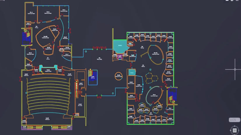
Extract BIM File Floorplan essentially recreates the Floorplan dataset found in Revit workspaces in a file geodatabase. For both IFC and Revit files, the tool creates four feature classes:
- Footprint: a polygon representing the overall area of the model
- Plan Line: floorplan linework
- Plan Polygon: extent of defined areas such as slabs or floors, spaces or levels, roofs, and stairs.
- Plan POI: points of interest showing the location of individual elements
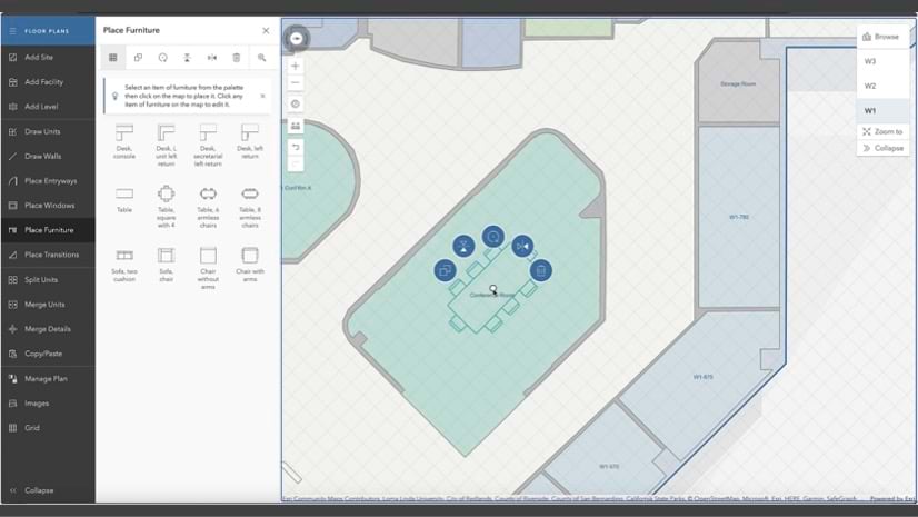
Using Extract BIM file Floorplan
If used with a Revit file, the Floorplan dataset is effectively copied directly from a Revit workspace to a file geodatabase. If used with an IFC file, the tool derives 2D linework from the 3D data.

From IFC, the tool will build floorplan line data from the following IFC categories:
ifccolumn

ifccurtainwall

ifcdoor

ifcstair

ifcwall

ifcwindow

To use the tool, specify the BIM file workspace you would like to use along with the output location and name of the feature dataset and feature classes to be created. You can specify additional polygon and polyline categories to include from the model and select the floors to be included. See tool documentation for specifics on which categories can be included.
Using Import IFC to Indoor Dataset
Import IFC to Indoor Dataset utilizes developments made for the Extract BIM File Floorplan tool to create floor plan data suitable for ArcGIS Indoors. Similar to other ArcGIS Indoors tools, you specify existing ArcGIS Indoors information model feature classes for output and attribute mappings between model properties – ifcspace or Revit rooms – and Units attributes. You can freely customize which Units fields the ifcSpace properties are mapped to.
The ground floor and facility name must also be specified. The ground floor name parameter specifies which level will have a vertical order and Z-value of 0. Floors above will have positive vertical position while floors below will have a negative vertical position. Facility name allows you to select both an existing facility in the target ArcGIS Indoors information model dataset or type in a new one. If an existing facility is specified the tool will overwrite data for that facility only.

Optionally, you can choose to load floorplans from the output of the Extract BIM File Floorplan tool, meaning it will honor selections from the input floorplan layers before importing directly from the IFC file. With the release of ArcGIS Pro 3.3, you can also import roofs and 3D elements. If the IFC file contains a slab element for the roof and Load Roofs is checked, the roof and associated elements will be imported as a level. This is necessary in use-cases such as work order/asset management involving equipment located on the roof and general wayfinding to rooftop amenities.
If the 3D features parameters are populated, the tool will create 3D multipatch features for units, Details, and Facilities directly from the elements of the IFC file. You can inspect these features in ArcGIS Pro prior to importing. There are also a number of free programs, such as BIMvision, that are specifically designed to visualize IFC files.
Facilities 3D

A multipatch feature is created in the Facilities3D feature class (part of the Indoor model) representing the facility shell of the building from the ExteriorShell feature class in the BIM file workspace. This feature class is created from the exterior IFC categories in the model like roofs, columns, walls and windows that have the IsExternal property set to true.
Units3D
Units3D multipatch features in the Indoors model are created based on IFCSpace elements in the model. They will effectively resemble the regular polygon features found in Units, but enable compatibility with floor-aware 3D scenes and ArcGIS Indoors apps.
Details3D

The same IFC categories used to create the floorplan linework are also imported as 3D details features. The elements must be associated with a level which, in ArcGIS Pro, is indicated by the BldgLevel attribute. Elements that span multiple floors will be sliced so that there is a 3D detail feature for each level across which the feature spans.
Bridging the Gap
It is important at this point to stress the skill and effort represented by these IFC enhancements. It’s official: Revit and IFC are at feature parity in ArcGIS Pro; everything in ArcGIS Pro that once could be done with Revit can now be done with IFC, be it for ArcGIS Indoors-specific or more general workflows.
Programmatically representing complex 3D space as 2D is a challenging problem, especially when it comes to floorplan lines. A floorplan is one of many depictions of the physical reality while a 3D building model is – or should be – an exact replica. A digital twin. Floorplans are usually created by humans who understand building’s physical makeup and the abstraction necessary to draw lines that are recognizable to others.

The AEC industry has benefited from IFC as an open-source format that enables workflows between different BIM software packages. Consequently, Esri recognized the need to import IFC files into the ArcGIS Indoors information model. With each ArcGIS Pro release, exciting new enhancements are rolling out to ease the process of importing all types of source data into ArcGIS Indoors. Stay tuned for more enhancements in the future.
For more information on ArcGIS Indoors, please visit our product page. To ask questions and provide feedback on ArcGIS Indoors, please join our Esri Community place.
Article Discussion: