We are thrilled to introduce our latest release for 2024, packed with features and enhancements designed to elevate your 3D web experience. This significant update brings transformative features that will usher your workflows into a new era.
Unveil the 4th dimension of GIS with Time
Time, the 4th dimension of data, enables you to visualize data across temporal scales, offering a dynamic and comprehensive view of your information. This release introduces two powerful features to help you incorporate the 4th dimension into Scene Viewer with ease.
Time Slider Support
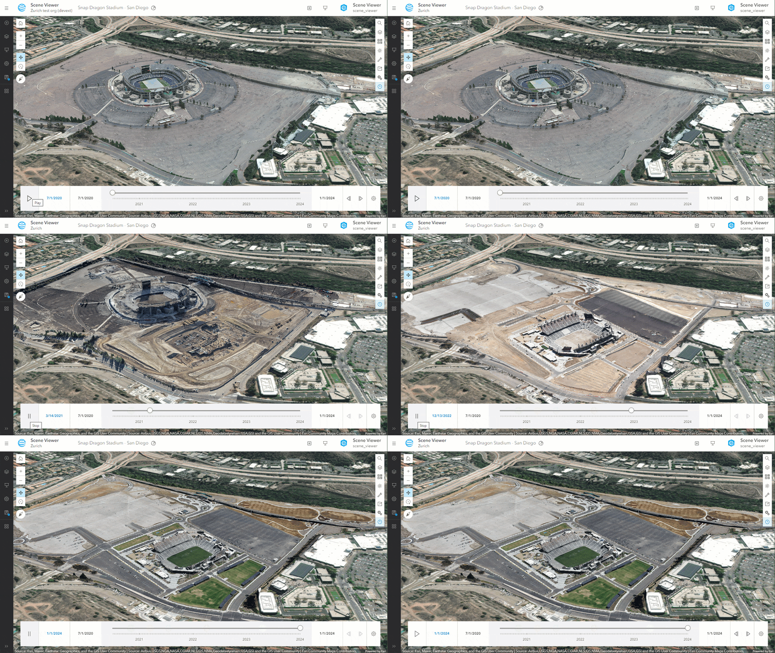
With the new time slider, you can seamlessly explore and visualize time-enabled data. Besides the existing 2D layers with time, we also support time-enabled point, 3D object, and voxel scene layers now. You have full control over the animation, with options to play, pause, and navigate between previous and next time periods. Time information can also be persisted in slides. You can either store specific points in time within a slide for quick access or save your scene and load it into other applications, such as StoryMaps, with the same time period displayed.
Customize Time Periods for Each Layer
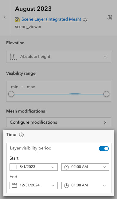
We always had time support on a feature basis, where individual features show or hide based on time. We are now introducing time on a layer basis, where whole layers show or hide based on time.
After signing into Scene Viewer, you can define a period for layer visibility in Layer Properties. This feature allows you to combine different datasets into one continuous story across time. This can make a lot of sense for data where each update is stored in a new layer. For example, in a construction project, you can now visualize drone imagery of a construction site or compare imagery before and after a natural event like a landslide, providing you with deeper insights and improved project management.
New content in 3D context
Scene Viewer is the foundational application that empowers you to integrate all kinds of data into a single, dynamic Web Scene. Our mission is to revolutionize your 3D context by enriching it with diverse datasets that elevate and streamline your workflow.
3D Model Upload Out of Beta with Enhanced Editing Accuracy
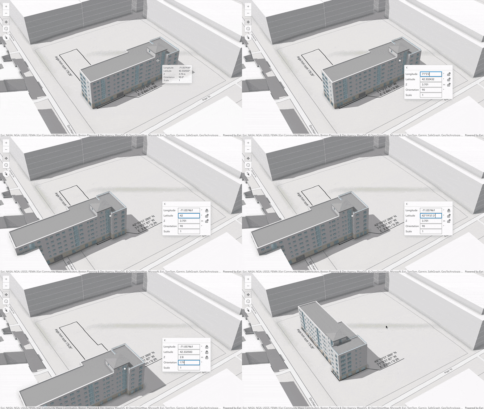
We are delighted to announce that the ability to upload your own 3D models is now officially out of beta! With the editable 3D object scene layer, users can seamlessly upload 3D models into the web environment. This feature serves as an entry point for effortlessly integrating 3D models of various formats into the geospatial context. We have made enhancements to improve stability and ease of use, including a new feature that allows for coordinate input during editing. Simply press Tab key to edit the tooltip fields, which significantly enhancing accuracy.
Support Catalog Layer
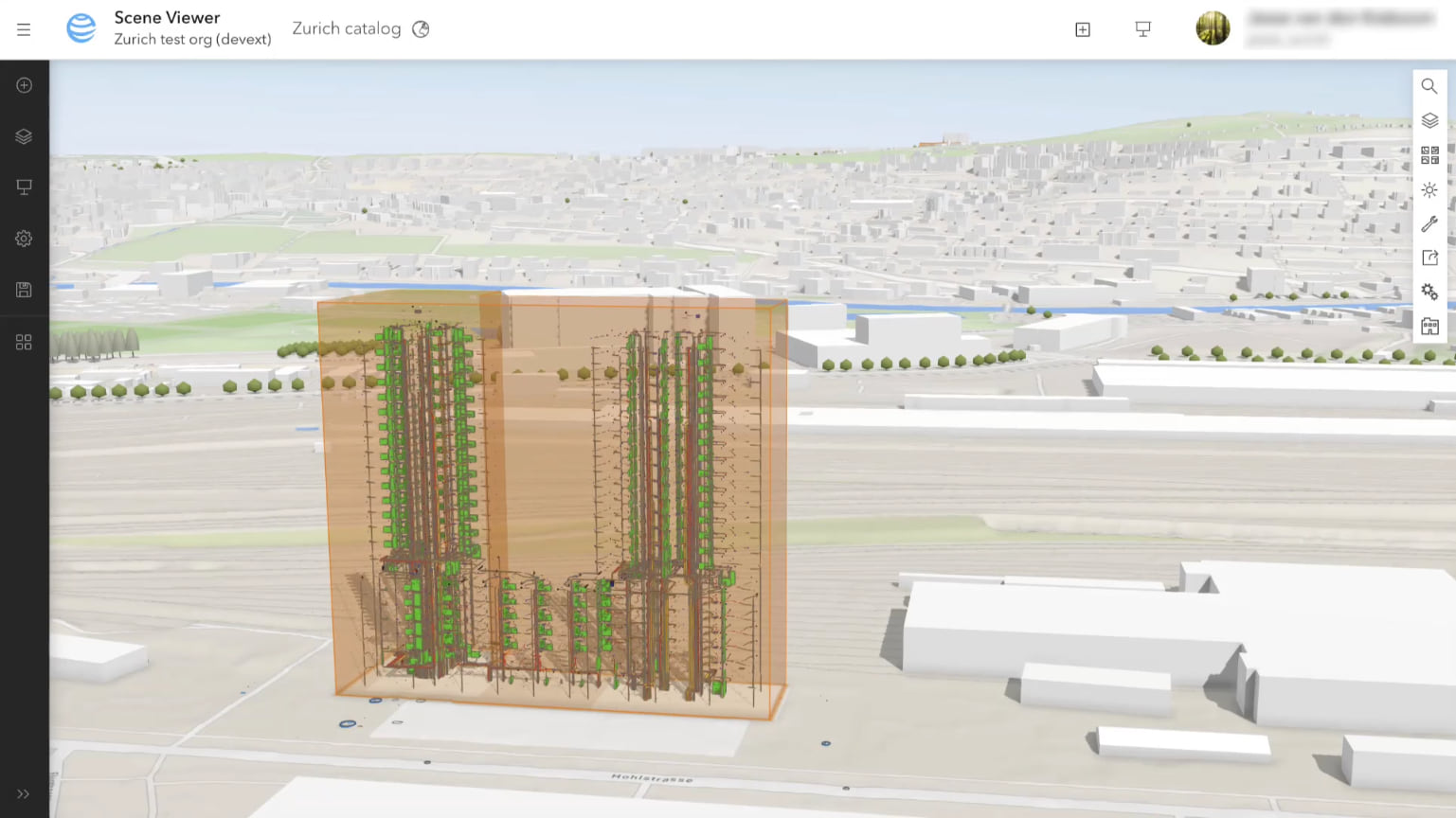
Managing extensive collections of layers from different sources can be challenging. That’s why we introduced the Catalog Layer ,which acts as a collection of item references to layers and services. A well-maintained catalog dataset, coordinated across single or multiple organizations, allows you to quickly discover and explore content and view visual changes over a given time, range, or other attributes.
Support Media Layer
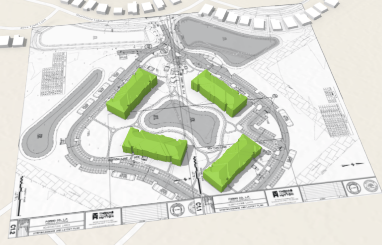
The Media Layer enables the addition of image to the 3D scene at specified geographic locations. This layer is perfect for displaying a variety of content, including old scanned maps, weather data, satellite imagery, aerial and drone images. You can begin digitizing features or upload a 3D model into your scene using the existing Media Layer as the starting point for your editing workflows. By incorporating the Media Layer into Scene Viewer, you can bring these contents to life in a creative and immersive 3D environment. Note: Existing Media Layer can be added to Scene Viewer. Follow this blog to learn more about how to create Media Layer with Map Viewer.
Enhanced 3D visualization
Position Your Data at the Right Elevation
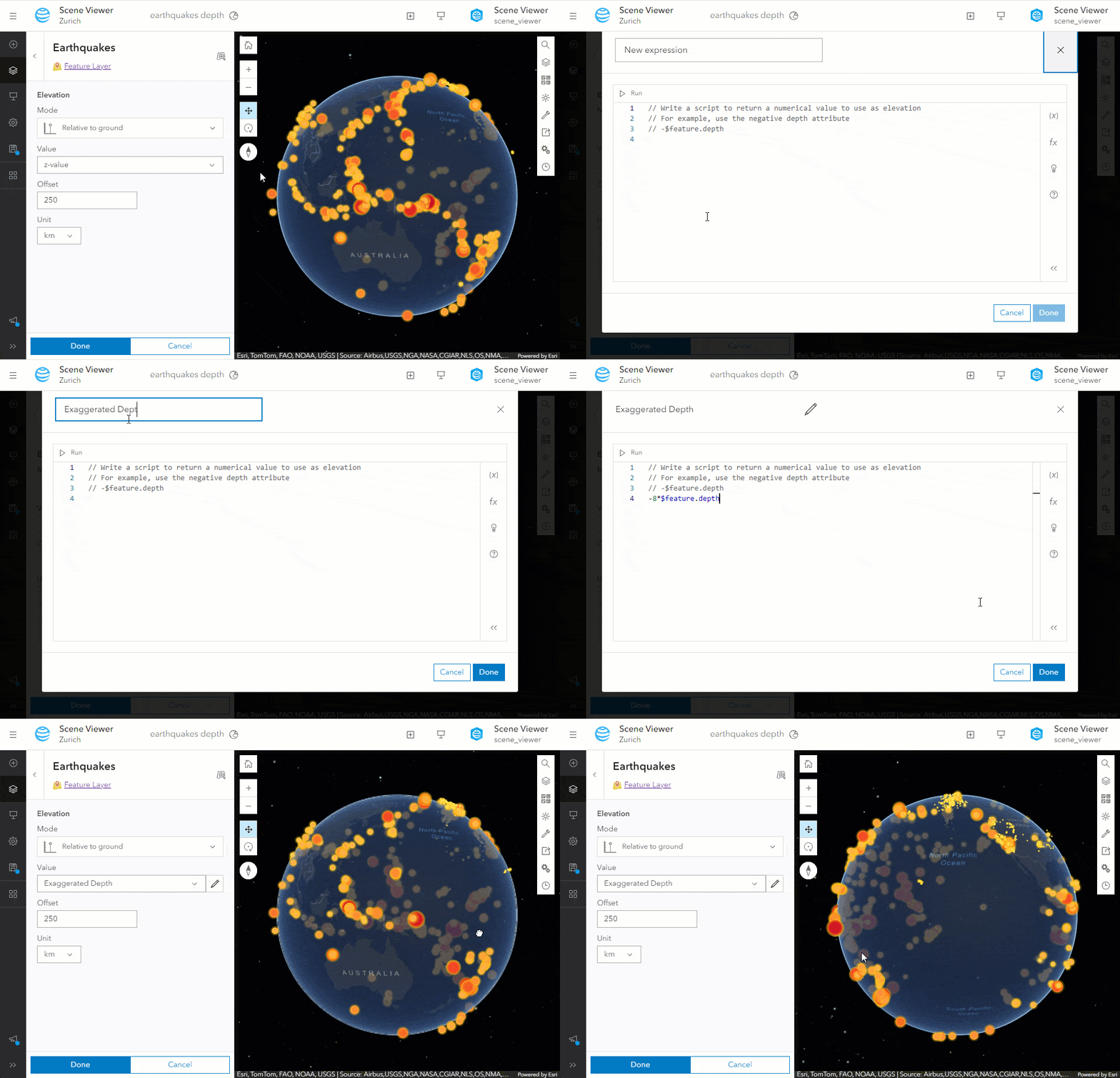
In this release, we have introduced the ability to customize the elevation mode to precisely position your layers. While much data has elevation stored, it is not always inside its geometry. Scene Viewer now allows the use of attributes and Arcade expressions as inputs for the elevation of a feature layer.
For instance, depth information can be transformed into a negative value, or numbers can be exaggerated to make differences more visible, as we did for the earthquakes below. Whatever the transformation, the powerful language of Arcade lets you position your data accurately.
Improved Realistic Effects and Labeling
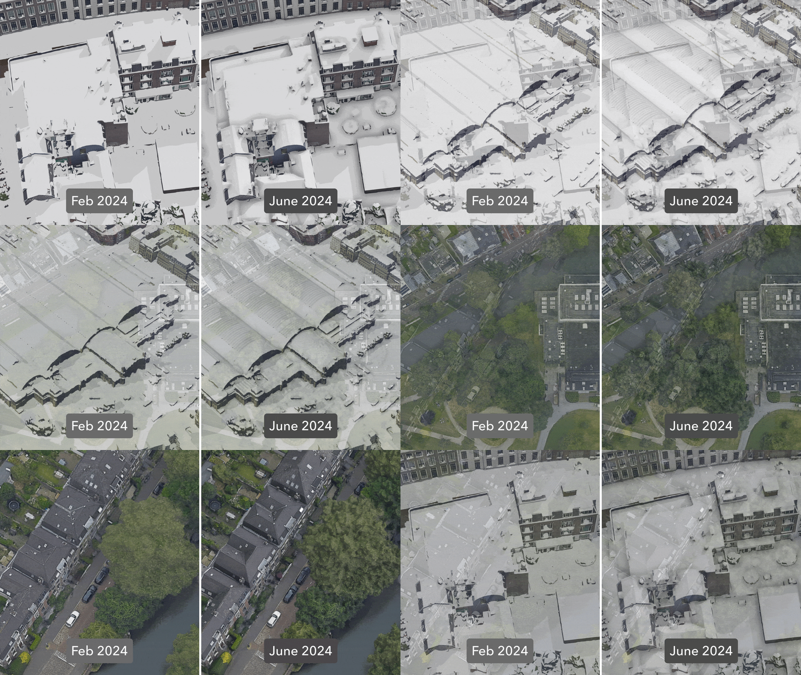
We’ve prioritized enhancing the visual quality in Scene Viewer over the past few years. This release introduces new shading for integrated mesh layers (scene and 3D tiles), improving the lighting and overall appearance of your 3D content.
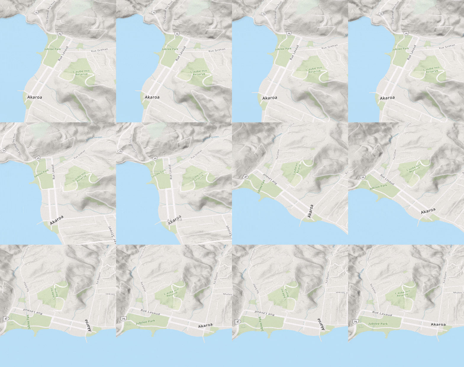
Moreover, we have adjusted the labeling for vector tiles, making them easier to read and improving the overall user experience. Labels for streets, rivers, and mountain ranges are rendered along a line and are flipped depending on the camera heading, while other labels and symbols are rotated to keep them upright in the view when the camera heading changes.
Integrate Web Scene with Dashboard
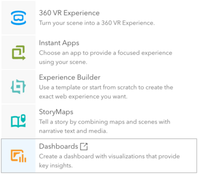
Web Scene is the vehicle to illustrate your 3D content across various configurable apps. With the Create Apps function, you can create a 3D dashboard directly from Scene Viewer. Feature layers, Scene layers in web scenes including 3D object scene layers and point scene layers with associated feature layers are supported as data sources for other dashboard visualizations and selectors.
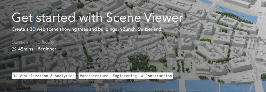
Get Started with Scene Viewer
We have also updated the tutorial, designed to get you started on real-life workflows with Scene Viewer. Imagine creating a stunning 3D web scene featuring the beautiful trees and iconic buildings of Zurich, Switzerland. Whether you’re new to Scene Viewer or looking to enhance your skills, our step-by-step guide will lead you through every detail.
We hope you enjoy the updates! We’re excited to see how these new features and improvements will elevate your 3D web experience and streamline your workflows. You can explore all the exciting new features and enhancements we’ve introduced over the past year, along with real-world use cases, in this StoryMap – What’s new in Scene Viewer 2024. Stay tuned for more updates and happy exploring.
Meet us at Esri User Conference 2024
If you will be at Esri User Conference 2024, come and join the Scene Viewer sessions or meet the team at Scene Viewer booth. We look forward to meeting you in San Diego soon!
Tuesday 7/16/2024 11:30 – 12:15 PM PDT | Authoring 3D Scenes with Scene Viewer

Article Discussion: