Approximate Reading Time: 7 Minutes
The Points To Line geoprocessing tool creates line features from point data. The tool constructs lines by identifying points that share a unique value specified in the Line Field. The points with shared values are connected sequentially based on attributes specified in the Sort Field. You can think of Points to Line like a game of connect-the-dots!
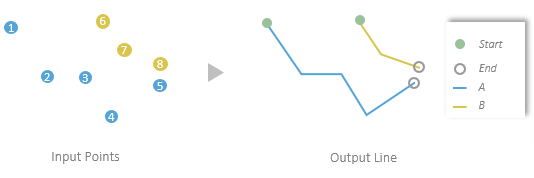
In ArcGIS Pro 3.1, three parameters were introduced to the Points to Line tool to provide more control over how output lines are constructed and add the ability to transfer attributes from the input points to the output lines.
- Use the Line Construction Method parameter to choose between constructing a continuous line or multiple 2-point lines that connect every two consecutive points.
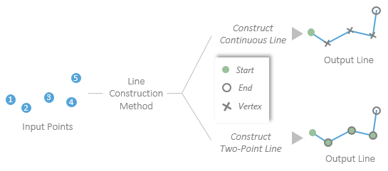
- Use the Attribute Source and Transfer Fields parameters to transfer attributes from the input points to the output line. The first specifies how the attributes will transfer and the latter specifies which field values will transfer.
Let’s take a closer look at the new parameters with an example.
Example: Bus Routes in Charlotte, NC
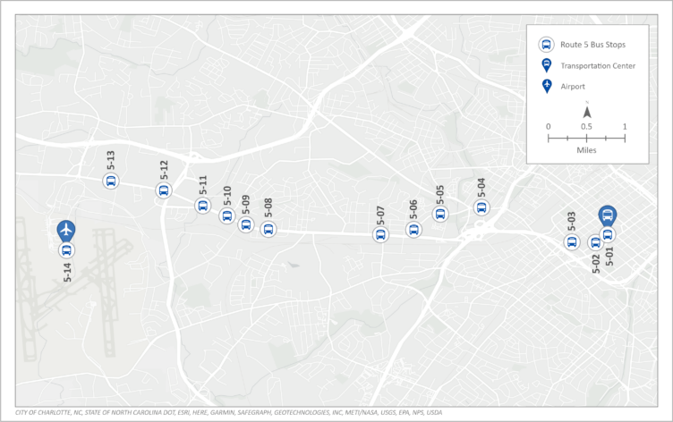
The following example uses bus stop data from the City of Charlotte, NC. Using the Points to Line tool we will create a line that connects 14 bus stops from the city’s Transportation Center to the Charlotte Douglas International Airport.
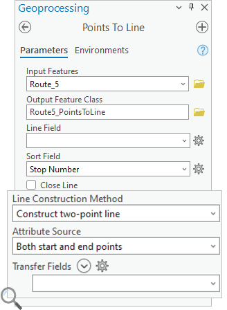
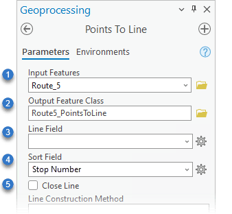
In the Points to Line geoprocessing tool:
(1) Select the Route_5 points for the Input Features
(2) Specify the Output Feature Class or leave the default
(3) Leave the Line Field blank. This will connect all points regardless of their attributes.
(4) Use the Stop Number for the Sort Field
(5) Leave the Close Line parameter unchecked
Line Construction Method
We will use the Line Construction Method parameter to determine the structure of the output line features. The parameter options include two types of line features, Construct continuous line and Construct two-point line.
Construct Continuous Line
First, suppose we want to create one continuous line feature from the first to the last point.
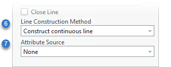
(6) Choose Construct continuous line for the Line Construction Method
(7) Specify the Attribute Source parameter as None for now; we will review how to transfer attributes in the next section
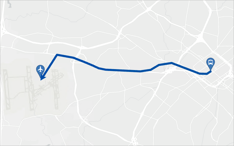
The resulting output contains one continuous line feature from the transit center to the airport.
Note: This tool does not construct lines along any underlying transportation network; it only makes straight-line connections between the provided input points.
Construct Two-Point Line
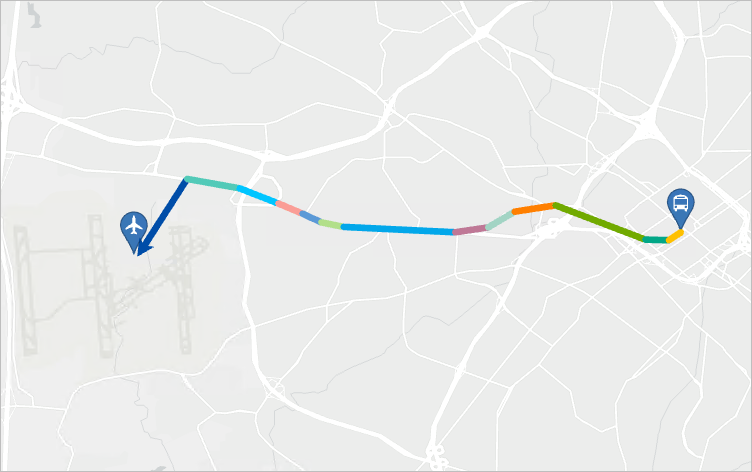
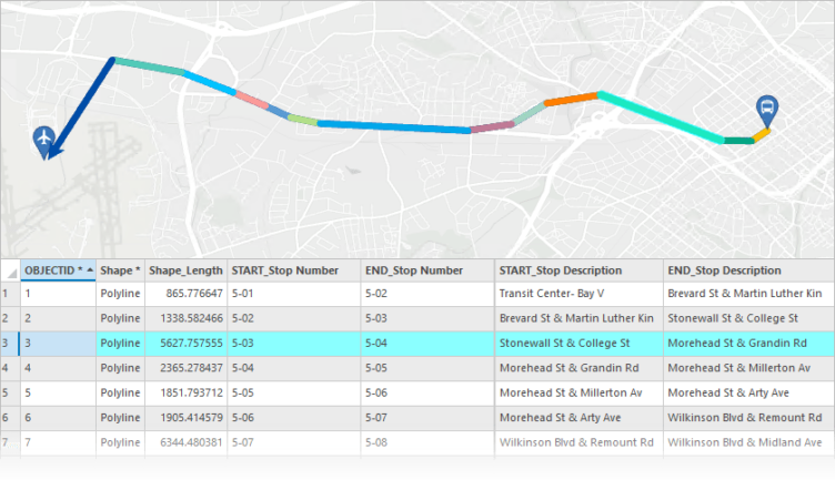
We can also choose the Construct two-point line option for the Line Construction Method parameter. This creates 13 output line features where each line feature is a connection between 2 sequential bus stops.
Attribute Source And Transfer Fields
The Attribute Source parameter includes four options to determine if or how the attributes transfer from the input points to the output lines.
- None–No attributes will transfer, meaning the output lines will not contain any fields from the input
- From both start and end points–Attributes will transfer from the start and end points of each line
- From start point–Attributes will transfer from only the starting point of each line
- From end point–Attributes will transfer from only the endpoint of each line
The Transfer Fields parameter allows you to select which attribute fields will transfer from the input points.
Next, we will use these parameters to transfer several attributes from each line’s start and end points.
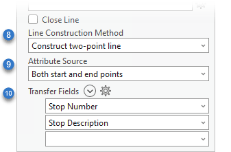
(8) Choose Construct two-point line for the Line Construction Method
(9) Choose Both start and end points for the Attribute Source
(10) Select the Stop Number and Stop description for the Transfer Fields
After running the tool, the output line’s attribute table contains fields with the prefix START_ and END_ for each transferred field.
Summary
The Points to Line geoprocessing tool creates lines from points, and in ArcGIS Pro 3.1, the tool has been enhanced with three new parameters. Use these parameters to specify how the tool constructs lines, as a continuous line or two-point lines, and to transfer attributes from the input points to the output lines.
These enhancements make the tool even more capable of being used in various workflows, and we’re excited to hear from you about how you will use these new capabilities!

Article Discussion: