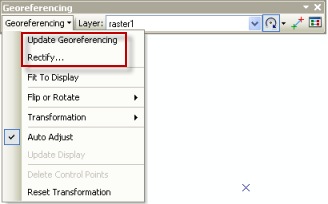
Once you have finished choosing and evaluating your links, you are ready to persist your results. There are 2 options to choose from: Update Georeferencing and Rectify.

Update Georeferencing
- Only updates your files- no redundancy created
- Update are almost immediate
Rectify
- A new raster dataset is created and the original file is left unaltered
- Choose many options: such as file format, cell size, resampling technique, and NoData value.
- This is the only option for some files: such as GRID and other files that cannot be updated (e.g. read-only files)
Depending on your workflow, both Update Georeferencing and Rectify have their advantages.
Commenting is not enabled for this article.