The ArcGIS Pro 3.0 release brings more exciting enhancements to improve mobile geodatabase workflows. Some of the improvements are related to the default workspace settings, the properties dialog, and the sharing capabilities.
Got you curious? Great!
But before we get started, make sure to check out the blogs we have previously published on mobile geodatabase. These will help provide context and share more light on the existing capabilities introduced in the previous releases.

Look at Mobile Geodatabases go! (What’s new in Pro 2.7)
This blog introduces mobile geodatabase as a new geodatabase type to store, query, and manage spatial and nonspatial data supported across the Esri platform. The blog also covers mobile geodatabase benefits and basic management tasks.

New Controller Datasets Supported in the Mobile Geodatabase
This blog covers new support for controller datasets such as topology, utility network, parcel fabrics, and trace network in the mobile geodatabase, as part of the ArcGIS Pro 2.9 release.
Now, let’s get into what’s new!
Setting a mobile geodatabase as the default project database
A big step in increasing mobile geodatabase functionality for everyday workflows is enabling a mobile geodatabase as the default database for a map project. The default mobile geodatabase becomes the home location of the map and can be used as the primary location to add and store resultant data from editing and geoprocessing operations.
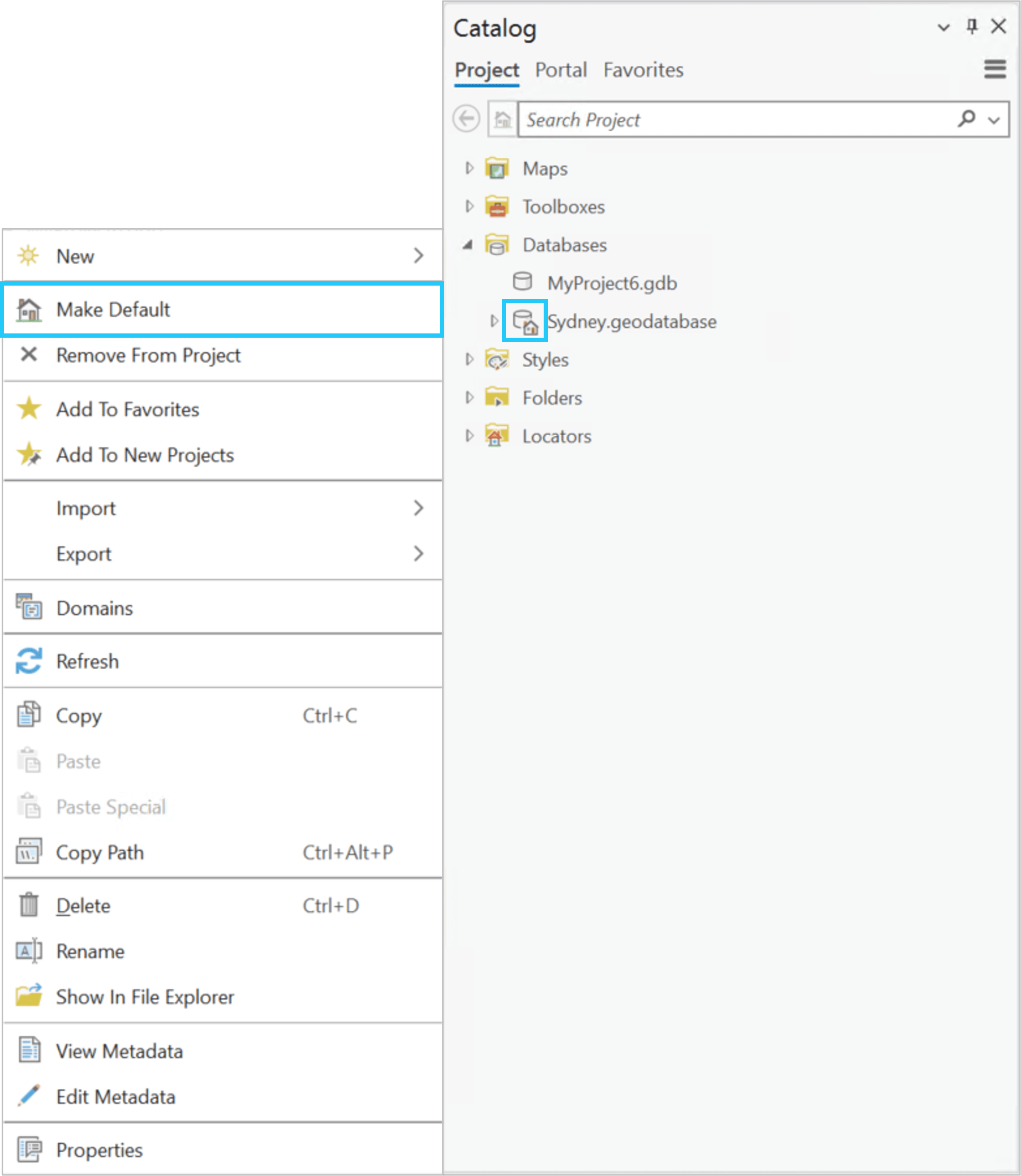
To make your mobile geodatabase the default workspace, in the Catalog pane, right click on an existing mobile geodatabase and select the Make Default option.
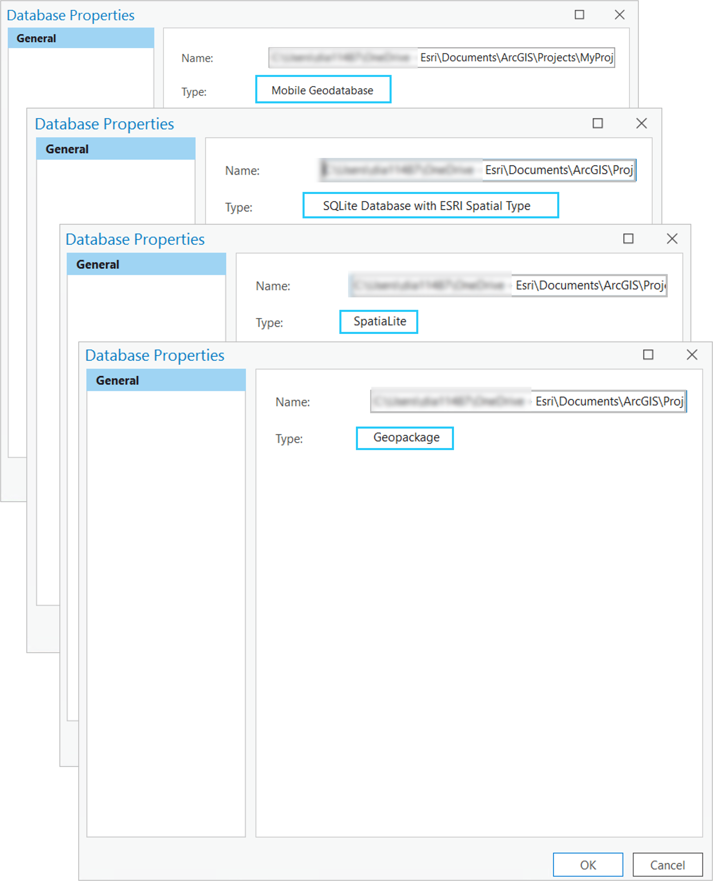
Displaying the database type in the Database Properties dialog for mobile geodatabase and other SQLite data sources
The Database Properties dialog provides information about the database or the geodatabase you are connected to. It shows details such as the name, together with the directory path to the location where that file is stored. It also indicates whether you are connected to a file geodatabase, SQLite database, mobile geodatabase, a specific database management system, or a cloud data warehouse.
Prior to this release, mobile geodatabases and SQLite databases were listed in the Database Properties dialog, but it did not show which specific type of mobile geodatabase or SQLite database you were using.
With this new software release, the specific SQLite database type and mobile geodatabase type are now displayed. These are categorized as shown below.
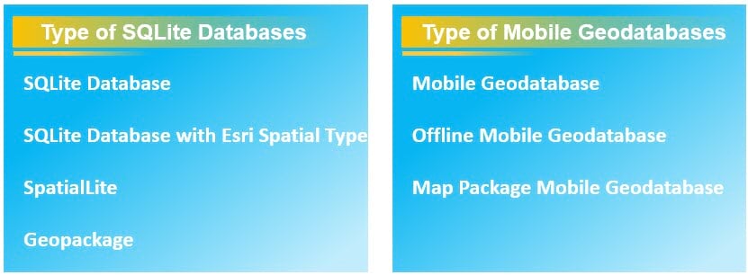
- SQLite Database is a public domain relational database management system contained in a C programming library. It has a “.sqlite” extension.
- SQLite Database with Esri Spatial Type is a type of SQLite database with ST_Geometry, the Esri spatial storage type. It has a “.sqlite” extension.
- SpatiaLite is an open-source library intended to extend the SQLite core to support fully fledged Spatial SQL capabilities. It has a “.sqlite” extension.
- Geopackage is an open, OGC standards-based, platform-independent, portable, self-describing, compact format for transferring geospatial information. It has a “.gpkg” extension.
- Mobile Geodatabase is a collection of various types of GIS datasets contained in a single file on disk that can store, query, and manage spatial and nonspatial data. It has a “.geodatabase” extension.
- Offline Mobile Geodatabase is a type of mobile geodatabase designed for offline workflows. When a map is taken offline, the data for each web feature layer that supports synchronization is automatically downloaded to an offline mobile geodatabase in the project’s home folder. It has a “.geodatabase” extension.
- Map Package Mobile Geodatabase is a type of mobile geodatabase used to share maps with mobile apps such as Explorer, Navigator, and other apps developed using the ArcGIS Runtime SDK. It has a “.mmpk” extension.
Sharing data from a mobile geodatabase
Sharing your data is the last, but one of the most important, steps of every workflow, as it provides an efficient way for teams within an organization and beyond to collaborate, view, and access data for further analysis.
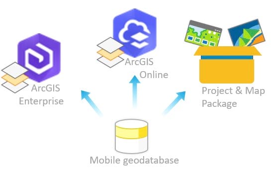
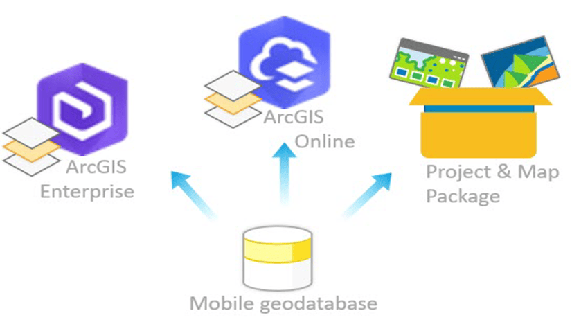
Because of that we improved the sharing capabilities from a mobile geodatabase. With ArcGIS Pro 3.0 release you can now share your data from a mobile geodatabase as following:
- As a web layer that references registered data in ArcGIS Enterprise portal.
- As a hosted web layer in ArcGIS Enterprise and ArcGIS Online portal.
- As a project package and map package, with the ability to preserve the mobile geodatabase format.
The Sharing Workflows from a Mobile Geodatabase blog elaborates on each sharing workflow and highlights essential capabilities to help you successfully share your data from a mobile geodatabase.
See you there!
Photo by Jason Dent on Unsplash



Commenting is not enabled for this article.