*Updated 1/28/2022.
A primary focus for the linear referencing team included continuing to close the gap in missing equivalency items and continuing to build out the help documentation.
What’s changed?
- New Linear Referencing ribbon
- Find Routes pane
- Display route events from the table of contents
- Assign a route identifier field
Linear Referencing ribbon
In ArcMap, linear referencing workflows were in disparate locations. With ArcGIS Pro 2.9, we wanted to simplify and centralize the experience when working with m-aware features. The new Linear Referencing ribbon appears when an m-aware layer is present in the Contents pane of an active map. The new tab organizes common linear referencing tools and workflows.

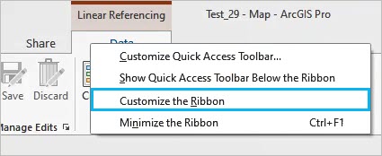
You can enable and disable display of the Linear Referencing ribbon by customizing the ribbon. To learn more see customize the ribbon options. To disable the ribbon, right click on the Linear Referencing contextual tab and select “Customize the Ribbon”. This opens the Customize the Ribbon section within the Options page. In the scrolling window on the right, representing the current ribbon configuration, browse to the Linear Referencing tab. Uncheck the box and click OK to hide the Linear Referencing ribbon.

Find Routes pane
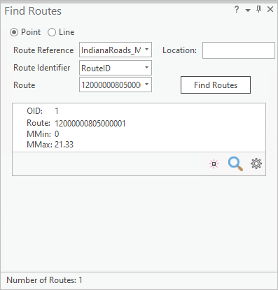
This version of ArcGIS Pro includes support for finding routes when providing measures. Users can zoom to a route, open a pop-up, and flash a route. To learn more see Find routes.

Display route events the from table of contents
Another equivalency item that users requested includes the ability to display route events from the table of contents. Users can now right-click an event table to launch the Make Route Event Layer geoprocessing tool. To learn more see Display route events.

Assign a route identifier field
Assigning a route identifier field is not required when working with routes; however, it saves you from having to set the route identifier field each time you use the linear referencing geoprocessing tools. To learn more see Assign a route identifier field.
What’s coming next?
In future releases, the team will be hard at work finishing out the remaining equivalency items such as Display Measure Anomalies along with continuing to build out the help documentation. We’d love to hear any suggestions or ideas that you’d like to share.


Article Discussion: