As a wildfire raged around the Getty Villa Museum in Southern California, the Roman antiquities housed inside were uniquely protected and remained safe. This wasn’t luck—it was by design. The museum’s designers had created multiple layers of resilience to keep a destructive wildfire at bay, as noted in this Wall Street Journal story.
Those measures included surrounding the campus with acacia shrubs and oak trees that soak up water, improving their fire resistance. A network of precisely positioned sprinklers treated the grounds when flames threatened. In the end, despite the fire coming within six feet of the museum’s walls, the Getty Villa remained standing.
This dramatic survival story provides valuable guidance for organizations seeking to protect their assets. Location-specific, strategic planning can go a long way toward disaster-proofing a facility or campus.
There’s certainly an economic argument for doing so. For every dollar invested in pre-disaster mitigation, $13 is saved on what it would have cost for damages and cleanup, according to a 2024 research report by the US Chamber of Commerce and insurer Allstate.
At its core, designing for resilience is a geographic challenge: Planners need to know where vulnerabilities exist and where mitigation measures will make a difference.
Designing for Resilience on Campus
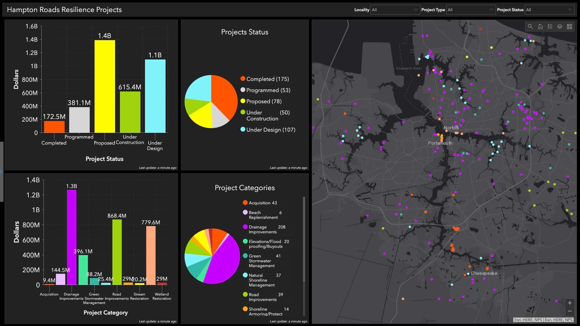
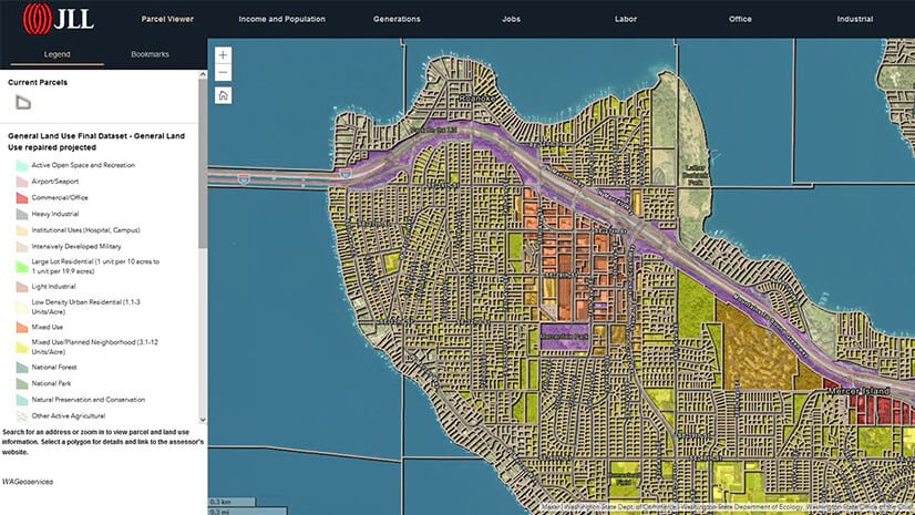
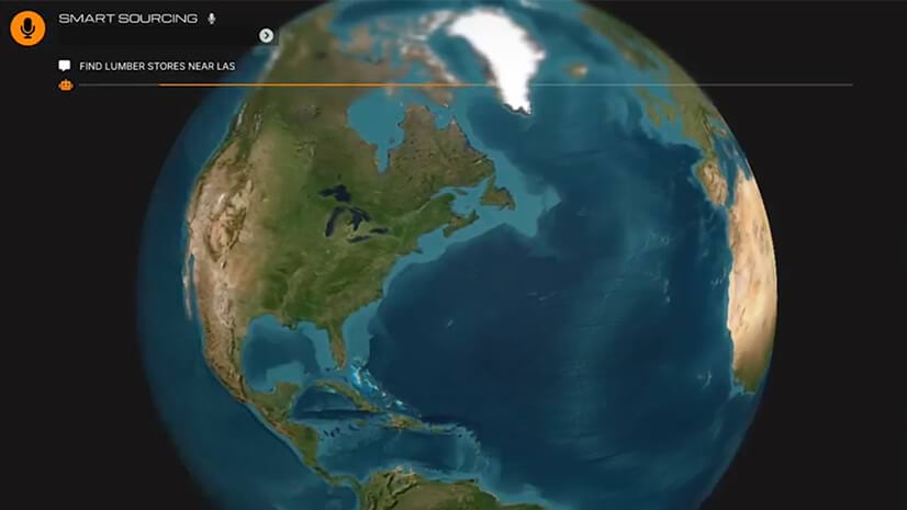
To safeguard corporate assets like offices, data centers, stores, distribution centers, and R&D centers, many facility managers rely on an operational basemap built with geographic information system (GIS) technology. This map is the digital twin of a facility—revealing the terrain beneath it, the resources and vegetation surrounding it, the utilities that serve it, and the watershed it inhabits.
A digital twin can also include proprietary information about assets housed at certain locations and the employees who work there, along with emergency contact information.
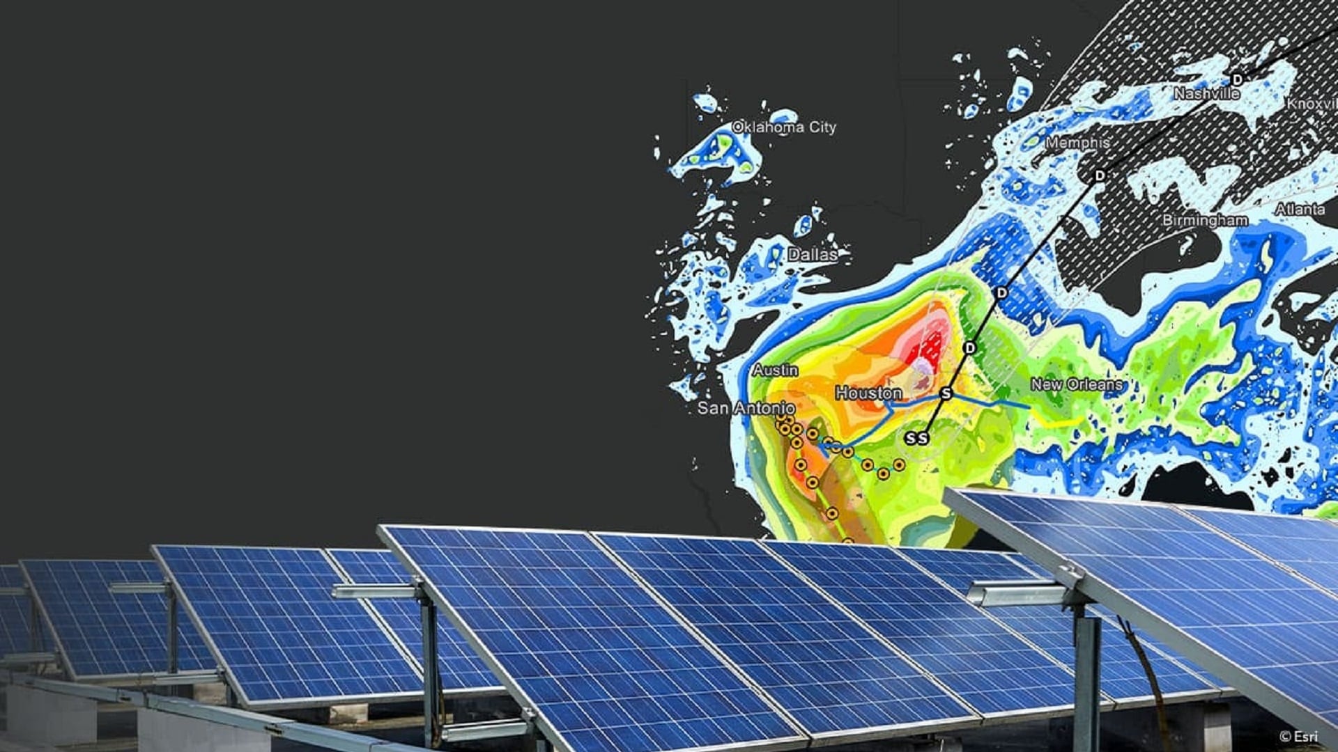
A GIS analyst can enrich this operational basemap with data on historical weather patterns, drought conditions, and local land cover to anticipate the effects of a wind-borne fire fueled by dry vegetation, or a storm surge created by 80-mile-per-hour winds. With this location intelligence, managers can decide how to design for resilience and protect company property.
Mitigation measures could include a water source positioned to defend areas that need it most, underground storage for use during tornadoes or hurricanes, and barriers to keep out floodwater.
With a digital twin showing which risks facilities face and modeling how assets can be protected, facility managers build resilience into a company’s long-term strategy.

To strengthen a facility’s resilience, planners need an in-depth understanding of geography—the location’s surroundings, topography, weather conditions, and more.
Sizing Up a Threat by Simulating It
For one aerospace and defense company with hundreds of facilities worldwide, a GIS-powered digital twin gives decision-makers real-time situational awareness of natural disasters, active threats, or unforeseen events before they impact operations.
If a corporate asset is at risk, staff in the global emergency operations center assess the threat on a GIS dashboard. The digital twin proved priceless when it helped operations personnel move employees to safety as a hurricane threatened.
Weathering wind-fueled wildfires, severe hurricanes, or treacherous floods requires a long-term, proactive strategy. With an operational basemap of facilities, planners can simulate environmental scenarios and see their potential impacts on assets. These best- and worst-case scenarios—played out in advance with a digital twin—help executives design for resilience by fortifying structures and assets for the long term.
When an event does occur, getting information to the right people quickly happens only when information lives in one accessible, collaborative space. GIS provides the shared situational awareness companies need to respond in real time.
With an operational basemap, some company leaders actually “see” the business for the first time. This new perspective gives them a valuable understanding of where properties, facilities, and assets are vulnerable, and what must be done to protect them.
The Esri Brief
Trending insights from WhereNext and other leading publicationsTrending articles

December 5, 2024 |
July 25, 2023 |
November 12, 2018 |
April 1, 2025 |

April 29, 2025 |

February 1, 2022 |