
October 24, 2024

Data, particularly the geographic kind, is driving meaningful change in Minnesota. From ensuring drinking water isn’t contaminated by lead pipes to feeding students regardless of financial need, the work aligns with aspirations that communities across the world want to achieve through the United Nation’s Sustainable Development Goals (SDGs).
The University of Minnesota system has been at the forefront of using data and geographic information system (GIS) technology to track the state’s progress on these goals.
Katey Pelican, coleader of the university system’s Sustainable Development Goals Initiative, described the SDGs as a globally agreed-to framework of the world’s biggest challenges. “What we have been doing is really using the sustainable development goals as a framework to create a more coherent approach to the work the university system is doing both internally and outside its campuses,” Pelican said.
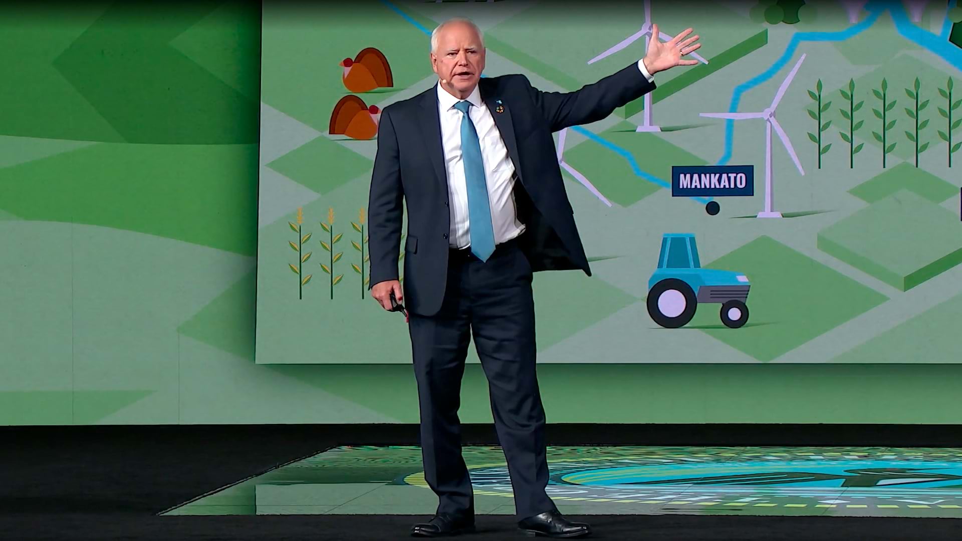
The goals will undoubtedly be passed on to the next generation as a foundation for improving the world they’ve inherited. A nuanced understanding of local geography will be essential, as will the tools needed to gain insights about a community to contribute to its prosperity. Minnesota Governor Tim Walz, candidate for US vice president, has spoken about how essential GIS is for understanding and effective action.
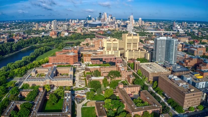
The University of Minnesota—a public land-grant research university with five campuses, more than 68,000 students, and an international presence—has embraced the SDGs for several years, weaving them into the university’s strategic planning, curriculum listings, and academic research.
Students have the option to search for courses related to the SDGs. So far, nine of the 17 goals are available to search. The AGRO 4888 course, Issues in Sustainable Ag, for example, fits the SDG to end hunger. A course titled War and Public Health aligns with the goal of achieving gender equality. A biology course on Curing Cancer matches the goal of good health and well-being.
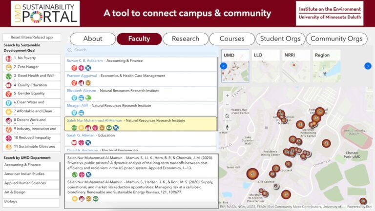
The university has also been encouraging SDG research through grants awarded by the UMN SDG Initiative. In 2021, seven UMN research projects won a total of $120,000. In 2022, eight projects—including studies into green space inequities, low-tech wastewater solutions, and gender-based violence in refugee camps—were awarded $160,000.
The university system is also a founding academic partner in the SDG Data Alliance, a global partnership of foundations, UN organizations, governments, and private industry—including Esri. The alliance focuses on bringing GIS technology to developing countries to speed up SDG achievements.
In an evaluation of thousands of universities around the world, ranking their work related to SDGs, UMN is among the top five in the US. The Times Higher Ed (THE) Impact Rankings determined the University of Minnesota was 85th in the world last year, and it tied for fifth overall in the United States. On topics top of mind for Minnesotans—clean water and climate action—UMN ranked even higher, coming in second for its water initiatives and third for its climate action.
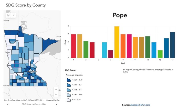
Location-specific data forms the foundation for many of UMN’s SDG efforts, including the university’s prototype SDG Geospatial Impact Hub. Built by a team of students and faculty using the Sustainable Development Goals Solution from ArcGIS Solutions, the hub site shares relevant county-level performance data on each of the 17 SDGs. Still a work in progress, the hub site’s creators plan on scaling it to be replicated by universities worldwide, making it a catalyst for local action anywhere.
“You’re talking about a place and people in that place and bringing all that together and using geography as the lens, as the filter, as the way of intersecting all of these different approaches and indicators,” said Len Kne, director of U-Spatial, the university’s research center for GIS, remote sensing, and spatial computing.
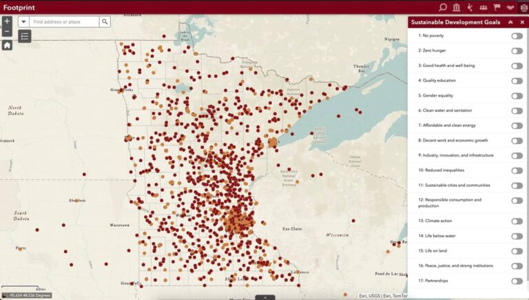
Kne expects the SDG hub site to be a constant work in progress since new and different datasets are being added online all the time. County-level data the university has collected so far comes from ArcGIS Living Atlas of the World, the US Census, the Federal Emergency Management Agency, state agencies, and university colleagues.
Eventually, the SDG hub site will include enough data for cities and towns to support the work of local and state policymakers, organizations, and the public. The GIS tools inside the hub site will enable efforts to measure and visualize progress. It will be a virtual place to facilitate collaboration on efforts—locally.
Kne explained that Minnesota, like other states, is made up of unique localities in rural or metropolitan areas. In confronting issues such as poverty, policy must be addressed locally.
That emphasis on fostering global SDG efforts locally is evident in UMN’s other recent SDG work.
In April 2024, the University of Minnesota system along with the University at Buffalo and multiple universities and technology institutes across India partnered to launch a Sustainable GeoCommunities program. The goal is for academic research to help communities achieve SDGs.
UMN has pointed to its research that enabled water quality monitoring in the state’s 10,000 lakes as an example. The Minnesota LakeBrowser map-based site provides satellite-derived data on lake clarity.
The university system is currently accepting applications for seed funding of up to $300,000 for three years for Sustainable GeoCommunities projects. Winning ideas will be those that address a significant high-impact problem for a community and are led by at least one UMN faculty member and a community member.
“A lot of the change that happens in moving that bar with SDGs is going to happen at that local level,” Kne said.
“We’ve been focused on Minnesota as the prototype to show what’s possible.” Kne said, before noting, “SDGs don’t stop at the border of Minnesota.”
Learn more about how GIS supports the United Nations 2030 Agenda for Sustainable Development and the 17 SDGs that form a global call to action to support people, the planet, prosperity, and peace.

