April 2, 2024 | Jack Dangermond |
June 25, 2024
Here is the Preface from a new book by Esri founder and president Jack Dangermond.
Flying home from the University of Minnesota in 1966, I found myself in a window seat, absorbed by the views of the Upper Midwest landscape from 30,000 feet. As a new graduate student, I reflected on the teachings of one of my mentors, John Borchert, who first introduced me to the concepts of quantitative geography. His research focused on abstracting and modeling geography by creating digital map data and developing system models that described spatial relationships, patterns, and fundamental geographic processes.
This fundamental work allowed him to build theoretical models that could help predict many types of human and economic behaviors, including social interaction, transportation flows, and even consumer visits to stores. These basic models were building blocks for understanding how cities evolved, with many valuable lessons for urban planners.
Professor Borchert taught me that the city—and the world—is a vast series of complex interconnected systems that if digitized and analyzed properly could explain so much about the world we lived in. He also advocated strongly that the world should use geography as a basis for planning and managing the future.
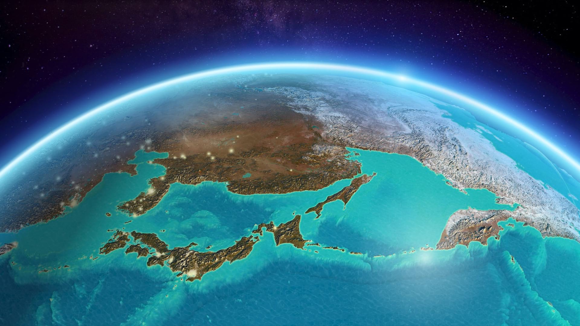
As my flight home continued and the airliner reached the Rocky Mountains in Colorado, I could see spatial systems everywhere: stream networks as part of a hydrology system, road networks interconnecting places, and as the flight passed over Utah’s farmlands, agriculture as its own kind of system. As we reached Las Vegas, yet another type of urban system appeared, surrounded by the vast Mojave Desert. It was there that I had my first aha! moment, realizing that geography and systems modeling provide a framework to understand everything, that systems interconnect, and that the world is a system of systems.
The 1960s brought many changes. It was the early days of what would later be called the digital revolution, which began to impact everything from science and business to the way people worked. As I continued my graduate school studies, I became increasingly interested in the subjects of this book—geography, computer mapping, and spatial analysis. I also came to realize that together, science and technology could be valuable in many fields. Since then, GIS has become essential infrastructure for managing hundreds of thousands of organizations around the world. Almost 60 years have passed since the day I flew home from Minnesota, but my excitement about the potential of integrating geographic science with the advancing technology of GIS has only grown. Times have changed, but the memory of that aha! moment remains as vivid today as the day I had it peering through a tiny window over Las Vegas.
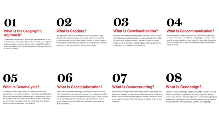
This book is about the power of where and the geographic approach. It includes maps, stories, and GIS apps that demonstrate the value of using geographic science to create better understanding and transform how people do their work. I did not write this book alone. Rather, it has been assembled with the help of my colleagues across Esri and the GIS user community. It represents many of the latest concepts behind modern GIS and the revolution it has created in thinking, action, and technology. Our collective aspiration is to share what we have learned and what we believe is a powerful way to better understand Earth’s systems and guide human action.
My life’s work has centered on the question of how to put the geographic factors that define Earth’s systems into a computer so that we could see problems as relationships between phenomena. The idea was that by visualizing and modeling these relationships, we could harness the computer to compare vast amounts of data, make predictions, and arrive at new understandings to drive the smartest approaches to planning, design, and environmental protection.
The science of geography is all about where. The word itself is a simple yet profound part of language that resonates with human experience. We intuitively comprehend the concept of where because it’s part of our daily life. It can be both a question and a statement. Where serves as a bridge to exploration, triggers our curiosity, and evokes human connection. Where is about location, and location is one of the most natural and common ways for us to organize our thoughts and experiences. As children, we begin our explorations by understanding where we are, and from there, by searching for where we want to go. In other words, we focus on where something is in reference to everything else.
Location is a way to organize, index, and retrieve our memories. Almost everything happens somewhere, and as humans we use spatial location to catalog everything we know about a place. It’s different here than it is there. Where is essential for comparative analysis, asking questions such as, “Where is it more expensive to live?” “Where are there better schools?” “Where are the areas with more trees?”
Where is also emotional and personal. We visit our birthplace, vacation with loved ones, hike with friends, and survive misfortune. Later, when we remember these experiences, we recall exactly where we were— and the feelings associated with them. Where underpins everything we do and provides context for our stories and memories.
Grounded in the power of where, GIS organizes and integrates all types of data and supports mapping and virtually all human activities with analysis, models, and maps of all kinds of information, transforming how we address challenges and act responsibly. GIS also enables the geographic approach as a way of thinking and acting that brings together all the factors and supports holistic thinking.
The geographic approach answers questions such as “Where is it?” and “How do I get there?” In that way, where is as much a verb as it is a noun. But instead of addressing problems in a linear way, the geographic approach integrates all the factors—and all the scientific disciplines—to reveal unseen patterns and relationships.
We began automating maps and overlaying map layers at scale in the early 1970s. These were used to do simple arithmetic and logical manipulation of environmental data in vegetation, soils, slopes, and landforms. As we digitized this data, we began realizing that GIS could model these interconnections and become a useful platform for understanding the complications of our world.
These map overlay models and many related spatial analytic tools have led to new insights and ways to solve problems. They have also supported ecosystem models and helped us realize that almost everything is related to everything else—that my actions or inactions here affect your life there, which makes the geographic approach an empathic endeavor. Geographic thinking is the ability to use interdisciplinary data to model these relationships and perform geographic analysis to show how they connect and interact.
Maps, particularly digital maps, are rapidly becoming a language that magnifies our understanding of everything. We grasp maps intuitively; other forms of communication can take longer to comprehend. They allow us to easily communicate information about human activities, including design and collaboration. They describe not only what is but what could be. The power of where is about unleashing all our knowledge of the world and using spatial analytics and mapping to support many natural and science-based actions. My hope is that the stories, maps, and examples in this book will inspire you to embrace and use this geospatial power as we work together for a better tomorrow.
Visit the Esri Press website to learn more about The Power of Where book and purchasing options.