
November 7, 2024

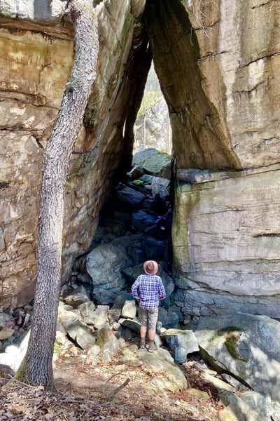
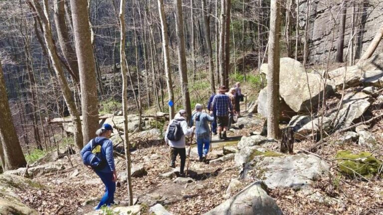
Nestled among West Virginia’s rolling hills, Needleseye Park is a 300-acre recreational haven. Ancient boulders, towering cliffs, and scenic trails weave through verdant forests, inviting outdoor enthusiasts from all corners of the country to hike, bike, and seek adventure.
But it wasn’t always this way.
For most of the 20th century, an Appalachian-based land management company known for its mining operations owned the land.
The ownership of this land concealed its climbing potential from all but a small group of locals and early explorers who had discovered the climbing opportunities at Needleseye.
The park’s formal development trace back to 2015 when the City of Oak Hill annexed the neighboring town of Minden and redrew its map. That’s when Marvin Davis, Oak Hill’s geographic information system (GIS) coordinator at the time, noticed something special. On a 3D map informed by lidar data, Davis saw an impressive two-mile series of boulders and cliffs that looked perfect for outdoor recreation.
The map caught the attention of key stakeholders, including City Manager Bill Hannabass who called for an on-the-ground exploration. That exploration eventually led to the acquisition and development of what is now Needleseye Park.
From the first 3D map through data gathering and planning, the Oak Hill team has been guided by GIS technology.
“GIS helped make Needleseye a reality from the start,” Davis said.
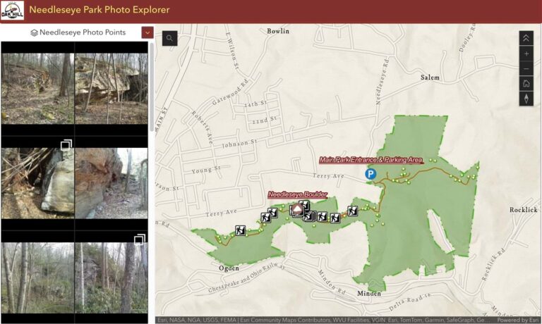
Before exploring the idea of creating a park, the city needed a system to record survey trips and share the information. So, Davis created a mapping solution using the city’s enterprise GIS technology. “It encouraged collaboration,” he said. “We could share data with multiple stakeholders to get their buy-in and secure funding.”

Davis, Hannabass, and their teams collected field data and photographs for various park features, including cliffs, boulders, crags, and a cave. This data, layered on a GIS map, supported planning discussions. They worked with community experts such as professional climbers to determine suitable trails, rate the difficulty of climbing routes, and scout locations for trailheads and facilities. Davis also created a geospatial digital twin, a digital replica of the park that can support planning and operations.
The digital twin helped Oak Hill secure funding to conserve the park through the West Virginia Land Trust.
Needleseye Park opened to the public in 2019 and is still a work in progress. But Tyler Bragg, the City of Oak Hill’s GIS coordinator, said geospatial technologies are supporting nearly every aspect of the park’s development.
Bragg and Josh Sapio, Oak Hill’s inaugural Parks and Recreation director, have been utilizing GIS tools to gather data and oversee development. Each week, they collect data from contractors about the work they have completed. The team then use a GIS data collection app and a Global Navigation Satellite System (GNSS) receiver to record the exact location and details of new trail segments. This data flows into a GIS dashboard almost immediately, allowing all stakeholders to monitor trail construction progress.
The streamlined process helps ensure contractors are adhering to project timelines. The team also uses GIS to verify data in the contractors’ reports, recording what each contractor is owed for features such as rock armor and retaining walls.
Part of the park’s construction management involves stormwater inspection surveys every four days or after every quarter inch of rainfall. Bragg digitized the process using ArcGIS Survey123, a mobile survey tool. The survey includes details such as inspector names, site addresses, and inspection types. Once the survey is completed, the app automatically generates and shares a report.
“If I can save somebody 10 minutes in their day, then that makes me feel like I’ve done something productive,” Bragg said.
As projects develop, Bragg collects images for points of interest along with precise construction data. All this information, collected inside GIS, will be used to create the final trail map. Bragg also plans to create a climbing guidebook and a virtual trail network to help people preplan their visits.
“The mindset going into this is not just collecting data to get by right now, but, ‘How can I use it later?’,” Bragg said. For instance, Bragg used GIS to create a road development plan and Sapio used the data to create an evacuation plan in case of emergency.
GIS is also a collaboration tool, and Bragg said it is helping groups work together on shared park spaces. For instance, when the Fayette Trail Coalition received funding for a new trail, they designed a stacked loop for hiking and biking at different difficulty levels. At the same time, another group proposed a disc golf course. Bragg mapped both proposals and shared the map with the groups to find overlaps and make changes.
“Everyone was happy with the result,” Bragg said.
Bragg emphasized that the park’s development is a collaborative effort between municipal staff and local volunteers. The New River Alliance of Climbers (NRAC), for instance, has been integral to the early stages of planning and site development.
“They provided critical knowledge of quality climbing areas within the park and continue to play a major role in the development of climbing and bouldering management policies,” Bragg explained.
He added that the NRAC has also spearheaded volunteer efforts within the park, including the construction of the primary hiking trail to access the popular climbing areas. The group is also collaborating with Bragg and Sapio on ongoing development of the climbing guidebook.
“As the park develops, it is critical that the city also maintain the conservation easement placed on the park to ensure the most optimal and sustainable wilderness setting possible. Doing so will allow generations to come to enjoy the park,” Sapio said.

Throughout its journey from undiscovered treasure to popular climbing spot and local recreation attraction, Needleseye Park has proven that simple maps can reveal great stories.
Bragg says maps will continue to guide the park’s operations. He plans to use GIS tools to plan signage and keep an inventory. Similar workflows will guide the creation of climbing routes, and support collaboration with the National Park Service to connect Needleseye via hiking trail to New River Gorge National Park and Preserve.
For Sapio the park has offered a unique opportunity for the City of Oak Hill to bring additional recreational activities to the region within a municipal park setting.
“With Oak Hill being in the heart of the New River Gorge National Park, the region is surrounded by opportunities for adventure recreation,” Sapio said. “Uniquely, Needleseye promotes health and fitness for various user groups within a diverse municipal park setting while also providing a completely natural environment. To offer these activities in a sustainable, protected park setting creates a huge asset to the park system for Oak Hill residents and visitors.”
Learn more about how GIS guides the planning and maintenance of public parks and outdoor recreation experiences.


