A Colorado City Turns to Geodesign in Planning Its Creek Walk
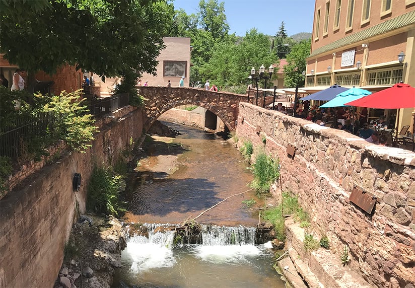
Manitou Springs is a quaint mountain community (population 5,300) nestled at the base of Pikes Peak in Colorado. The city has its roots in the gold rush and railroad expansion of the mid-1800s. Historic buildings and stone bridges, walls, and staircases abound along the narrow, winding roads. Many of these roads crisscross picturesque Fountain Creek, which runs the length of the city.
Another feature that defines the area is its unique geology. Twelve natural, effervescent springs bubble up through a series of cavernous aquifers below the valley floor. Long before western expansion of the United States, Ute, Cheyenne, Arapaho, and other plains tribes stopped at the springs to enjoy its healing waters.
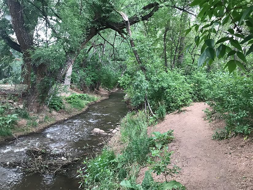
The beauty of Fountain Creek and the mineral springs gave Manitou Springs its identity as a place of healing. Early settlers built their homes along Fountain Creek, which provided immediate access to water and the bounty found in the lush valley. But over the years, the creek has been diverted, built over, and neglected. As a result, the creek has not manifested its full potential as a public space that connects people and promotes their wellness.
But that’s about to change. The city plans to spend $12 million building a two-mile walk along Fountain Creek. The Manitou Springs Creek Walk will give residents and visitors safe walking, biking, and running routes that are connected to the local shops and restaurants that make the city a unique destination. The Creek Walk would promote active living, reduce traffic congestion, and improve environmental quality.
The city formed the Creek Walk Steering Committee, which faced the challenging task of uniting a diverse set of stakeholders with competing interests. The answer was to use geodesign methodology and Esri ArcGIS software to analyze different design scenarios and create maps showing those alternatives.
Geodesign is a powerful planning method that uses stakeholder input and spatial analysis to show the possible impact of alternative design scenarios. Stakeholders are the people who are most affected by a given project. Geodesign gets its strength from the diversity of participants—as the adage says, two (or more) heads are better than one—and from the power of spatial analytics, which allows people to visualize the world both as it is and as it could be.
Placemaking Meets Mapmaking
Jane Jacobs, author of The Death and Life of Great American Cities, and William Whyte, who wrote The Social Life of Small Urban Spaces, pioneered the early concepts surrounding placemaking. They described how communities could be designed to capitalize on local assets, the intent being to give public spaces an atmosphere that attracts people to spend time and socialize, creating a greater sense of well-being.
Since 1989, the City of Manitou Springs had envisioned that the Creek Walk would be just such a public space. The Creek Walk Steering Committee and its consultants walked all the possible Creek Walk routes, noting on a map which segments would be either suitable for such a walk or capable of supporting one. There were at least 12 route options to choose from, as well as several possible combinations of routes.
Based on this site investigation and preliminary discussion, steering committee members and consultants created a list of desirable attributes for the Creek Walk, which included the following:
- Routes should be walkable and bikeable.
- They should comply with the Americans with Disabilities Act (ADA).
- Routes should be near enough to the creek that visitors could see and hear it.
- Routes should use existing pathways and easements (or be on parcels where easements could be easily acquired).
- Areas should be dominated by parks, trees, and meadows, creating a natural setting.
These criteria would later be used to develop spatial models using ArcGIS Pro, but first they had to be vetted.
Obtaining Feedback from Stakeholders
Seeking input from stakeholders is an essential part of the geodesign process that typically helps clarify requirements and validate assumptions. Two stakeholder workshops were conducted to get this input. The first workshop was held in June 2018 with a small group of active community leaders from Manitou Springs who represented visitors, residents, business and property owners, and local government executives. These workshop attendees reviewed the list of desirable attributes and offered additions to it.
The stakeholders wanted to accentuate the value of the creek itself as part of Manitou Springs’ identity. They stressed the importance of the creek’s stone bridges and nearby mineral springs; the quiet areas frequented by deer, duck, and fox alike; the spots where people can get their feet wet on a hot day; and places such as a restaurant patio where people can just enjoy the sound of the creek. This aha moment was a positive, unifying realization that became an important theme of the citizen engagement workshop.
Building the Spatial Models
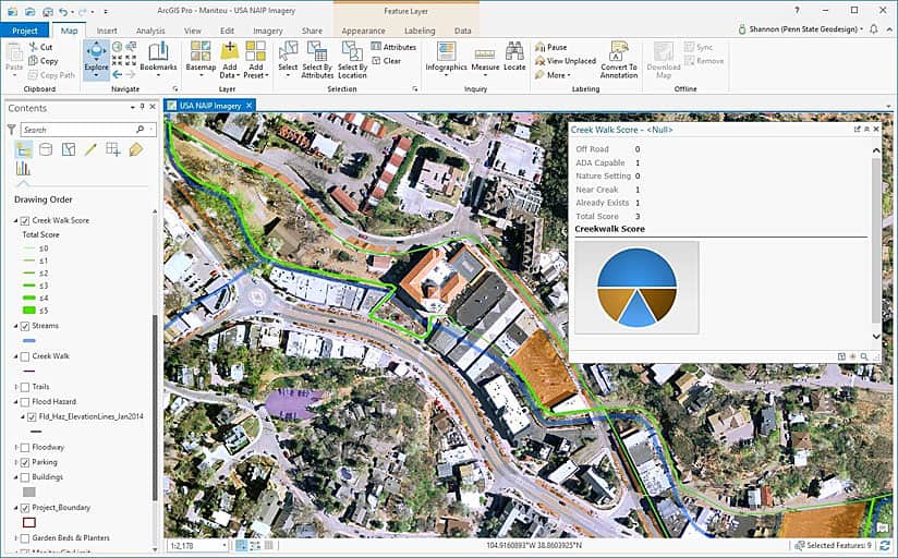
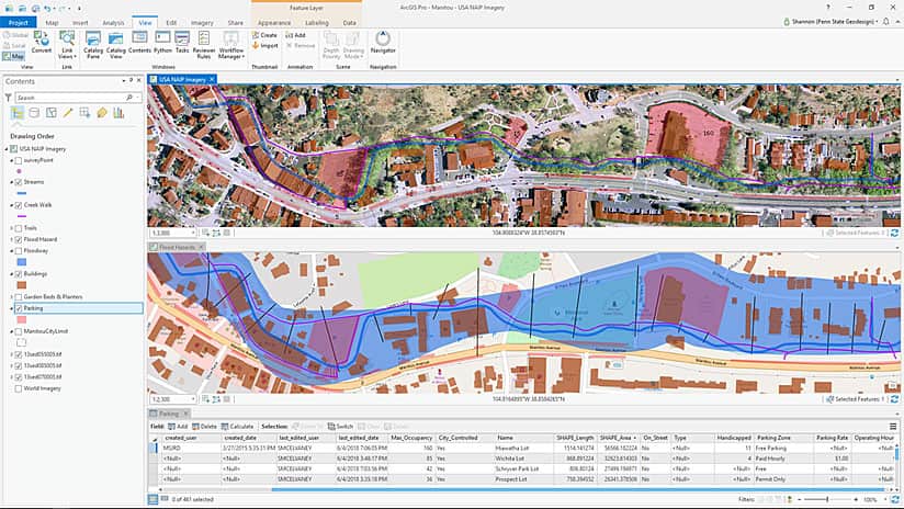
Now it was time to build spatial models to evaluate alternative routes. The consultants used out-of-the-box ArcGIS Pro tools to develop maps of these routes. They relied on heat map symbology and graduated symbols, as well as the Buffer, Spatial Join, and other tools.
Safety dictated whether a route was bikeable. A simple overlay of road data with vehicle speed limits and congestion was used to determine bicycle-friendly routes.
Shade was an important physical and temporal criterion for evaluating walkability. People are more likely to walk along shaded pathways to avoid the hot sun. In identifying which routes have more shade, ArcGIS Pro was used to create a heat map that showed the relative density of more than 2,000 trees. Alternative routes were overlaid with the resultant shade map, and locations along the routes were compared with photographs taken between 1:00 p.m. and 2:00 p.m.—typically the hottest time of day during summer—to validate the accuracy of the shade map.
A resident said that he wanted the Creek Walk to be aesthetically pleasing and enjoyable, so another heat map was made to evaluate this subjective concept. It raised a new question: What would that look like?
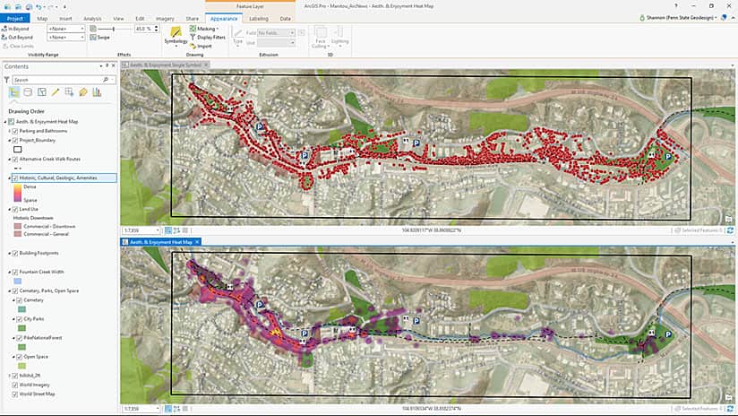
A list of criteria began to take shape: art, historic architecture and trees, beautiful views, geologic formations, ponds, and waterfalls. And when the committee added enjoyment, the list grew to include benches, informal seating, outdoor dining, interesting shops, bathrooms, parking, and so forth. To create the Aesthetics and Enjoyment spatial model, all those elements were mapped and a heat map was produced showing the concentration of these important elements along the alternative routes.
Thematic maps were made displaying the routes that passed near businesses, either directly in front of them or within sight of them. Map layers showing parcel ownership, land-use type, existing right-of-way, and information on easement status were combined to make the Easement Status map.
Visualizing Design Options
Armed with 10 maps that evaluated existing conditions, the consultants used ArcGIS Pro to develop three alternative designs:
- Cyclists Rule—bicycle-friendly routes
- Nature Walk to Shop—ADA-compliant walkable routes through natural areas
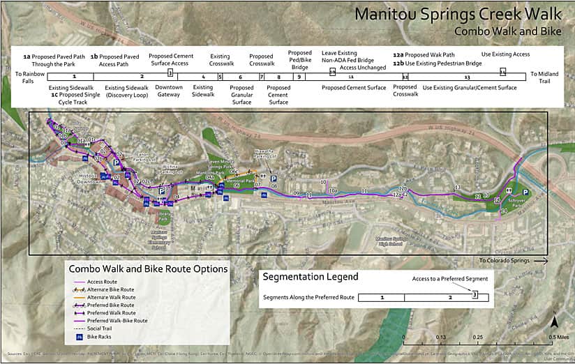
- Combo Walk and Bike—the best combination of the two other options
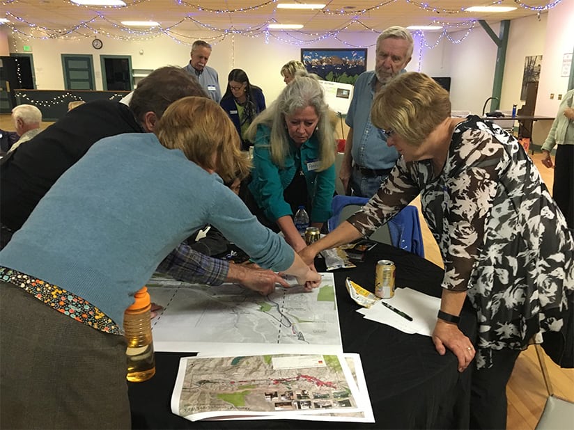
In September 2018, all three design options and the evaluative maps were presented during a much larger citizen engagement workshop that was attended by approximately 50 community and organization members. The participants broke up into groups of four or five per table to map their own routes. Each group then reported its designs to the rest of the workshop attendees.
Several major themes or messages arose from the group mapping efforts. The Creek Walk should be a system of trails with strong connections to other trails. Walking and biking paths should be separate. Natural-setting areas and parks should be left alone and spared from concrete.
The Combo Walk and Bike option was ultimately chosen, expanded, and improved on by the stakeholders, creating an integrated system of trails. The recommended Creek Walk design now consists not only of a primary, paved, ADA-compliant multimodal route but also secondary walking trails, a road bike path, a potential one-way bike track, and significant connections to existing trails and important destinations.
“The Creek Walk project enjoys incredible popularity. That being said, we all had a different idea of what a finished Creek Walk experience would be,” said Natalie Johnson, director of economic development for the City of Manitou Springs. “Using the geodesign process, we were able to preserve the passion and popularity of the project without turning it into a divisive issue.Geodesign is a benefit to all communities and community projects.”
Geodesign as a Stakeholder Engagement Process
The City of Manitou Springs has a strong citizen engagement framework that supports community-driven decision-making. There is also a strong desire to use science to inform those decisions. Geodesign upholds those goals, improving both the quality and creativity of decision-making.
The Creek Walk Steering Committee’s open, collaborative planning effort was very positive. Everyone felt that their voices were heard. The integrative, values- and science-based geodesign approach virtually eliminated conflict, making mutually beneficial deliberation possible.
By engaging stakeholders representing economic development, residents, government, and visitors, the Creek Walk blossomed into an important city asset that should benefit businesses, cyclists, and nature lovers. It became something more than its individual parts.
That is the power of participatory planning and the geodesign process. But it doesn’t happen naturally. It must be proactively nurtured and even institutionalized as part of the way change happens in a community. Geodesign is about problem solving; it’s about informed decision-making. More importantly, it’s about guiding conversations among diverse stakeholders to come up with plans that people both understand and are happy with.
From Plan to Implementation
By October 2018, the City of Manitou Springs Creek Walk Master Plan was fully accepted by the planning commission and the city council, and design drawings were drafted for the first segment. What started as a $100,000 master planning project is expected to turn into a $1.3 million effort by June 2019. Completion of the Creek Walk is estimated to cost $12 million, the vast majority of which will be funded by grants.
What’s important to remember is that a plan is just that—a plan. Over time, it will change and morph as people come and go, but with the right values and rationale for decision-making, the next leaders will be able to pick it up, understand how decisions were made, and carry the project forward. That is part of the beauty of the geodesign framework and the hallmark of a successful geodesign project.
“Due to a number of factors, communities are demanding transparencyfrom their city leaders,” Johnson said. “Geodesign enables project managers, administrators, and officials to clearly and succinctly explain the process and build confidence in citywide projects.This is a necessary—and often missing—part of so many community efforts.”

