Since taking the position of GIS/lifecycle data analyst at Boston College in 2021, Kevin Hess has made substantial improvements to the accuracy, security, and value of the institution’s spatial data. By adopting a hybrid solution that shares public data via ArcGIS Online and manages sensitive facilities data securely and efficiently in ArcGIS Enterprise, Hess implemented a modern GIS for Boston College.
Since taking the position of GIS/lifecycle data analyst at Boston College in 2021, Kevin Hess has made substantial improvements to the accuracy, security, and value of the institution’s spatial data. By adopting a hybrid solution that shares public data via ArcGIS Online and manages sensitive facilities data securely and efficiently in ArcGIS Enterprise, Hess implemented a modern GIS for Boston College.
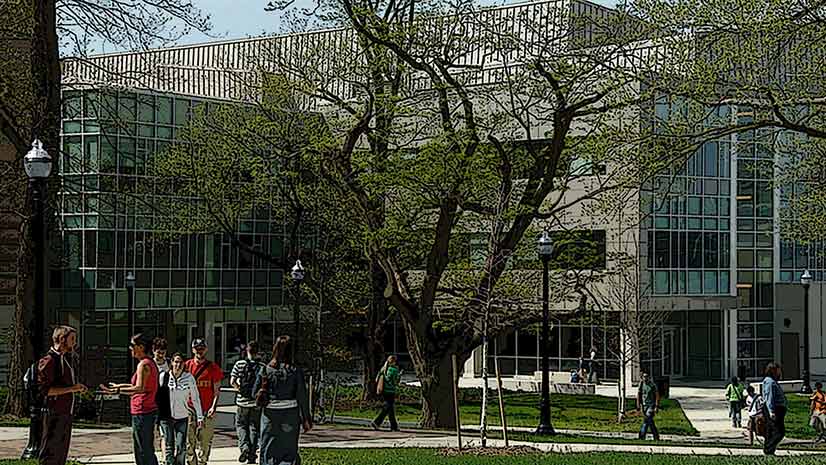
A private research university with a current enrollment of more than 15,000 students, Boston College was founded in 1863 by the Society of Jesus (Jesuits) in Boston’s South End as a liberal arts college. The main campus is now located in nearby Chestnut Hill, with additional campuses in Brighton, Newton, and Brookline.
More Efficient and Accurate
Boston College has been using GIS since 2008. Prior to Hess’s arrival, all GIS work had been completed using ArcMap. Maps were made available through ArcGIS Online and ArcReader. All GIS data was stored in a geodatabase on a file server.
“Since starting in my position, my first initiative was to migrate all maps and projects into ArcGIS Pro. I found [ArcGIS] Pro to be much more efficient and reliable, and generally provided better functionality to my work,” said Hess.
Although most of the campus had been mapped, data had been imported from sources such as Adobe Illustrator and AutoCAD. As a result, spatial accuracy for the entire campus map was lacking. The accuracy problems Hess identified included building footprints that were shifted and sized incorrectly and surface features, such as roads and sidewalks, that had been roughly digitized. Underground utility data was shifted and updates for major projects were missing.
Consequently, improving spatial accuracy of the entire GIS was a top priority. “I spent a very significant amount of time and effort editing all features to effectively redigitize the entire campus using surveys where available and high-resolution imagery elsewhere,” Hess remembered.
Redigitizing and correcting the spatial accuracy of surface features consumed his first six months at Boston College. However, Hess has continued improving accuracy, using new surveys as they are conducted and collecting GPS data on campus using a Leica GPS/GNSS device. To maintain and continually improve data accuracy, he works with all project managers to ensure he receives quality as-built drawings and surveys for any work done on campus.
Hess has moved on to more complex datasets, such as those associated with campus utilities. Acquiring location information for these assets has been more challenging. For all new utilities, he captures GPS coordinates during installation so that precise horizontal and vertical location data is obtained.

Enhancing Existing Maps
Although the accessibility map showing parking, walkways, entrances, and elevators existed previously, Hess worked with others on campus to update features and make corrections to accessibility paths. Maps that provided information on permit and visitor parking were also outdated, so he made them current and implemented functionality to easily filter parking spaces by permit type. All these public-facing maps were updated in an ArcGIS Experience Builder app that is integrated with the Boston College website, making them easy to locate while maintaining institutional branding as well as improving map printing.
Improving Data Management and Security
After migrating the maps and projects to ArcGIS Pro and improving data spatial accuracy, Hess wanted to implement ArcGIS Enterprise because it addressed several concerns he had about the GIS implementation he inherited.
“My most recent initiative has been to improve the security, management, and availability of the GIS data. This was the driving factor for deploying ArcGIS Enterprise,” said Hess.
Previously, the data resided in a file geodatabase on a network share. “While we restricted who had access, I was always concerned about data links being broken, the quality of backup processes, and lack of editing control,” said Hess.
By moving to ArcGIS Enterprise, he was able to store sensitive utility data and better control management of that data. Hess moved all GIS data to a Microsoft SQL Server Enterprise geodatabase. This data included data for the college’s steam, gas, telecom, electricial system, stormwater, sewer, irrigation, and chilled water. Boston College has moved away from maintaining utility data in CAD. It uses GIS to store and maintain the information. However, Hess has processes that export utility features maintained in GIS to CAD so it can be shared in that format, if needed.
Moving to ArcGIS Enterprise improved read/write speeds when editing and viewing data, which optimized workflows. Now he could store sensitive utility information and distribute it through Portal for ArcGIS, rather than ArcGIS Online. With Portal came better authentication and control over who could access and edit data. By enabling versioned workflows, student workers could edit their own versions instead of working directly with production data. The move to ArcGIS Enterprise allowed the use of better processes for data backups.
Migrating to ArcGIS Enterprise also streamlined operations. Hess has published a web app that references the utility data directly from the SQL database. This map updates on the fly, so everyone sees the most current data without requiring Hess to update ArcGIS Online layers. He plans to publish more apps and maps with referenced data.
Hess characterizes the organization’s response to the move to ArcGIS Enterprise as “excellent.” Once ArcGIS Enterprise was set up, he could generate all the user accounts needed without having to get users to set up accounts or remember passwords to access maps.

Expanding GIS
Just as Boston College is constantly evolving, so is its GIS. Two large property acquisitions have required updates for the accessibility and parking maps. Hess is also considering building a 3D campus map of Boston College. This map could be shared publicly and used as a tool for planning initiatives on campus. It would be useful for visualizing lines of sight and previewing how proposed projects would look on campus.
About the author