An updated version of the Historical Topo Map Explorer app(/livingatlas.arcgis.com/topomapexplorer) lets you explore more than 180,000 historical US Geological Survey (USGS) topographic maps. Available from ArcGIS Online, it provides easy access to Esri’s USGS Historical Topographic Map collection, which contains quadrant maps dating from 1879 to 2006 at scales from 1:10,000 and 1:250,000 (excluding orthophoto quads). The new app provides access to 1,745 new maps and corrected versions of maps previously available in the 2014 version of the app.
Maps in Esri’s USGS Historical Topographic Map collection are part of the USGS Historical Topographic Map Collection (USGS HTMC). Starting in 2011, the USGS National Geospatial Program began publishing scanned maps printed between 1884 and 2006 that were created using traditional cartographic methods and lithographic printing processes. Esri’s USGS Historical Topographic Map collection contains scanned maps that were published as an ArcGIS Online image service.
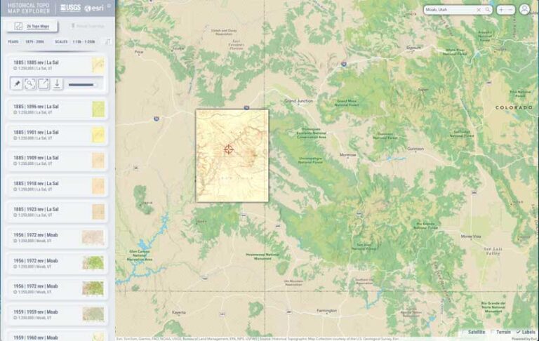
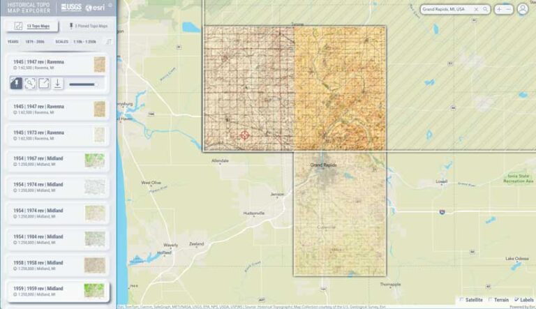
Using the Historical Topo Map Explorer app, you can search for maps by address or place or interactively from the map. The results are displayed in chronological order. Filter results by geographic extent, publication year, and map scale.
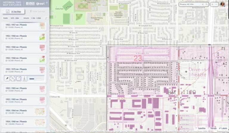
The updated app released in February 2024 adds new functionality. You can adjust the transparency of the topo map to see how it relates to current map features. You can also overlay historical maps on satellite images or 3D hillshades and add labels for current geographic features.
You can also pin and view adjacent historical maps to collections that you can save and refer to later. By pinning maps of the same location from different times, you can use the app to generate an animation that shows how an area and the cartography of those maps of that area have changed over time. You can download that animation as a video that can be exported and shared in a presentation or via social media.
By activating the satellite and/or terrain layers, you can view historical topo maps in even greater context. Access and copy metadata for individual maps by hovering over the i icon.
The scanned maps you find using the Historical Topo Map Explorer app can be used with your maps in ArcGIS Pro, ArcGIS Online, and ArcGIS Enterprise. Maps can also be downloaded as georeferenced TIFs and used in other applications.
For a demonstration on how to use the Historical Topo Map Explorer app, watch the John Nelson video at links.esri.com/Histopo.