ArcGIS Software Donated to GISCorps

Esri recently announced that it will donate personal use licenses of its ArcGIS software for each GISCorps volunteer who takes a GIS Service Pledge to volunteer for a worthy cause.
GISCorps is a program of the Urban and Regional Information Systems Association (URISA). GISCorps volunteers have been involved in the response to disasters since 2003, providing a range of mapping and disaster response services.
Each personal use license being donated has a commercial value of approximately $6,000 per year and will enable volunteers to address crucial location-based issues. GISCorps volunteers can leverage this software donation to support any cause or organization, whether local or abroad, which they are passionate about and that meets the criteria described on the GISCorps website.
Anyone interested in joining the GIS Service Pledge program should visit the GISCorps home page at www.giscorps.org.
United Nations’ New Global Data Hub Based on the ArcGIS Platform
Esri and the United Nations Statistics Division (UNSD) are working with a number of UN member states to utilize a data hub that will allow countries to measure, monitor, and report on Sustainable Development Goals (SDGs) in a geographic context.
The SDGs are a set of global goals that include such objectives as poverty eradication, access to safe water, clean oceans, eliminating hunger, gender equality, climate action, peace and justice, education, and other important areas on the UN agenda.
Called the Federated System for the SDGs, this data hub is based on Esri’s ArcGIS platform. It will use location intelligence to make it easier for countries to collect, analyze, and share the data required to monitor progress toward the SDGs.
The Federated System explores new ways for facilitating dataflows and action through data hubs and supports and informs data-driven decision-making through access to data that is usable, interoperable, and visual.
“The key challenge to collaboration between nations is a common digital context,” said Esri founder and president Jack Dangermond. “Data hubs provide this context with location intelligence and use organizations’ core data to engage stakeholders, communicate policy, inform the public, and measure progress.” Participants of the UN forum in Mexico City issued a declaration on the importance of geospatial technology’s role in implementing the SDGs.
Using Esri’s capabilities to enable access, collaboration, analytics, and powerful maps provides visualization and awareness that supply the critical information needed to ensure each country meets its commitment to these goals. Most importantly, the Federated System allows collaboration across countries and makes it possible to measure the success of global SDG initiatives for the first time.
Based on early success, UNSD and Esri are working to advance the initial research exercise to support broader adoption by other member states and organizations in 2018.
Meeting Environmental Challenges with GIS, Deep Learning, and Artificial Intelligence
Current methods for collecting the detailed geographic data needed for land-cover mapping are highly labor-intensive. Advanced technologies, such as artificial intelligence (AI), could help with the collection of this critical data but are not widely available for conservation applications. To remedy this situation, Esri and Microsoft are collaborating to provide greater access to these technologies through a newly aligned grant process.
This grant process will allow eligible organizations and individuals to receive ArcGIS, access Microsoft’s Data Science Virtual Machine and Cognitive Services offering, and obtain Microsoft Azure credits. Microsoft AI will integrate with Esri’s ArcGIS Living Atlas of the World and ArcGIS Image Server to help users perform high-resolution image classification and generate insight into land-cover changes that go far beyond current capabilities.
These new capabilities have been demonstrated by the Chesapeake Conservancy. This organization has done a great deal of work protecting and restoring the local watershed, but it needed more precision data to focus its work on the areas that could most benefit. To generate current and accurate data, it used ArcGIS and AI in the Microsoft Azure cloud to produce dynamic land-cover products in minutes rather than days.
“We believe that human ingenuity and AI can pair together to tackle some of our biggest societal challenges—including managing climate, water, agriculture, and biodiversity resources. We’re excited to work with Esri to deliver AI technology to researchers and organizations that will help them address these challenges,” said Lucas Joppa, chief environmental scientist at Microsoft.
Lands Critical for Biodiversity Preserved through Donation by Esri Founders

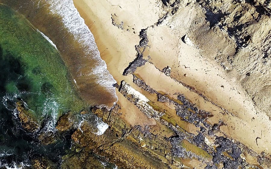
A private donation of $165 million by Esri founders Jack and Laura Dangermond has enabled The Nature Conservancy to purchase and permanently protect rare, coastal habitat in Santa Barbara County, California. The area, inhabited by at least 39 threatened or special status species and adjacent to a marine protected area, connects coastal lands to mountains and contains crucial wildlife corridors.
“This is an incredibly rare, ecologically important place with eight miles of coast and centuries-old coastal oak woodlands,” said Jack Dangermond. “This deserves to be preserved and managed by an organization like The Nature Conservancy.”
The site, encompassing more than 24,000 acres at Point Conception, will be named The Jack and Laura Dangermond Preserve and will be owned and managed by The Nature Conservancy. The Dangermonds’ gift, the single largest philanthropic gift in The Nature Conservancy’s history, has inspired other generous donations to the organization.
“We want to inspire more people to give major contributions toward conservation; that’s the only reason we’ve chosen to share our involvement. We want to set an example. Conservation isn’t just being nice to animals or plants; it’s investing in the continued life support systems of humans and all other species on the planet. We need more people to step up to protect our last great places,” said Dangermond.

