ArcGIS Dashboards Beta
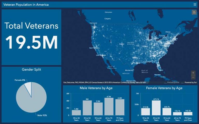
All ArcGIS Online users are invited to try a public beta of the next version of ArcGIS Dashboards (formerly Operations Dashboard for ArcGIS). Built on the ArcGIS API 4.x for JavaScript, ArcGIS Dashboards has been rearchitected so that dashboard authors can take advantage of enhancements that have been introduced across the ArcGIS platform.
Advances in overall map performance are part of an improved user experience. Better summary statistics for percentile and count and support for HEX, RGB, and HSL formats for color input provide more flexibility in data visualization.
ArcGIS Dashboards will fully leverage map authoring customizations using ArcGIS Arcade, a portable, lightweight, and secure expression language written for use in the ArcGIS platform. Arcade can be used to perform mathematical calculations, manipulate text, and evaluate logical statements. ArcGIS Dashboards exposes an interface for users to directly compose Arcade expressions for list and indicator elements that customize how data points are rendered.
ArcGIS Dashboards can be accessed by clicking the ArcGIS Dashboards icon labeled BETA in the ArcGIS Online app launcher. After ArcGIS Dashboards moves out of beta, it will be available in the subsequent version of ArcGIS Enterprise. Go to the ArcGIS Dashboards Beta GeoNet community for help and FAQ documentation on the beta version.

Saint Louis University and Esri to Advance Geospatial Innovation
Saint Louis University (SLU) and Esri will work together on projects.
SLU, well-known for its commitment to geospatial research and application development, recently founded the Geospatial Institute (GeoSLU). The institute will encourage students and staff to explore ways that GIS technology can provide insight into climate change, access to food and clean water, economic stability, and other issues.
SLU and Esri are both affiliated with the National Geospatial-Intelligence Agency (NGA), the nation’s primary resource for geospatial intelligence (GEOINT) for the defense and intelligence communities. Esri has collaborated with NGA for the last 30 years to broaden the scope and application of GEOINT nationwide. SLU signed a collaborative research and development agreement (CRADA) with NGA last year to share technical capabilities and research efforts to drive innovation in the geospatial field.


