“Technology is important, but it’s the power of collective action that will drive massive change.”
Leah Lizarondo, Founder, Food Rescue Hero

Last summer, more than 21 percent of adults in the United States reported experiencing food insecurity in their households—an increase of more than 6 percent over the previous spring, according to the Robert Wood Johnson Foundation (RWJF), a health-focused philanthropic organization.
While food banks provide an essential service in supporting people experiencing food insecurity, reliable transportation is often required to get to and from the distribution facilities. Yet this is sometimes unavailable to food bank users.
In 2016, Food Rescue Hero developed an ArcGIS technology-based system to provide delivery services of surplus food from food shops and restaurants to nonprofit organizations that serve those experiencing food insecurity. Using ArcGIS Pro and ArcGIS Online, the nonprofit has provided fresh food to tens of thousands of people living in its pilot city of Pittsburgh, Pennsylvania, according to Leah Lizarondo, founder of Food Rescue Hero.
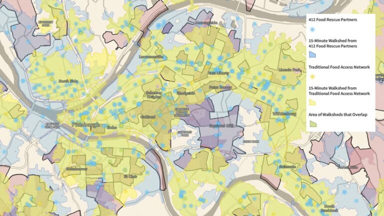
“More importantly, the distribution facilities are within an easy walking distance of just 15 minutes from their homes,” said Lizarondo. “This is because Esri’s geospatial technology has allowed us to be more precise in determining the exact locations of those that are underserved by traditional food banks.”

A Novel Use of Standard Food Delivery Technology
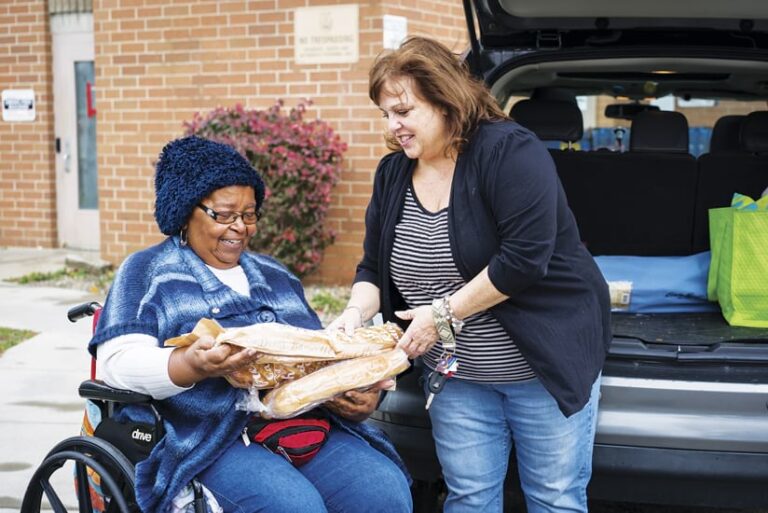
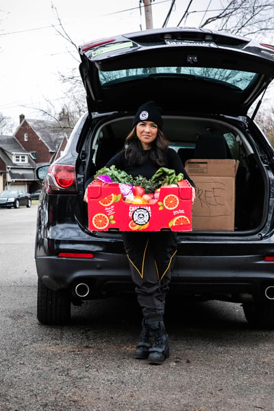
The organization’s volunteer drivers pick up surplus food from restaurants, grocery stores, and other food suppliers. They then deliver it to nonprofit organizations and community centers for distribution, or directly to households in need.
Food Rescue Hero modeled its service on the technology used by notable for-profit companies that specialize in food delivery. Volunteers get push notifications when surplus food is available nearby. The Food Rescue Hero app then guides them through every step of the process, giving them pickup instructions and allowing them to use delivery verification tools.
The process provides same-day service to people who lack food and eliminates the need for distribution centers to store it, allowing perishable food to be consumed while it is still fresh.

“Traditional pantries serve many people, but for the 35 percent of people living in poverty who don’t have access to reliable transportation, an additional—and sometimes insurmountable—difficulty is faced,” said Lizarondo. “In Pittsburgh, we used ArcGIS to activate nontraditional food access sites, filling in the gaps left by traditional pantries. We used data from the US Census Bureau, the US Department of Agriculture, and Pittsburgh Regional Transit.”
Pinpointing Priority and High-Risk Areas
To map public transportation deserts in the Pittsburgh area, Food Rescue Hero used a methodology outlined in Transit Deserts: The Gap between Demand and Supply by Junfieng Jiao, an associate professor at the University of Texas at Austin, and Maxwell Dillivan, now a senior planner at The Rapid, the transit authority in Grand Rapids, Michigan. In their 2013 study, Jiao and Dillivan developed procedures for quantifying and calculating transit supply and demand using census data.
The data that Food Rescue Hero’s staff extracted using Jiao and Dillivan’s methodology was then overlaid with the locations of traditional food pantries and nonprofit food distribution sites to determine the areas in Pittsburgh where food deserts occur.
The three datasets—poverty rates, food deserts, and transit deficits—are used to identify the populations most in need of food access. The Food Rescue Hero platform and database provide detailed metrics and analytics of the targeted areas and populations in which the organization works.
“We mapped low-income areas, food deserts, and transit deserts and identified priority and high-risk areas,” said Lizarondo.

Staff also used ArcGIS Online to calculate walking distances within these areas to better understand the footprint of Food Rescue Hero’s partners. The team then compared that to the walking distances around traditional food pantries.
“This is a new way of looking at food access and delivery,” said Lizarondo. “Using Esri’s geospatial tools, we have provided 40,000 people living in the Pittsburgh region with access to nutritious food that they wouldn’t be able to access if they were limited to the traditional food pantry system.”
Expanding the Service’s Reach
Food Rescue Hero is now licensing its food recovery system to similar organizations.
“I’m really proud to say that Food Rescue Hero is now helping food rescue organizations in 25 cities and towns across the US and Canada scale their operations,” Lizarondo concluded. “With our partners, we’ve been able to mobilize a growing network of 39,000 volunteers that deliver food to more than a million people each year. Our goal is to bring the technology to new cities each year and reach 100 cities worldwide by the year 2030.”

