West Broad Street in Columbus, Ohio, bears one of the longest and richest histories of any street in the state. Stretching for 9.3 miles through busy downtown Columbus, West Broad Street presents challenges to pedestrians and cyclists—but not for much longer.

As part of Columbus’s LinkUS project, the Central Ohio Transit Authority (COTA) is planning to turn West Broad Street into a rapid-transit bus corridor that will include bike lanes and paths to improve connectivity and walkability. Esri startup partner inCitu is using augmented reality (AR) and ArcGIS technology to help COTA bring its vision to life.
A New Vision for Public Transit
Started in 2020 by founder and CEO Dana Chermesh-Reshef, inCitu leverages AR technology to help city planners collaborate with residents and others impacted by urban development to visualize and plan new projects.
“We take open data from cities and generate augmented reality experiences,” said Chermesh-Reshef. “We create a map but also an experience on the ground where you can walk block by block and see the projects.”
By redesigning West Broad Street, COTA plans to foster a more equitable and sustainable community. The goal is to provide better access to jobs, businesses, schools, and health care for residents of one of the fastest-growing metropolitan areas in the United States.
To gain public support for this far-reaching vision, COTA needed to help residents understand not just how the infrastructure would impact streets, but also how it might transform neighborhoods and the commuting experience between historic areas such as Hilltop and Downtown Columbus.

“That’s where we come in,” said Chermesh-Reshef. “Through InCitu’s pipeline, planning data is turned into georeferenced mobile AR experiences using multiple ArcGIS products.”
The LinkUS team collaborated with InCitu to bring to life a new vision of public transit in central Ohio.
Seeing New Infrastructure in Context
Working with COTA’s communication partner Murphy Epson, the team designed an immersive bus tour experience for stakeholders and members of the public. The tour shares the narrative of several hypothetical future bus riders as they navigate from the Westland Mall area toward Downtown Columbus.
COTA used inCitu’s platform to visualize three parts of the proposed project in their real-world contexts: a bus rapid transit (BRT) station, micromobility hubs (places where commuters can transfer to other modes of transportation), and the projected mixed-use developments that will spring up along the West Broad Street route.
Leveraging InCitu’s already existing ArcGIS integration, the project was set up for fast and accurate testing and iteration. ArcGIS Maps SDK for JavaScript was used to host 3D models on a web map. InCitu’s technology then converted the models into georeferenced AR experiences that were accessible via QR codes. In addition, InCitu’s pipeline generated 3D feature layers and scene layers that were stored in ArcGIS Online and could then be used in other ArcGIS products.
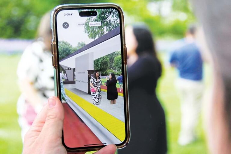
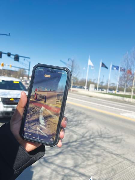
Once the AR visualization was ready, COTA ran bus tours along West Broad Street twice a week. Participants were let off the bus at three stops, where they scanned a QR code with their smartphones and, using the devices’ cameras, experienced the area in its future state via AR.
“This approach allowed people to see the proposed infrastructure and its impact on the area from their own perspective and let them share screenshots and videos with friends and family,” said Chermesh-Reshef. “It helped the public understand and get excited about the improved regional connectivity and accessibility, sustainable development, and how—even with expected population growth—[that] might lead to thriving, transit-connected neighborhoods instead of congestion.”
The AR tour engaged more than 2,500 viewers directly over six months, catching the attention of various stakeholders, including local government officials. Columbus mayor Andrew Ginther participated in the AR experience and even took a photo in front of the future Belle Street Station, sharing it on Instagram. This further expanded the reach of the AR visualization.

Interacting with Proposed Changes
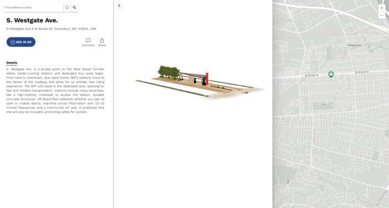
For people who couldn’t participate in the bus tour, the LinkUS website features a map, powered by ArcGIS Online, where users can take a self-guided version of the AR tour showing key locations along West Broad Street. Highlighted areas include the South Westgate Avenue and Belle Street BRT stops and the Westland Mall.
The map allows users to explore and experience these future developments interactively. By overlaying AR visualizations onto real-world locations, the map lets people picture themselves next to the new infrastructure being proposed in the area so they can visualize how these projects will benefit the community. It also makes the concept of future changes to transit more understandable and engaging.
“The goal is to provide an accessible platform for residents to see and interact with the proposed changes, as well as build an enduring sense of ownership and participation among community members,” said Chermesh-Reshef.
A Broader Vision for Regional Connectivity
The West Broad Street BRT corridor is just one part of a larger LinkUS plan that includes five more rapid-transit bus corridors. These corridors are part of a comprehensive strategy to enhance regional connectivity, reduce traffic congestion, and promote sustainable growth.
By using ArcGIS Online and inCitu AR technology within a larger experiential storytelling campaign, the LinkUS team helped make a complex project more tangible. Now, members of the public can see that by incorporating various modes of transportation into their main transit corridors, the LinkUS plan is supporting a more livable and sustainable urban environment.

