As the coronavirus disease 2019 (COVID-19) pandemic ravaged New York City (NYC) this past March and April—causing almost 170,000 known cases and more than 13,000 known deaths in the city’s five boroughs during that time alone, according to the New York City Department of Health and Mental Hygiene—heroes from all walks of life emerged. First responders and medical workers put their lives on the line to treat patients; cab drivers and public transportation employees still got people where they needed to go; grocers, bodega owners, and restaurant workers kept everyone fed; and the list goes on.

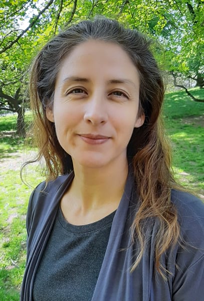
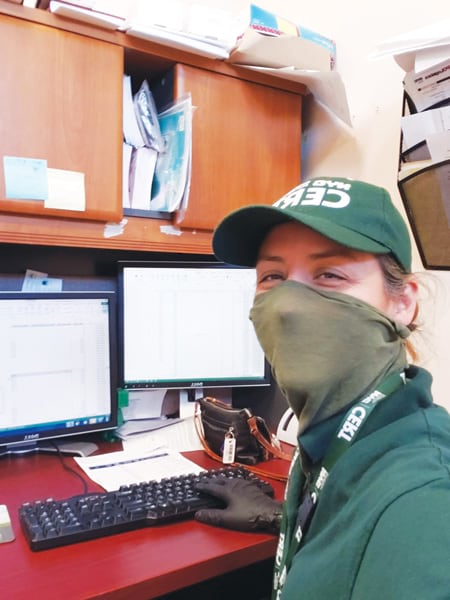
Terese Flores, a regional manager at the New York City Department of Parks & Recreation, shone brightly as a GIS hero during the crisis when she volunteered her time to help sustain some of the city’s most vulnerable local residents. Donning a green mask that matched her Community Emergency Response Team (CERT) uniform, Flores spent one day each week doing back end data entry, delivery, volunteer management, and canvassing tasks to support critical food distributions while residents were under stay-at-home orders.
The city was running this program out of some of NYC Parks’ recreation centers. Cab and car service drivers would show up at a distribution center, retrieve the food packages and paper work that went along with them, and go out to make the deliveries. They would record, by hand, whether each delivery was made.
“It’s one of the more thankless jobs but possibly one of the most important because it’s not fun, it’s not sexy, but it’s really important to know whether your system’s working,” said Michael DeMers, professor of geography at New Mexico State University and one of Flores’s former teachers, who admires not only her work but also her big heart.
Although it’s a bit unusual to have someone in a management role doing rote data entry, that experience took Flores back to her roots. When she first started working in GIS while pursuing a degree in geography from New Mexico State University, her bread and butter was data entry.
“I was very good at it,” she said. “I would just put my headset on and listen to music and sing really loudly and enter data when nobody was in the office. I fell in love with data entry because it was so easy to do. And it got me through college.”

After frequently working three jobs while going to school, jumping from one living situation to the next, and taking a three-year break from her education to travel and study Spanish as a native speaker in Spain, Flores got a job at the New Mexico Environment Department (NMED) during her last years of college.
“It was really great because it was the only job I had to hold down,” she reflected.
While there, she digitized data about aquifer sensitivity; parcel maps from the tax assessor’s office; and data on water wells, sewers, and septic tanks. The objective was to essentially upgrade—to digital formats—how different offices within the state viewed their data.
“This allowed them to quickly make decisions and speed up their inspection process,” said Flores. “All this practical experience gave me the best, well-rounded understanding of GIS.”
Once she finished college and her contract with NMED ended, Flores decided that she wanted to make one of her big dreams come true: moving to New York City. She signed up to attend an Esri business conference in Boston, Massachusetts, to meet people and look for job opportunities on the East Coast. At the conference Expo, she encountered Esri president Jack Dangermond and asked him to help her figure out how to move her career forward.
“I was thinking of pursing either management or computer programming. Jack told me to pursue management, and that is where I am now,” said Flores. “It was two seconds of his life that changed my life forever!”
She ended up moving to New York City and took odd jobs to make ends meet—from waiting tables to doing temp work. At the same time, she started learning project management and management theory by studying on her own. And she was always thinking about how GIS could be applied to various problems she encountered in her new hometown.
“New York has so many wonderful GIS applications that it’s just a fun place to be,” she said.
Soon, Flores landed a job at NYC Parks as a borough analyst. She did a lot of work for the Manhattan borough commissioner and gave presentations on capital spending projects. One of her most memorable undertakings—which helped her earn the department’s Rookie of the Year Award—was coming up with a way to distribute and display new accessibility signage at parks throughout Manhattan.

“I created maps of which locations needed what types of signs, so it was easy to distribute everything, and each district put the signs up quickly,” Flores explained. “We had to be under federal compliance within a month, and I think I got it done early.”
As soon as she was able to, Flores applied to the Department of Citywide Administrative Services (DCAS) Management Academy, and she got in on her second try. She then applied for a management job at NYC Parks and received the promotion.
“I was one of the younger managers, and to go from being an analyst to a manager is a big jump in city government,” she recalled. “It was a challenge trying to prove myself. I worked very hard and got a ton of experience with New York City government, and I was able to see all the different benefits that GIS can bring to the city.”
Flores was working so hard—and wanted to do so much more—that her supervisor suggested she take on interns. She started with one or two, then received an engineering student from France who went back and told all his friends about his experience. In the ensuing years, Flores ended up with more international students in her internship program.
“I had these really brainiac, intelligent people working for me, taking all the necessary measurements and working out how to fix stuff in parks,” said Flores. “They really helped me figure out how to get things done.”
Now, Flores has interns and volunteers that range from local high schoolers to college students from all over. She’s trained more than 100 of them in GIS, project management, presentation skills, and field mapping techniques—usually on Saturdays. Flores, who received an Alma Award in 2018 from NYC Parks’ Latino Society for this work, also sets up her interns and volunteers in dynamic teams. So college students become supervisors and high school students become teammates, and they all gain exposure to the working world.

“I was fortunate to work on a team made up of local New Yorkers and international interns, and that was very enriching,” said Robert Celestin, a former intern from Marist College, who now works as a GIS analyst at Esri partner Tetra Tech.
“Learning technical skills like GIS, combined with the policies involved in operating public spaces, proved to be invaluable in both my graduate-level schooling and career development,” said Jordan Ruggieri, a former intern from New York University, who is now a government relations manager at FlixBus.
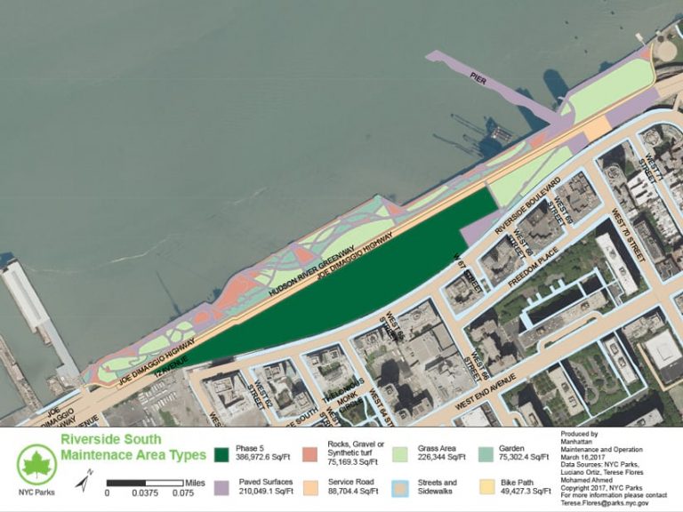
Managing parks throughout Lower and Midtown Manhattan, along with staff, interns, and volunteers, is no easy task. But Flores relies, as she always has, on GIS to make decisions. And she loves what she does and where she does it.
“It’s like I have my own little microenvironment in Manhattan, even though it’s only a 13-mile-long island,” she said. “There’s so much to study. There are so many needs here, and there are so many applications for GIS. I’m just excited all the time.”

