When organizations find themselves saddled with outmoded technology and inaccurate data, Esri partners can help. With expertise in developing innovative GIS-based solutions, as well as in guiding users through implementations and new workflows, Esri partners are seasoned collaborators that take an active part in helping their clients realize their goals.
See how three partners assisted a gas utility and two counties in enhancing their GIS-based workflows to streamline operations and fix data inaccuracies.
Geoenabled Workflows Foster Better Connections to Pipeline Projects
The pipeline acquisition process was tedious for Georgia-based energy services firm Southern Company Gas (SCG), a Fortune 500 company that serves 4.4 million customers in Georgia, Illinois, Tennessee, and Virginia. Historically, SCG’s land management team used a spreadsheet with 53 columns and more than 100 rows to manage and track new and existing gas pipeline easement acquisitions.
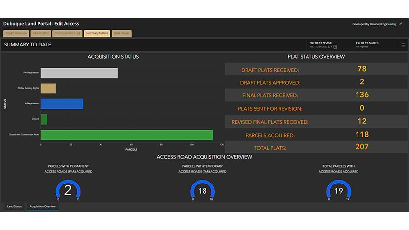
To improve project efficiency, Dawood Engineering geoenabled SCG’s spreadsheet-based workflows by implementing the new SCG Land Management GIS portal. This project data hub and transparent central repository empowers SCG’s pipeline design project team to better detect patterns, anticipate challenges with property owners, and identify areas of concern.
Natural gas transmission pipelines in the United States cross public and private land, where easement restrictions, environmental issues, and current and future land use complicate regulatory compliance during construction. Geoenabled workflows help SCG employees overcome these challenges by making it easier for them to stay connected not only to the overall status of a project but also with each parcel in a pipeline’s path.
Dawood staff members created SCG’s geospatial portal using ArcGIS Dashboards, ArcGIS Survey123, ArcGIS StoryMaps, ArcGIS Web AppBuilder, and ArcGIS Experience Builder. They employed an eight-step Agile-based methodology to develop the GIS workflow—a process that engaged users and enabled continual feedback and testing.
Development included beta and “sandbox” testing—a security practice that relies on an isolated environment to test code, files, and programs without affecting the underlying app, platform, or system. This was a key factor in the project’s success. Dawood staff also employed Esri’s AEC Project Delivery subscription service to host the portal, making maintenance easier.
Since developing the portal, Dawood has added functionality to allow users to load design information—such as location data for access roads, reroutes, workspaces, and boreholes—into the system. If any changes are made to pipeline designs, designers have 24 hours to provide new computer-aided design (CAD) files directly in the portal, which also tracks the progress of environmental surveys.
Encapsulating the idea of a one-stop shop, the portal delivers near real-time data for complex and fast-paced energy pipeline projects.
“Dawood’s GIS land portal increases efficiency, tracking, communication, and reporting while reducing past issues SCG faced in these areas,” said Dave Surina, SCG’s systemwide manager of land management. “We’re confident it will more than pay for our initial investment and apply to additional infrastructure and asset improvements.”
GIS-Based Asset Management System Improves Road Inspections
In Woodford County, Illinois—home to more than 35,000 residents—the county’s highway department conducted regular asset inventories, but the data wasn’t well organized and was often outdated. The department, which maintains 159 miles of roads, had limited funding and resources. Inspection records were documented on paper and stored in binders, which prevented staff members from making full use of this infrastructure data. Referencing the records was time-consuming, and using them introduced the potential for human-caused errors.
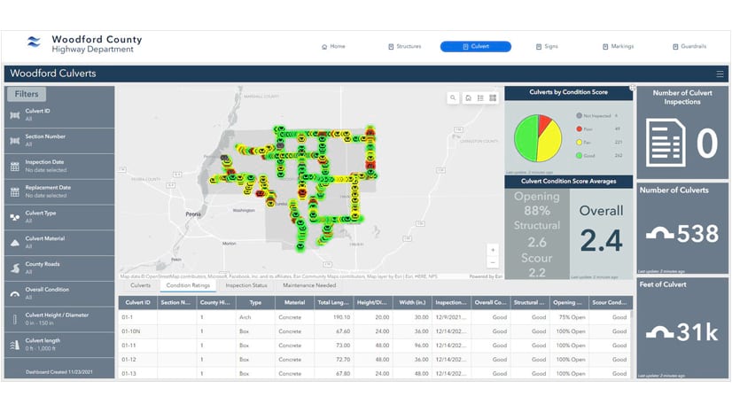
To address these issues, the Woodford County Highway Department partnered with Cloudpoint Geospatial to create a GIS-based asset management system using ArcGIS Online. The Cloudpoint team employed ArcGIS Experience Builder to consolidate the highway department’s existing asset inventories into one centralized system and integrated ArcGIS Field Maps into the department’s field-based workflows. Now, mobile crews can digitally collect and update asset data in real time, eliminating manual data entry, improving accuracy, and enhancing communication between mobile staff and office employees.
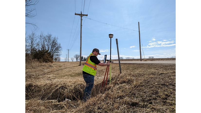
Cloudpoint team members conducted initial inspections on 75 percent of the county’s 538 culverts and 36,000 feet of guardrails, with staff members from the highway department completing the rest. This thorough data collection process laid the foundation for more effective infrastructure management.
The results have been transformative. The new GIS-based asset management system—with its easy-to-interpret visualizations of spatial data—has empowered department staff to monitor asset conditions more closely, schedule proactive maintenance, gain a comprehensive overview of infrastructure assets, and make more informed decisions. The new system saves time and resources by streamlining workflows, optimizing maintenance scheduling, and reducing redundancies.
Woodford County now benefits from taking a more proactive approach to infrastructure management, fostering long-term sustainability, improved resource allocation, and significant cost savings. The highway department’s adoption of the new asset management system serves as a model for how GIS technology can enhance public works operations.
Parcel Fabric Implementation Transforms Tax Mapping and Enriches Collaboration
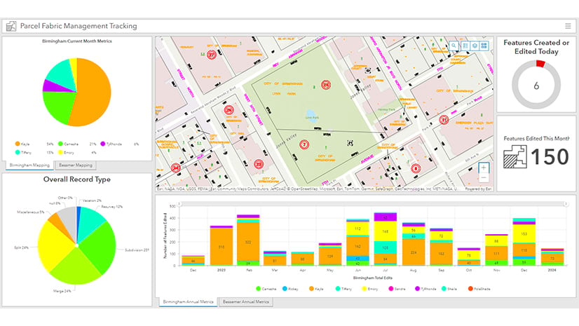
Jefferson County is the largest county in Alabama, serving more than 600,000 residents. Recently, staff at the Jefferson County Assessor’s Office found themselves grappling with a nearly 20-year-old tax system that relied on obsolete technology and outdated scripting languages. The county’s 320,000 parcels had significant issues with data accuracy, including problems with tile corners and edges, along with data gaps and overlaps. Additionally, some cities within the county, including Birmingham and Bessemer, operated independently, further complicating things.
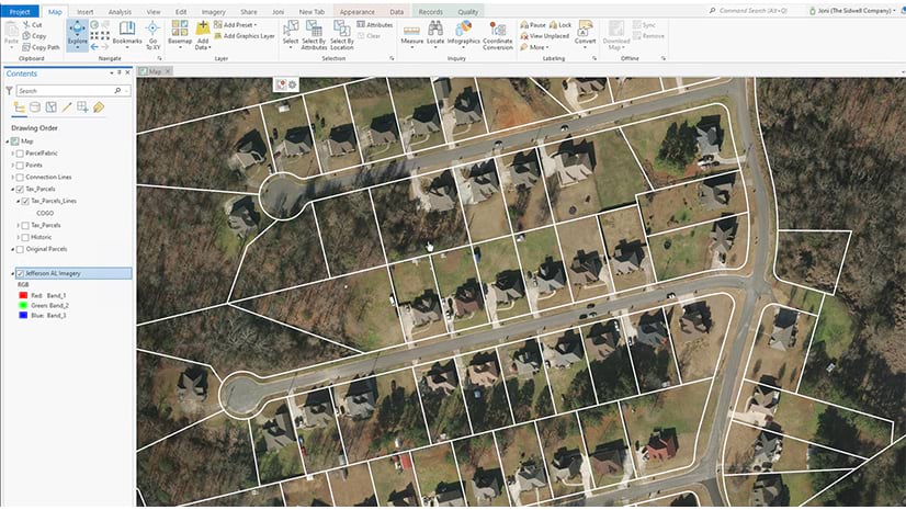
To increase data accuracy and consistency among collaborative departments, the Jefferson County Assessor’s Office turned to Sidwell for the company’s expertise in developing cost-effective GIS solutions. Working together, the two organizations used ArcGIS Enterprise to deploy ArcGIS Parcel Fabric, a comprehensive framework for managing, editing, and sharing parcel data. The assessor’s office needed a solution that could be edited and maintained in a multiuser environment using a services-based architecture. The team implemented attribute rules and workflows to ensure continuity in editing and reduce errors among mapping staff.
Sidwell and the assessor’s office initiated a countywide project to remap all parcels from the source plats and other land records. Now, the countywide parcel layer is updated each night to reflect changes made that day, keeping the data accurate. Staff across the county felt the effects of these endeavors almost immediately: There was a remarkable reduction in constituents reaching out to report data inaccuracies or request clarifications.
By adopting Esri’s parcel fabric data model, Jefferson County shifted from outdated processes to cutting-edge technology. The county has since extended this to optimizing its emergency services network boundaries. Additionally, the City of Birmingham—one of Jefferson County’s largest partners—has used the parcel data to update and refine its existing city boundary data.
“Tax assessor Gaynell Hendricks’s goal was to bring the county into the 21st century, [and] this project is a great example of that,” said John Powe, chief deputy tax assessor for Jefferson County.
With its ongoing partnership with Sidwell, Jefferson County is continuing to keep its technology up-to-date and its data accurate.

