Esri users now have another compelling option when deploying their ArcGIS technology in the cloud. As of April, Esri and Alibaba Cloud, the cloud computing unit of the Alibaba Group, are collaborating to ensure that their technology is interoperable.
This is an important step forward for Esri in driving the expansion of GIS and The Science of Where throughout the world, especially in the Asia Pacific region. Alibaba Cloud is Mainland China’s largest public cloud service provider and the third-largest in the world. The Hangzhou, China-based company currently has 18 data centers worldwide, including ones in Hong Kong, Jakarta, Kuala Lumpur, Mumbai, Singapore, Sydney, and Tokyo.
This collaborative agreement comes as Esri has observed rapid growth in successful ArcGIS implementations in Alibaba Cloud and is a testament to Esri’s commitment to its partner ecosystem.
“We’ve seen our users achieve amazing results already with Esri technology in Alibaba Cloud,” said Esri president Jack Dangermond.
He emphasized both companies’ shared belief that location intelligence in cloud infrastructure is pivotal to addressing users’ needs and solving real-world problems—particularly those that require scalable computing, storage, and networking capabilities.
“This has been made possible as both organizations have engineered interoperable and compatible technology, based on industry standards,” Dangermond added. “The agreement will now bring our engineers together to collaborate on shared initiatives that deliver the next wave of location intelligence innovation in the cloud.”
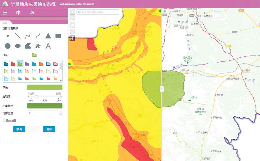
Esri’s sole authorized distributor in Mainland China, Esri China, has a proven track record in helping customers implement ArcGIS technology in Alibaba Cloud. For example, the Ningxia Land and Resources Bureau has built its own foundational geospatial data platform using ArcGIS Enterprise in Alibaba Cloud. The department has consolidated its electronic map data, imagery, survey results, and 3D data into a one-stop catalog used by all agencies at all levels of the Ningxia Autonomous Region’s government. Since the platform was released in 2016, an unprecedented amount of authoritative data has been made available to government and civilian users alike.
Esri China’s president, Francis Ho, has witnessed the rapid migration of location intelligence capabilities to cloud infrastructure—and believes that this will only continue.
“Organizations are rapidly adopting GIS and combining it with the capabilities of cloud technology,” said Ho. “Our users already rely on ArcGIS Enterprise and Alibaba Cloud to do this reliably and efficiently, using world-class innovation from our GIS experts in China, the United States, and around the world.”
Alibaba Cloud provides robust and licensed images of popular operating systems, such as Windows Server 2016 and RedHat Enterprise Linux, in its Elastic Compute Service (ECS) instances. Several of these available operating systems are already tested, certified, and supported by Esri. This means that organizations can deploy ArcGIS Enterprise technology in Alibaba Cloud ECS immediately.
As Esri’s relationship with Alibaba Cloud moves forward, its product engineers and developers will continue to work on adding support for other systems and services.


