Every person deserves clean drinking water. Unfortunately, this basic standard goes unmet in many communities due to lead-contaminated water. When consumed, this can cause impaired mental and physical development in children and accumulate in adults to the point that it damages the nervous system, the brain, the kidneys, and red blood cells.
These ill-health effects can be completely avoided by removing lead pipes from water service lines. Despite this well-known fact, the Natural Resources Defense Council (NRDC) estimates that between 9.7 million and 12.8 million homes in the United States are connected to water mains via lead service line (LSL) pipes. Funding to assist communities with replacing lead pipes was negligible until the Infrastructure Investment and Jobs Act, passed with bipartisan support at the end of 2021, allocated $55 billion for expanding access to clean drinking water, particularly in low-income communities.

With this new influx of capital, the City of Oconomowoc, Wisconsin, acted quickly and began taking elevated measures to replace all the lead service lines within its jurisdiction. Together with Esri partner Symbiont Science, Engineering, and Construction, Inc., the city implemented some of the latest Esri technology—including the Lead Service Line Inventory solution and ArcGIS QuickCapture—to get moving in the right direction.
Gaps and Inefficiencies in Data and Documentation
A key component of implementing a lead service line replacement program is having an inventory of service line locations and the materials the pipes are made from. This helps utilities better understand, plan for, and manage all the activities associated with the replacement. However, in many cases, utilities lack complete and accurate information about pipe materials.
As operations staff at the City of Oconomowoc’s water utility got started on the replacement project, they soon identified significant gaps and inefficiencies in their existing datasets and documentation practices. For one, the city recorded information about service lines and replacement activities in spreadsheets. Additionally, supplemental datasets on sidewalks, street surface condition ratings, and water main breaks simply didn’t exist.
To support the LSL replacement program, the city needed a way to quickly advance its datasets and develop new tools to monitor progress. The timing proved ideal. The city was already undergoing a multiyear GIS conversion from an external, third-party provider to an in-house ArcGIS Enterprise system.
“It became apparent that there had to be a better way,” said Joe Pickart, the City of Oconomowoc’s utility manager.

This realization prompted Pickart to contact Symbiont, a nationally recognized engineering, design-build, and construction firm. The GIS team there introduced the utility’s operations staff to the Lead Service Line Inventory solution from Esri, which, although it wasn’t available in ArcGIS Enterprise, could serve as a framework to support the LSL replacement program. The solution was built with inventory, tracking, and reporting in mind, and it is meant to be a comprehensive system that can also incorporate supplemental datasets. Symbiont offered to replicate the solution’s data structure and apps in the city’s ArcGIS Enterprise implementation.
But first, the City of Oconomowoc was going to need to collect data, and leaders wanted that done in just two months, since the water utility had a number of assignments to tackle in fast-approaching 2022. This was going to be tough because the team had to gather some critical data from scratch.
Quick and Accurate Mobile Data Collection
In many cases, water service pipes cross beneath sidewalks as they extend from the water main to a house. Thus, replacing lead pipes often requires digging up sidewalks, which adds to the cost of an LSL replacement project—unless pipe and sidewalk replacements can be done in tandem.
This is what the City of Oconomowoc sought to do. Staff from the water utility got in touch with the city’s engineering department to identify sidewalks that needed to be moved or replaced. However, the engineering department didn’t have maps that pinpointed the locations of previous data collection activities, which made it difficult to determine the scope of the project and estimate costs.
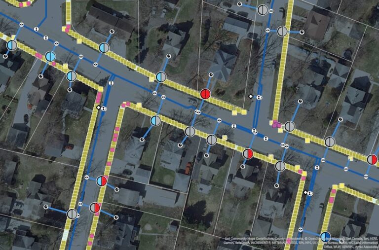
When Symbiont got involved, the team there proposed that Oconomowoc map every single sidewalk as an individual asset instead of a line, which is what the city had been doing before. This way, the data would better support long-term sidewalk management and simplify coordination between the sidewalk and LSL replacement projects.
After doing a quick analysis, Symbiont’s GIS team determined that it would have to gather data on an estimated 135 miles of sidewalk. Using a high-precision GPS unit, Symbiont planned to capture data on approximately 8 miles of sidewalk per day. Instead, after one day of mobile work, the team collected fewer than 2 miles of sidewalk data. This would have made it impossible for the team to meet the city’s data collection deadline.
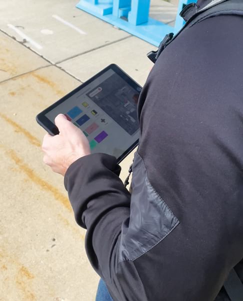
Having heard of ArcGIS QuickCapture, a simple geospatial app that speeds up field data collection, the team at Symbiont decided to try using it for the sidewalk project. QuickCapture allows mobile crews to walk at a faster pace while still capturing information about each asset—in this case, sidewalks—using high-accuracy data collection software.
QuickCapture took just a few hours to configure. After also implementing the R2 backpack-mounted GPS unit from Esri partner Trimble, the team tested this new approach to mobile data collection. Immediately, crew members recognized the benefits of using QuickCapture: collection speeds improved significantly while still maintaining accuracy.

On average, the team gathered 6,000 data points per day, which amounted to more than 100,000 points by the time the project was finished. This reduced the time it took to collect sidewalk data from an estimated 59 days to just 16 days, allowing the team to meet the city’s data collection deadline.
Streamlined Data Helps Prioritize Improvement Projects
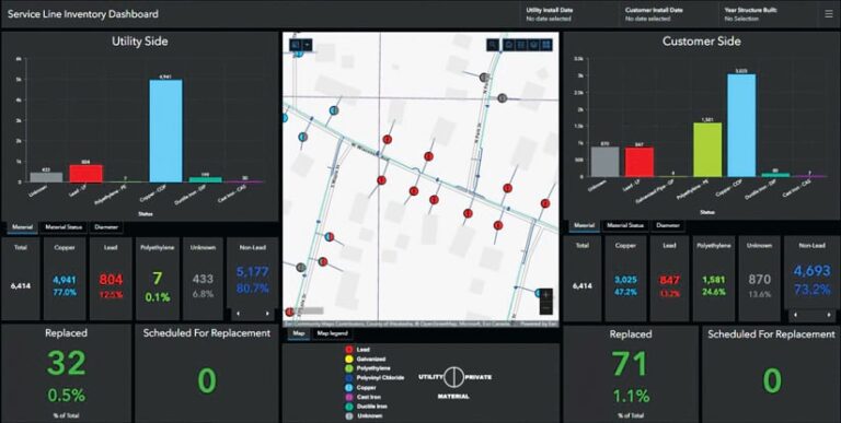
With the sidewalk datasets complete, Symbiont’s GIS team focused on implementing the Lead Service Line Inventory solution for the City of Oconomowoc. The solution engages many Esri products that the city already had in place, including ArcGIS Field Maps, ArcGIS Dashboards, ArcGIS Web AppBuilder, and ArcGIS StoryMaps. This made it easier to implement a comprehensive software solution for the LSL replacement project that provides precise mapping, accurate infrastructure analysis, ongoing tracking and reporting, increased field mobility, and detailed communication and outreach with stakeholders.
And because the city streamlined data collection and management for its supplemental datasets, various teams can better prioritize their city improvement projects as they set out to achieve the goals in Oconomowoc’s five-year capital improvement plan. The web mapping app built for the LSL replacement project integrated so much information—including sidewalks in disrepair, poor street conditions, historic water main breaks, and water quality complaints—that city staff can now focus on clusters of issues in problem areas instead of dealing with issues one by one.
Of course, the city has also been able to use the Lead Service Line Inventory solution to identify customers with suspected lead laterals and integrate this information with precise sidewalk, street, water main, and customer datasets. Now, the City of Oconomowoc is actively removing lead pipes from residents’ service lines, paving the way for other efforts to provide safe, clean drinking water to all.


