The Relevance of Cartography, A Cartographer’s Perspective
Modern cartography is everything we do in our daily life as a cartographer or GI scientist to produce maps or—to be more precise—to design cartographic communication processes.
The role of the map has changed. Maps used to be artifacts. They had to look beautiful and be well designed. They had to store information for a long time because that information was needed for a long time. In modern cartography, the map has an increasing number of functions. Besides being an artifact, a modern map is also an interface that gives people access to information stored in the map and—beyond the map—in databases.
The map therefore functions as a table that structures information through spatial attributes. If a modern map is an interface that gives access to structured information, then the concept of modern cartography in one phrase would be “efficient communication of geospatial information.”
That’s why a modern cartographer needs to be an interdisciplinary professional. For a cartographer, it is most important to know about computer sciences, as well as GIS, photogrammetry, remote sensing, geodesy, design, art, modelling, and analysis techniques. A cartographer must be able to adopt new technologies.
All these fields influence the end product of the cartographer. This triangle formed by art, research, and technology makes the best cartographic products. The modern cartographer is in the middle—better yet at the heart—of that triangle. He is skilled, trained, and able to deal with geodata, design principles, and the newest technologies.
Unfortunately there are fewer and fewer cartographers who have this mix of skills. Rather, there are experts in geodata handling who lack design skills. There are programmers who lack a profound understanding of geo. This is caused by the lack of dedicated cartographic education as well as due focus on particular skills.
The challenge cartography faces: while maps are more prominent than ever, cartography is losing ground in institutions. Those who have been involved in cartography for a while have witnessed transitions not only in what we do and how we do it but also especially how we talk about it. Instead of talking about cartography, we use terms such as GIS, geomatics, geoinformation science, geovisualisation, visual analytics, and geospatial information management—to name just a few. Those terms have a short history that dates to the adoption of computers for making maps. Maybe you have experienced difficulty in describing a “geo-spatial-visual something,” but maps and cartography are universal terms that everyone recognizes.

Maps are big news right now. Influenced by companies like Google, Apple, and Microsoft, maps have become a must-have on smartphones and web applications. They are very attractive to many, and map is a term with contemporary, relevant, and attractive associations.
However, it seems the term cartography is seen differently especially by experts, specialists, and those closely related to the field. Maybe this is because it seems that a different name is needed because the job we do with maps has changed. Different technologies and methods are used, which demand new and often very complex competences, so how can I use the same term?
Isn’t a new name needed that reflects these changed competences and technologies? Shouldn’t this name indicate I am doing something modern, complex, and contemporary that will be respected, appreciated, and recognized? If I am to call myself a cartographer or say I am involved in cartography, will I receive the same respect, appreciation, and recognition, or will I be associated with something old-fashioned and outdated? There are many rationales for the use of certain terms, and all have relevance. However, it seems that the term cartography is avoided, especially by cartographers. Many activities now associated with other terms could easily simply be called cartography.
In communication science, we use the theory of semiotics to explain communication processes. In this model, syntactical, semantic, and pragmatic dimensions are used. Unlike semantics, which examines meaning that is conventional or coded in a given language, pragmatics studies how the transmission of meaning depends not only on structural and linguistic knowledge of the speaker and listener but also on the context of the utterance. In this respect, pragmatics explains how language users are able to overcome apparent ambiguity, since meaning relies on the manner, place, time, and other characteristics of an utterance.
If this is true, then how we use and understand terms is always an ongoing process. Use and understanding can be influenced. This applies to the terms map and cartography as well. Therefore, it is in the interest of those who use and love maps and appreciate the art and science of making maps to contribute to this process, which fits into the ongoing renaissance of maps and mapmaking.
For more information, contact Georg Gartner or president@icaci.org or visit www.icaci.org.
About the Author
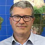
Georg Gartner is a full professor of cartography at the Vienna University of Technology. He holds graduate qualifications in geography and cartography from the University of Vienna and received his PhD and his habilitation from the Vienna University of Technology. He was awarded a Fulbright grant to the University of Nebraska at Omaha in 1997 and a research visiting fellowship to the Royal Melbourne Institute of Technology in 2000, to South China Normal University in 2006, and to the University of Nottingham in 2009. He is a responsible organizer of the International Symposia on Location Based Services and editor of the book series Lecture Notes on Geoinformation and Cartography published by Springer. He is also editor of the Journal on LBS by Taylor & Francis. He serves as president of the International Cartographic Association.


