Biodiversity is the variety of life on Planet Earth, from microscopic genes to entire ecosystems. But the natural world is under siege. The rate of species extinction right now is at least 10 times to hundreds of times higher than the average over the past 10 million years—and is accelerating—according to the Intergovernmental Science-Policy Platform on Biodiversity and Ecosystem Services (IPBES).
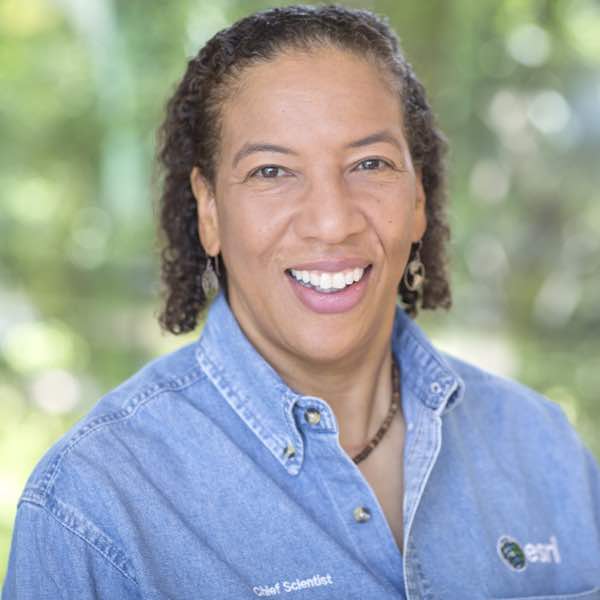
It is essential that we all care about biodiversity. As Dr. Healy Hamilton, chief scientist of NatureServe, pointed out in her Keynote Address during the Esri Science Symposium at this year’s Esri User Conference, diversity of life is the foundation of our ecological, cultural, economic, and spiritual well-being. It has everything to do with the food we eat: 15 crop plants feed 90 percent of the world’s population, yet 400,000 plant species are known to have edible parts, Hamilton noted. It has everything to do with the medicines we take: 40 percent of drugs come directly from the biodiversity in creatures such as amphibians, sea cucumbers, and bats, she said. We cannot survive on the earth without the services that biodiverse ecosystems provide, such as pollination from honeybees, native bees, and even flies; nutrient cycling, wherein nutrients move from the environment to plants and animals and back again; and the purification of air and water.

The implications of a less biodiverse planet are gargantuan for agriculture, forestry, recreation, real estate development, energy infrastructure, transportation, and even military readiness. And yet biodiversity remains a blind spot for humans. As the venerable naturalist E. O. Wilson has warned, the only hope for the species that are still living is a human conservation effort that’s commensurate with the magnitude of the problem.
For many scientists, 2021 is the year of biodiversity—the year in which we finally get serious about preserving the diversity of life on this planet. Momentum has been building toward a series of very important global biodiversity conferences. They include the United Nations (UN) Biodiversity Conference in Kunming, China; the UN Climate Change Conference UK 2021 in Glasgow, Scotland; and the E.O. Wilson Biodiversity Foundation’s Half-Earth Day in London, the United Kingdom (UK). Publishing around the same time from Esri Press is GIS for Science, Volume 3: Maps for Saving the Planet, which focuses heavily on biodiversity and analyzes it through the lenses of global satellite observation, forestry, marine policy, artificial intelligence, conservation biology, and environmental education. These meetings and the book all explore the actions we need to take and the essential tools we need to use to reverse the planet’s loss of biodiversity and address the impacts that this has already had on ecosystems, species, and people.
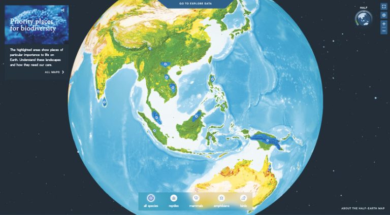
Esri is involved in many efforts to reduce biodiversity loss, primarily by helping people leverage geospatial technology to monitor at-risk species, control invasive species, protect critical habitats, improve water quality, help policy makers make science-informed decisions, and more. While there are so many important projects under way, one to call attention to is the Half-Earth Project. Put on by the E.O. Wilson Biodiversity Foundation, the project aims to safeguard half of the earth’s land and sea.
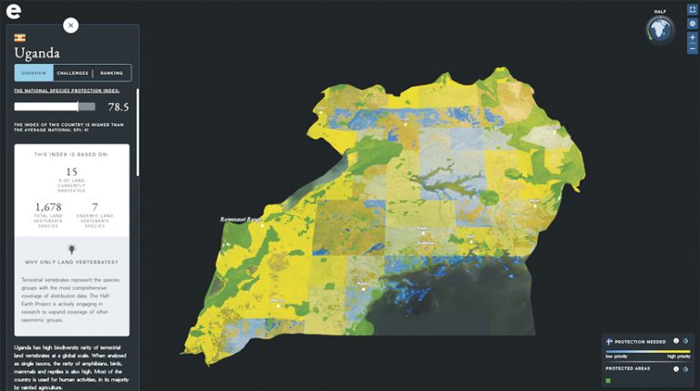
The Half-Earth Project puts species front and center for conservation. If species are accurately represented in how we characterize the planet’s biodiversity and half of all land and sea are eventually protected to better manage species’ habitats, then this can help reverse the current extinction crisis. To this end, one of the project’s goals is to map species distribution around the globe and track conservation progress at the species level to identify places where additional conservation actions would best preserve biodiversity. The Half-Earth Project Map—a joint effort from Yale University, Map of Life, Vizzuality, and Esri—allows users to interactively explore global biodiversity data, areas that are prioritized for conservation, and various biodiversity indicators.
A recent update to the Half-Earth Project Map introduces National Report Cards with a Species Protection Index (SPI). This measures how many and how well groups of species are protected by a country’s conservation efforts at the national level. The SPI is a very important biodiversity indicator for policy making because it helps ensure that conservation actions continue to reflect and achieve conservation goals over time by prioritizing areas where biodiversity protection is most needed. The layers of priority areas for conservation show where efforts can be directed to make the most rapid gains in species protection. And the Half-Earth Project updates the SPI regularly to reflect when additions are made to protected area networks, which is particularly significant in countries with low SPI values. The Convention on Biological Diversity is considering adopting SPIs as a trial indicator for collaborative, coordinated global action plans to protect biodiversity. Additionally, SPIs have been made available for use to organizations such as the UN Environment Programme World Conservation Monitoring Centre, the Group on Earth Observations Biodiversity Observation Network, and the IPBES.

Indeed, the foundational science of the Half-Earth Project is the forerunner of other initiatives such as the emerging 30×30 movement. Dozens of countries have recently committed to conserving 30 percent of their land and waters by 2030. The United States’ commitment includes an executive order signed by President Joseph R. Biden that went into effect in January, as well as pledges to do the same from tribal nations (in the spirit of equity and reconciliation) and states such as Hawaii, Illinois, Maine, Michigan, Nevada, New Mexico, New York, South Carolina, Virginia, and California. Not surprisingly, Esri is playing a major role in California’s 30×30 efforts by providing an open geospatial infrastructure that facilitates holistic conservation planning, incorporates indigenous and other community feedback, and allows users to evaluate scenarios for sustained landscape conservation. (Get more information about Esri’s 30×30 efforts.)
It is essential to discover, identify, and map not only as many species as possible but also those species that are at risk and aren’t already safeguarded. In “Open Science Is Good Science,” a column I wrote for the fall 2020 issue of ArcNews, I briefly mentioned NatureServe’s Map of Biodiversity Importance, which offers the first high-resolution view of the habitats of more than 2,200 at-risk species across the United States. At the Esri Science Symposium this summer, Hamilton shared the latest updates to the map and its data within ArcGIS Living Atlas of the World, plus the many other tools and resources that NatureServe makes available for mapping the distribution of imperiled species. (Check out posts and information from the Esri Science Symposium.)
Projects such as Half-Earth, 30×30, and the Map of Biodiversity Importance are showcasing how critical geospatial technology is to fighting the existential threat of biodiversity loss. This will ultimately affect the food we eat, the medicines we take, the buildings we live in, and all the natural spaces that we hope to enjoy. Biodiversity matters to all of us, so let’s get to work protecting it by joining these and other causes.


