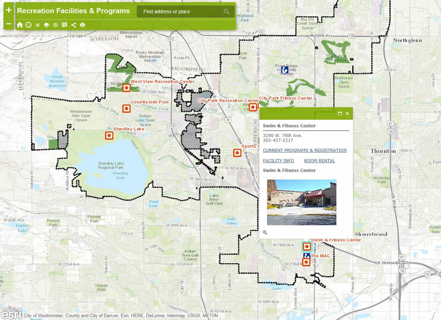
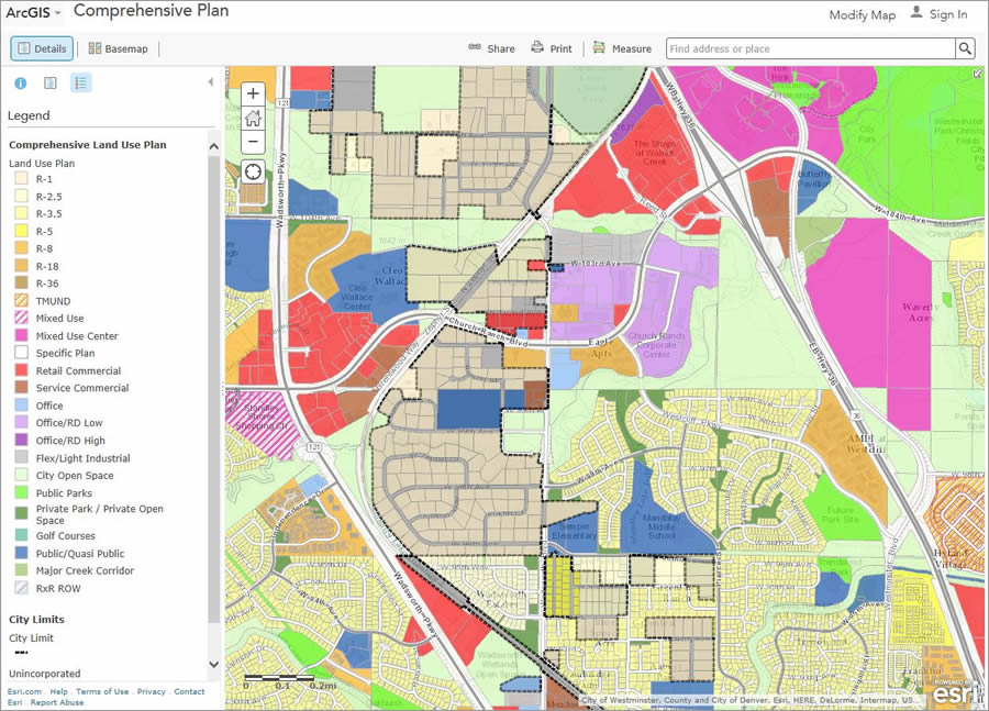
When residents in Westminster, Colorado, want to view the city’s comprehensive land-use plan, see where permits for solar power systems have been issued, or find a dog park, they can view web maps created and shared using Esri’s ArcGIS.
Westminster’s online map services page includes a map gallery of recreational facilities, vacant developable land, recycling drop off spots, city facilities, public art sites, and much more.
Located 10 miles northwest of downtown Denver, east of the Rocky Mountains, Westminster is a growing city with a population that tops 100,000. The Denver metropolitan area is a tech-savvy region, and Westminster has been one of the leaders in developing new ways of using GIS data and making geographic information available to residents. The four-member City of Westminster GIS group develops GIS applications and manages spatial data for the city. The team also does much of the municipality’s mapping work, which includes creating both web-based and traditional plotted maps.
Staying ahead of the GIS Curve
The Westminster GIS group prides itself on staying at the leading edge of geospatial technology. The staff created a series of interactive web maps for the map gallery, providing residents with an intuitive visual tool for learning more about city services and administration.
Westminster was also one of the early adopters of ArcGIS Online, giving the city the ability to publish web maps that would make information easily accessible to constituents. Many of these web maps are in the Living Atlas of the World or on ArcGIS.com. The Living Atlas contains beautiful, authoritative maps on hundreds of topics. The maps are created and shared by Esri, Esri partners, and members of the ArcGIS user community.

Time Savings Benefit Multiple Departments
Dave Murray, the city’s GIS manager, recognized the value of making authoritative local data available online by contributing to the Living Atlas. Contributed data is incorporated into Esri’s World Topographic Map, which is used as a ready-made backdrop for a wide range of maps, from interactive story maps to printed displays.
The Esri World Topographic Map is made up of 20 maps of different scales. When you zoom out, the scale of the basemap decreases, meaning you will see a simpler-looking map with fewer features such as street names. This means participating communities have a basemap, easily accessible in ArcGIS for Desktop or ArcGIS Online, which can be quickly dropped into maps with little concern that street labels are too small or the map symbology unattractive.
Westminster uses ArcGIS Online basemaps from the Living Atlas regularly in the city’s map products, including many interactive web maps. Sandy Malesky, GIS specialist for the city, estimates that she saves up to two hours each time she uses the basemap, as she doesn’t have to re-create a basemap for each individual web application she makes. “I can focus on highlighting Westminster’s features instead of wasting time making street labels and symbols for building footprints,” she said.

The Planning Department is one of the city departments that has benefited from using the Living Atlas. ArcGIS Online provides a convenient contextual tool for citizens to browse data related to planning and project development. Internally, the time saved using the basemaps from the Living Atlas has increased staff productivity and helped the city provide more meaningful information to the public.
Increasing Community Involvement
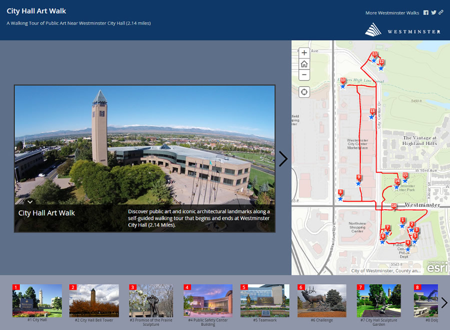
The GIS team also created an interactive story map that highlights the public art and architecture that are within walking distance of City Hall. The World Topographic basemap provides a high-quality backdrop for users navigating the route of the walking tour.

The City of Westminster’s Public Art Program represents the evolution of public and private investment, consistently high development standards, and the continual establishment of partnerships between the city and the development community.
More than 100 individual works of art are included in the program. “[The story map] allows Westminster to showcase an interactive map with eye-catching photographs of art and landmarks, all in one user-friendly application,” said Joe Simpson, GIS technician.
By using innovative GIS technology and the Living Atlas to share information with the public, Westminster is showing its strong commitment to bringing local government and citizens closer together.
