With the October 2019 update of ArcGIS Online, the Attachment Viewer Configurable App has been updated with some new hotly requested enhancements that provide additional ways for your audience to explore your datasets and the related attachments. This article shows six new ways to optimize your application for different scenarios.
New Map-Centric Layout
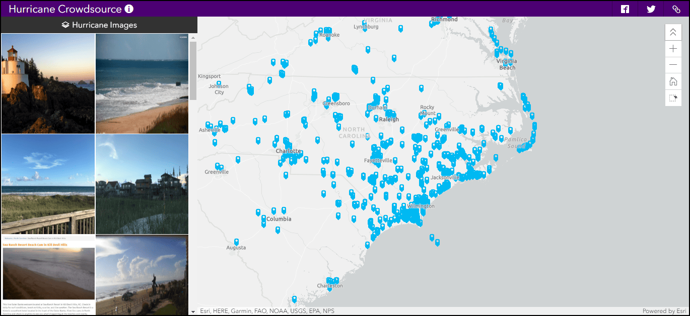
Attachment Viewer now supports an attachment-centric and map-centric layout. The new map-centric layout enables your audience to focus on an overview of the entire map and dataset, giving more space to the map in the application and showing multiple images in a single gallery. If you want to investigate a specific location in more detail, just select the image in the gallery, or click on the feature in the map to pull up the feature’s pop-up information. This provides similar functionality to the Crowdsource Story Map and when coupled with a data collection app like Survey123, QuickCapture or GeoForm, is a powerful way to display crowdsourced data.

In example 1, photos were added by the public during Hurricanes in 2018 and are displayed in the map-centric layout of Attachment Viewer.
Improved Location Selection
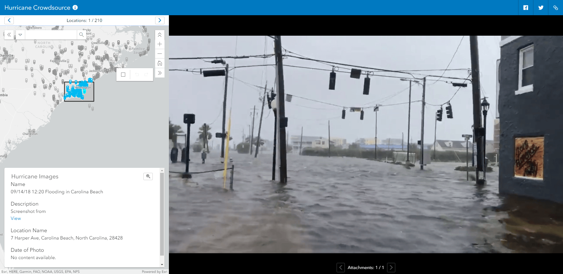
When viewing a large dataset with multiple locations with photos some users want to hone in on a subset of the total data. The ability to draw a selection box around some of the features in the map, lets your audience explore the photos in a user-defined area of interest. With the map-centric layout, the selected features populate the images in the gallery. In the attachment-centric layout, the selection determines the set of features to navigate through.

In example 2, the crowdsourced photos are displayed in the attachment-centric view. The activated selection activated 212 of the 1600 features to navigate through around Wilmington, North Carolina.
Support of Multiple Layers
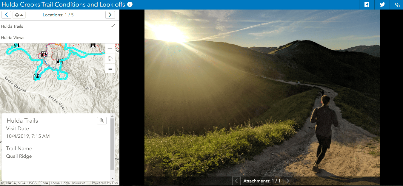
When field workers are out in the world performing inspections or capturing observations, they often collect information that is related but stored independently. For example, an orange grove inspector may inspect an entire grove area as a single area (polygon) and then inspect each tree as a separate tree feature (point). Attachment Viewer now supports switching between multiple layers and viewing the attachments, making it a seamless experience to view separate but related datasets in a single application.

Pan and Zoom Photos
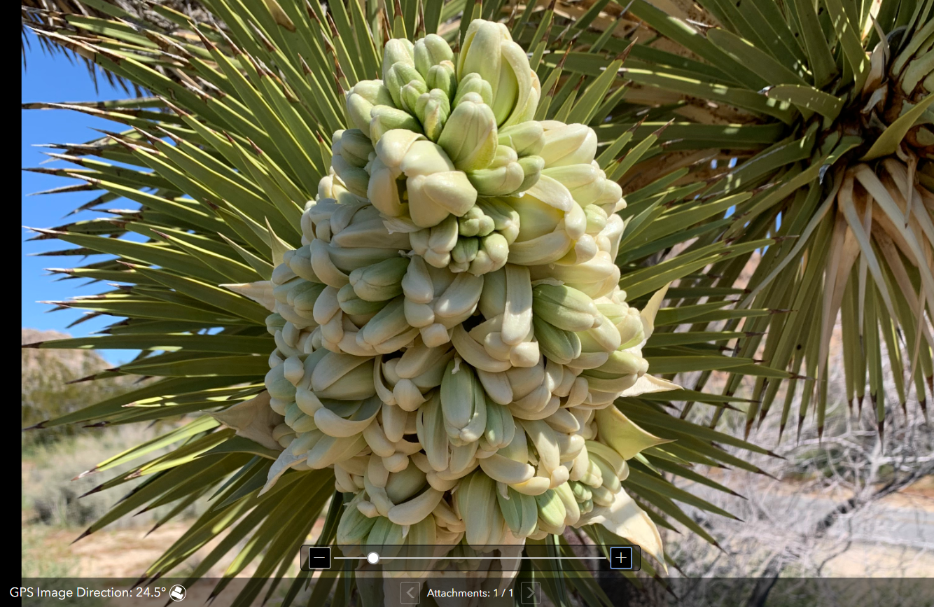
When your audience starts to look at the photos available in your Attachment Viewer app, they sometimes want to take a closer look and further inspect what is presented. With the update, it is now possible to enable image pan and zoom functionality. This gives users more capabilities to interact with the images.

This example lets users zoom in and inspect the well photo collected during the inspection.
Show Image Direction
If exif data is included with the images that are stored as attachments, app authors can choose to include this information in the map. This way, readers of the app can understand the direction the photo is facing.

Choose to hide features without attachments
Data collection isn’t always perfect, and sometimes features exist in a dataset without attachments. This can lead to a “No image available” message in the Attachment Viewer app. With this update, there is an option to only display features with attachments, which hides features from the view of the audience.
We are excited to see the great new applications that you create with these updates and have implemented the following ideas:
Explore Multiple Layers in Attachment Viewer
Photo Viewer for Survey123 and Collector
Please share what you build and keep sharing your ideas with us on GeoNet.


Commenting is not enabled for this article.