The November 2024 ArcGIS Online update includes some exciting enhancements to the Print experience in Map Viewer. Last release we introduced the beta option to print from layout template items published directly to ArcGIS Online. At that time, you had to create a specific print template group for your org to access the items. For the November release, we have added the capability to browse for these items directly from the print tool to the beta offering. For all users we now also provide the option to save your print export as an ArcGIS Online item, allowing for quick access and easy sharing. The last print enhancement for this release allows you to define a different Spatial reference for your print export.
Save exported Print items to My Content
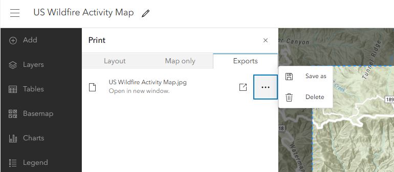
Your exported print files can now be saved as ArcGIS Online items! To access this new functionality, ensure that you are signed in to ArcGIS Online and create a print export. From the Exports tab, click the Options menu and select Save as. Fill out the required information and the export will be saved to your content. You can then easily share your exported files with others.
Note – Saving AIX, EPS, SVG, and SVGZ items to My Content is not supported.

Browse for Print Templates
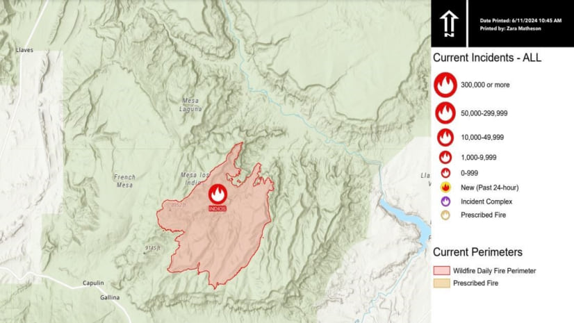
Last summer we introduced the option (beta) to print from layout items published directly to ArcGIS Online. This enhancement allowed users to create and publish their own layout items from ArcGIS Pro to ArcGIS Online and use them without having to set up and maintain their own print server. This is especially useful if you want to add your organization’s logo or branding to your print output or require more room to support a larger legend.
One limitation of the Print template group is that printing from these layout items is only available when a template group is configured and that requires an admin to set it up. Now users can access any template they want without having a group configured.
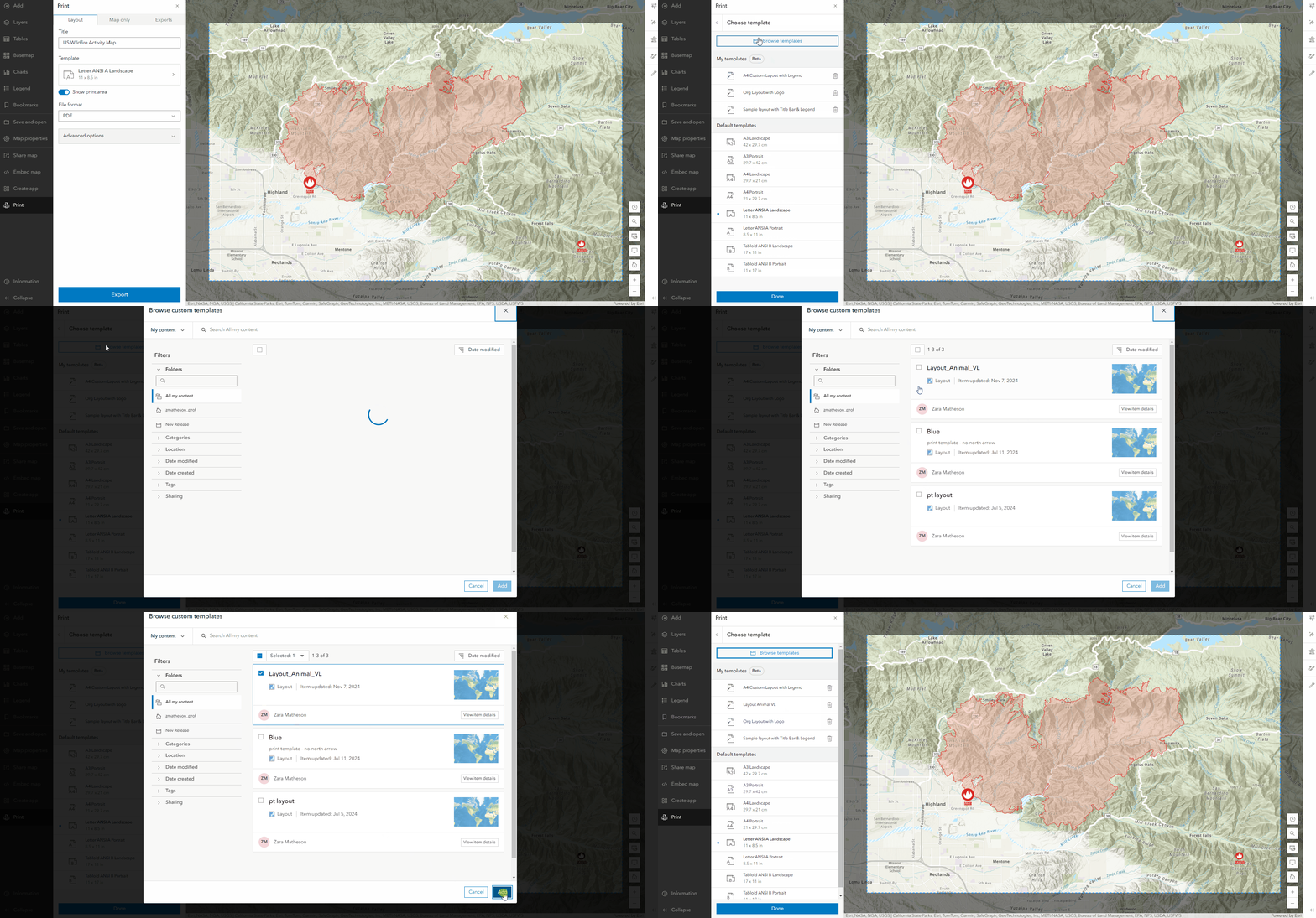
To access this capability, ensure that you have a Professional or Professional plus user type and open the print tool. Click into the templates and then click the Browse templates button. The added templates will be displayed under My templates and can be removed at any time. Printing from these items will always use the ArcGIS print service, even if you have a custom print service configured
Note – If you are not signed in, don’t have privileges (Professional or Professional Plus user type) , or your organization has beta access disabled, you will not see this option.

Set an Output Spatial Reference
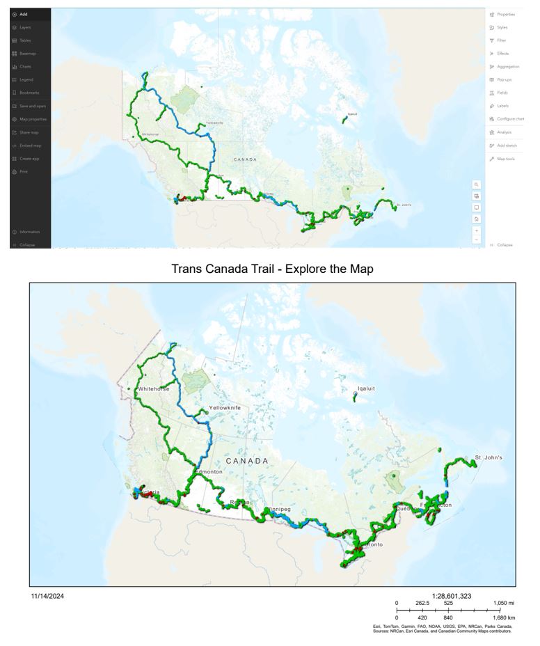
By default, your print exports are generated using the spatial reference of your map. Print now provides the option to set an output spatial reference using a WKID of your choice. In this example, I have a web map focused on Canada in Web Mercator, but I want the print export to have a more suitable projection. I can input the WKID of 102002 to use the Canada Lambert Conformal Conic coordinate system instead.

What’s Next?
While still in beta, printing from custom layouts is free to use for all Professional and Professional Plus users. Once out of beta, there will be a credit charge associated with printing from these custom layout items. We also continue to improve the overall print experience in Map Viewer and ArcGIS Online.


Article Discussion: