The release of ArcGIS Pro 3.2 for ArcGIS Aviation Airports and ArcGIS Aviation Charting includes enhanced tools to further support your airport, charting, data management, migration, and design needs. This blog article contains more information about these updates.
Enhanced tools
The following ArcGIS Aviation Charting tools have been enhanced:
Generate Airspace Lines
The tool in the Data Management toolset now includes the following enhancements:
Process multiple preferences all in one run
This tool now supports selection of multiple preferences that can be configured to process different groups of airspaces all in one run.
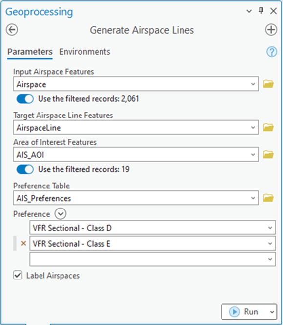
New Label Airspaces option
A new Label Airspaces option changes how the Airspace lines are generated and labeled to contain information from neighboring intersecting airspaces.
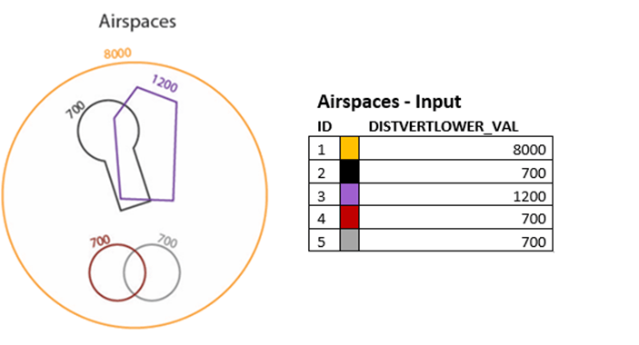
This allows you to now form a continuous line with similar intersecting airspaces as seen with Airspace lines f and g below.
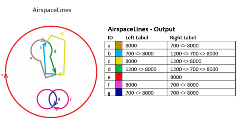
Additionally, AirspaceLine features’ Left and Right labels now also contain information from neighboring intersecting airspaces.
Generate Derived Airspace Geometry
The Generate Derived Airspace Geometry tool in the Data Management toolset has been enhanced to improve the geometry quality of the derived airspaces.
Smoother borders near connecting areas
Derived airspaces that are generated from the intersection of geoborders and other airspaces now produce smoother borders near the connecting areas.
Eliminate small gaps
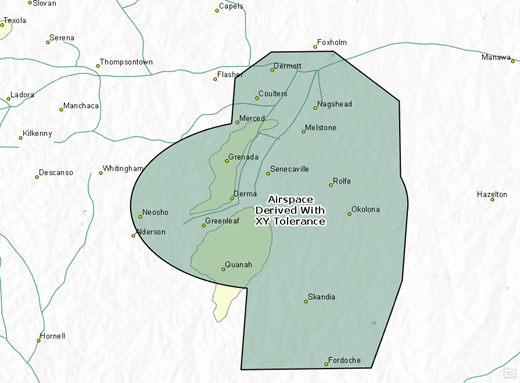
This tool now supports XY Tolerance environment values to prevent small gaps in geometry.
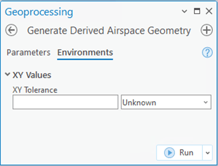
Small gaps between the geometry of the contributor airspace parts can lead to problems in the geometry in the resulting derived airspace.
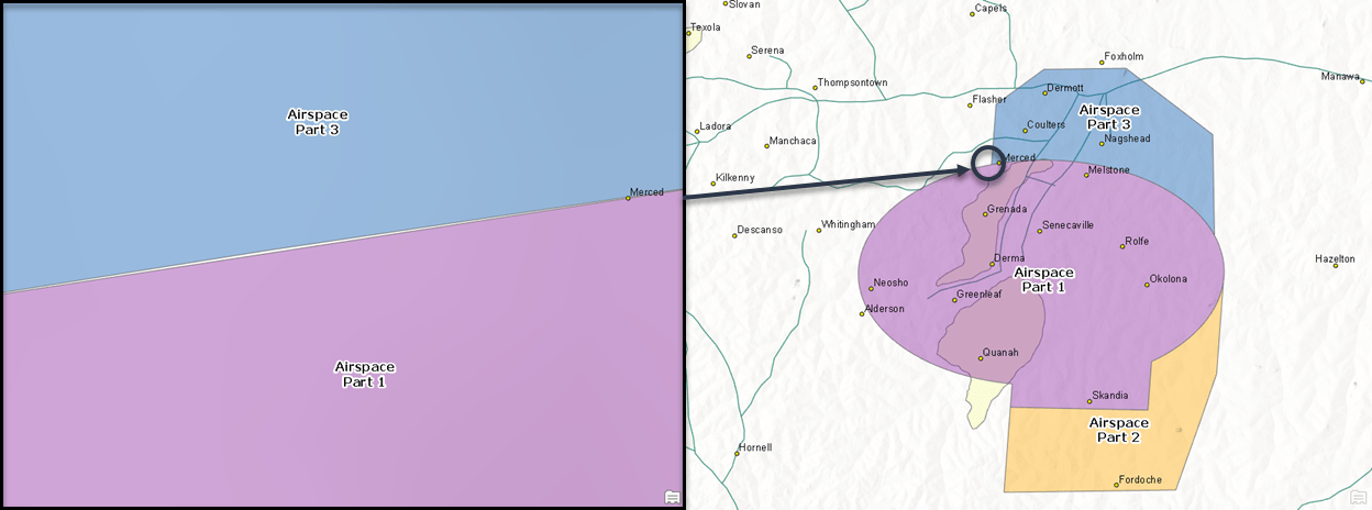
The x,y tolerance can be used to account for these gaps between airspaces and allow the contributor shapes to be combined properly.
Report Aviation Chart Changes
The Report Aviation Chart Changes tool in the Data Management toolset compares feature classes in two enterprise geodatabase versions and returns the differences in a report. This tool now stores all values (including NULL values) found in the base and comparison versions. Once this tool has been run, it no longer depends on existing versions to compare change, which means you can now see versions that have been reconciled and posted or even deleted.
Reach out to us at aero@esri.com if you have questions about these new capabilities.


Commenting is not enabled for this article.