ArcGIS solutions provide freely available maps, applications, templates, and widgets that support industry workflows and critical activities by organizations. COVID-19 Solutions help organizations maximize their ArcGIS investment in dealing with the COVID-19 disease pandemic.
Business Continuity
Coronavirus Business Continuity maps and apps can be used by businesses, utilities, and government agencies to maintain business operations and share authoritative information with customers and stakeholders during the COVID-19 pandemic. It includes ArcGIS applications for understanding the operational capacity of your workforce, monitoring the status of your facilities, and communicating disruptions to customers and stakeholders. Businesses, utilities, and government agencies can configure and share the entire collection of Coronavirus Business Continuity maps and applications or configure and share only the maps or applications that meet their specific needs.
Site Safety
The maps and apps in the Coronavirus Site Safety collection can be used by businesses, educational institutions, and government agencies to create COVID-19 health safety plans for facilities, sites, and campuses and monitor these plans as locations reopen. Health safety plans address issues such as optimally siting temperature screening locations, handwashing or sanitizer stations, personal protective equipment (PPE) stations, and isolation areas as well as estimating crowd capacities, monitoring social distancing, tracking cleaning and disinfecting, monitoring restocking of PPE stations, and reporting coronavirus-related problems and issues.
Health Screening
Coronavirus Health Screening maps and apps can be used by businesses, utilities, and government agencies to conduct COVID-19 health screenings before employees and visitors are permitted to enter a building, facility, or location to help ensure the safety and public health of all individuals in their facilities. These ArcGIS applications can be used to self-report coronavirus symptoms or contacts, record the result of temperature checks, and track who has been permitted to enter a facility, or location on a given date.
Response
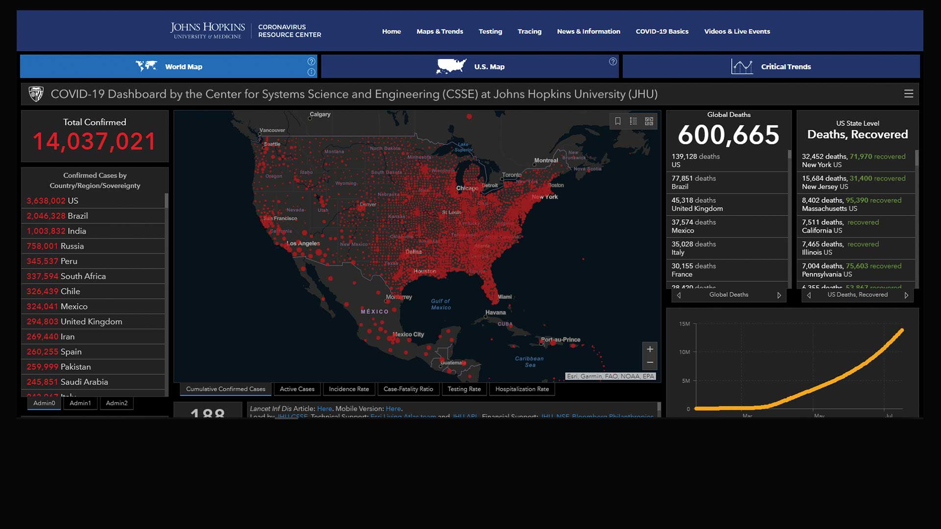
The maps and apps in the Coronavirus Response solution can be used by public health and other emergency response agencies to understand the impact of COVID-19 and share authoritative information about the pandemic with communities. These ArcGIS applications can be used to monitor coronavirus cases and response activities, communicate the impact on public places (e.g., schools, government buildings, common places), inventory meal sites, monitor meal programs, and share information with the public.
Testing Sites
Public health and other emergency response agencies can use maps and apps in the Coronavirus Testing Sites solution to identify at-risk populations, locate optimal testing sites, manage testing site status, and share testing site information with the public.
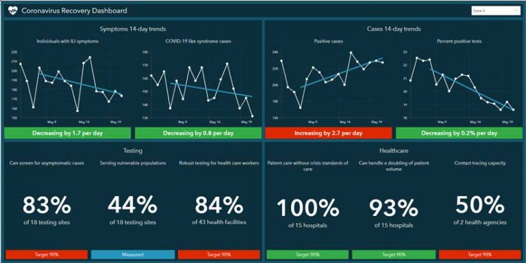
Coronavirus Recovery Dashboard
The Coronavirus Recovery Dashboard solution provides a series of ArcGIS applications to visualize metrics for an entire state or province and more specific locations within the state or province, such as a region, county, or postal area. It can be used to tabulate symptoms, cases, and hospital capacity metrics; monitor key recovery trends and performance targets; and communicate progress to interested stakeholders.
Coronavirus Wellness Checks
This solution focuses on monitoring the wellness of vulnerable individuals throughout a community. The Coronavirus Wellness Checks solution provides ArcGIS applications to engage community volunteers, register homebound individuals, conduct regular wellness checks of vulnerable individuals.
Small Business Recovery
Coronavirus Small Business Recovery solution maps and apps can be used by economic development staff to help small businesses operate during the COVID-19 pandemic and understand its impact on small businesses in their community. These ArcGIS applications can be used to engage local business owners, measure the impact of the pandemic on small businesses, report potential health order violations and their resolution, and promote small business recovery.
Force Readiness
State National Guards and other service branches can use Coronavirus Force Readiness to understand the operational capacity of forces, monitor the status of units, and communicate disruptions to commanders and administrative noncommissioned officers (NCOs).
Hospitalization and PPE Inventory
Emergency management staff can use this solution for inventorying the hospital capacity and PPE at local hospitals and acute care centers. In the United States, this solution complements reporting already being done through the National Healthcare and Safety Network (NHSN) and provides emergency management staff timely hospitalization and its inventory of PPE that informs COVID-19 response and recovery efforts. These ArcGIS applications can be used to solicit daily hospitalization and PPE reports, and monitor the capacity of hospitals and their PPE inventory. Government agencies can configure and share the entire collection of Hospitalization and PPE Inventory maps and applications or businesses, utilities, and government agencies can configure and share a survey and dashboard that can be used to understand their inventory of PPE.
Business Reopening
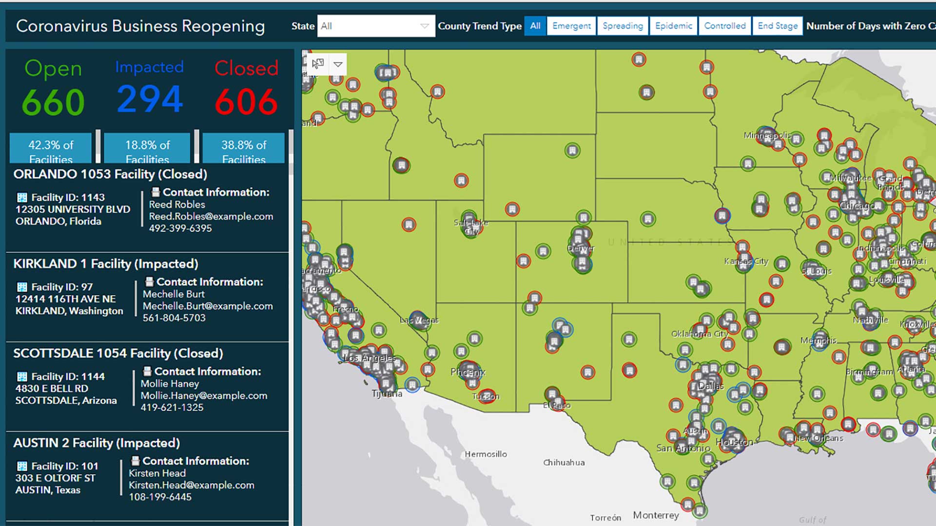
Businesses reopening during the COVID-19 pandemic can use Coronavirus Business Reopening maps and apps to guide re-opening locations that are in multiple jurisdictions. This solution includes ArcGIS Dashboards to evaluate coronavirus case data and health restrictions, understand the impact on business locations that are in many diverse jurisdictions, and share information with key stakeholders. The information gathered guides the decisions to open or close locations. These decisions can be recorded and shared with key internal stakeholders and customers.
Additional Resources
To ask questions and provide feedback, chat on GeoNet or contact Esri Support Services. Esri is providing several resources to help organizations combat the coronavirus. The COVID-19 GIS Hub is the place to access additional resources and to request GIS assistance from Esri.
