Lots of organizations are looking for ways to improve their business processes and maximize the value of their GIS investments. But GIS professionals are often asked to do more without enough resources.
ArcGIS Workflow Manager can help. This scalable enterprise workflow management system enables employees to complete tasks and projects in a predictable, accurate, and timely manner.

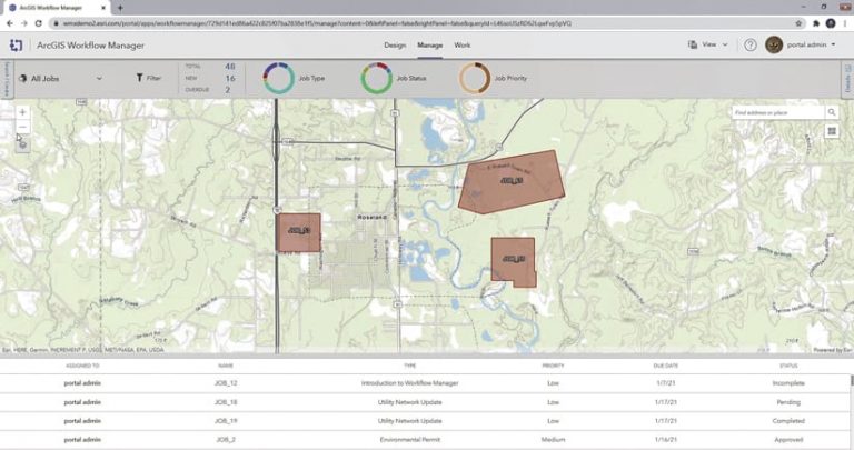
While work management and productivity systems are not unique, Workflow Manager is different because it focuses on optimizing both GIS- and non-GIS-based processes to create seamless, end-to-end workflows that are synchronized across web, mobile, and desktop devices. Workflow Manager is also location aware, meaning it employs spatial analysis to report on work statuses and metrics.
Step-by-Step Workflows
Users of Workflow Manager benefit from its simple interface that takes them, step-by-step, through GIS workflow processes authored by their organizations. The steps are tightly integrated with Esri technology, allowing users to carry out actions such as the following:
- Creating a work order using ArcGIS Survey123
- Accessing web maps or apps in ArcGIS Enterprise
- Coordinating field crews with ArcGIS Workforce
- Performing editing and analysis in ArcGIS Pro

For example, to figure out if a proposed project is within 50 feet of a water boundary, Workflow Manager can guide users through the whole process. The person submitting the permit request does so using Workflow Manager, then the system determines whether the project’s location meets specific permitting criteria. From there, Workflow Manager leads both the submitter and the person reviewing the project through any additional questions that need to be answered or forms that need to be filled out.
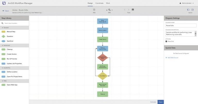
Workflow Manager lets users easily configure business processes like these in workflow diagrams that break operations down into digestible actions. Diagrams can include detailed steps directing users, for instance, to add an attachment or send an email. As an organization’s processes evolve over time, employees can update their Workflow Manager systems to mature with them. So the program operates as a sort of living help system.
Based on a Four-Stage Process
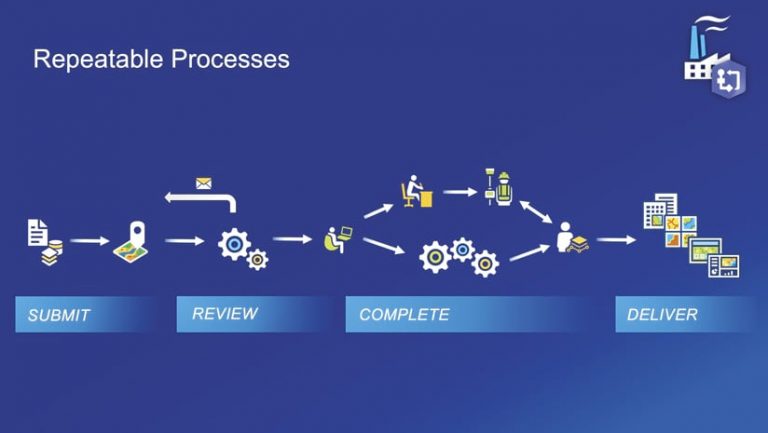
Streamlining a GIS production process is not specific to certain industries or use cases. In fact, most standard workflows follow the same four-stage process: submit the work order, validate the quality of the submission, complete the resultant work, and deliver the results.

When someone submits a request to an organization, it is either validated as a request that can be handled, or it is invalidated and sent back to the submitter or canceled altogether. A valid request is pushed forward in the process, and work is done to complete the job. The final product of the request is then delivered to the stakeholder.
Workflow Manager establishes the design and review process for requests and assists all project participants in completing their tasks efficiently. This works well for workflows that include doing inspections, allocating permits, soliciting or contributing data, managing incidents, and dealing with address changes.
An Automatic Production System
Some workflows—such as data aggregation, ingestion, and analysis—are becoming either fully automated or semiautomated, meaning that humans only need to intervene when necessary. Workflow Manager is evolving to act as the coordinator for heavily automated processes. By combining Esri technology and third-party systems, Workflow Manager is creating a powerful, streamlined, and scalable automatic production system.

Contributed data, for example, may not adhere to an organization’s attribute or spatial data standards, so it might need to be reviewed, adjusted, or enriched before being added to the organization’s larger data repository. Workflow Manager coordinates the steps the data needs to take from the point of being received through getting published. If the contributed data fails certain checks, it can be automatically rejected or pushed to a more advanced automated or manual data correction process before reentering the normal data processing pipeline.
By running a largely automated process like this, organizations can save on time and labor while maintaining the integrity of their data.
Discover Integrated Workflows
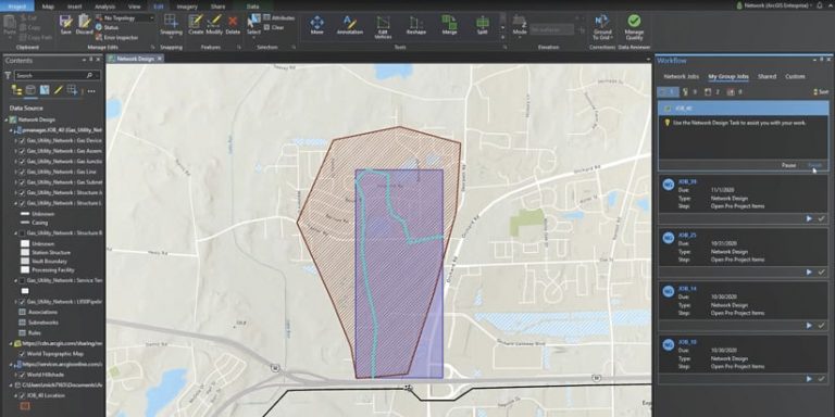
Want to see a real example of a Workflow Manager workflow? Watch the video Telecommunication Solution: Network Design Workflow Management to be guided through a workflow that helps a utility coordinate and track network designs. The workflow crosses from the web to ArcGIS Pro and shows how ArcGIS Workforce and web apps are integrated into a simple infrastructure design process.
Get more information about ArcGIS Workflow Manager, or reach out to your Esri representative.

