Every big decision made at an organization requires reliable data. Fortunately, ArcGIS Survey123—a form-first data collection app included with ArcGIS Online and ArcGIS Enterprise—makes it easy to gather data and incorporate it into maps, apps, workflows, and more.
With Survey123, users can set up a simple survey form in minutes or take a little more time to generate a sophisticated smart form that’s customized to specific environments. Why forms? Because people are familiar with them. They fill them out on websites, at the doctor’s office, and sometimes as part of their daily work. In terms of data collection, forms are an easy way to gather information because they require no training. Any respondent—whether an employee or a member of the public—can simply fill in the blanks with information and observations as needed.

Approximately once per quarter, Esri updates Survey123 to make it easier to use, streamline it with other ArcGIS products, and improve the user interface. Recent releases have focused on helping users design more sophisticated forms and make the data collection experience more efficient. Read on to learn about some of the more significant updates.
More Options in the Web Designer
The Survey123 web designer is a drag-and-drop interface that helps users set up a web-based form or mobile app directly in a browser. The most recent update to this includes added support for question types, such as the new address question that gives respondents another way to identify their location, and improved size options for uploading photos, documents, and signatures. The web designer now also lets users put hidden questions into their forms that make behind-the-scenes calculations, configure automatic calculations based on participant responses, and apply set formats for data entry through input masks. Additionally, if users want to set a custom map or locator for their form—to ensure that they get responses from the appropriate location—that’s possible, too.
Annotation Gets Simplified and Standardized
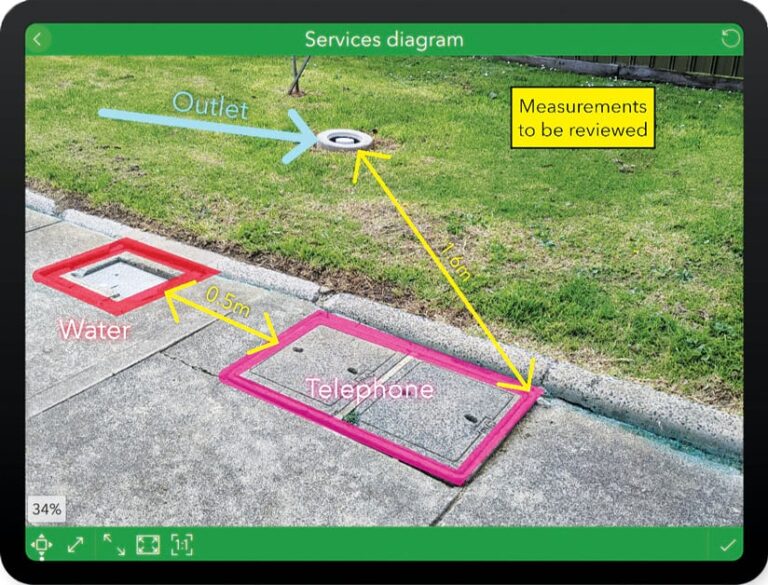
Survey123 allows users to annotate photos, diagrams, and maps to highlight areas that need attention and convey field observations. After completely refreshing the user interface for annotation in September, the Survey123 team recently made it possible for authors of smart forms to define the number and types of annotation tools available to respondents to simplify and standardize data collection. For example, the custom drawing tools palette on a construction site inspection form may include specific tools to denote electrical equipment, water meters, pipes, and so on.

Calculations Receive a Major Performance Boost
In Survey123, users leverage calculations—powered by XLSForm expressions—to populate questions within a form. Calculations can make use of existing data that’s either entered by respondents or read from a device, external sensors, photos, or other mechanisms. In the most recent release of Survey123, calculations received a major performance boost that allows users to build larger and more sophisticated surveys than ever before, which can be useful for taking a census or completing asset inspections. There is also a new option that allows survey authors to define when a calculation expression should be triggered: automatically, always, or manually.
Improved Signature Features
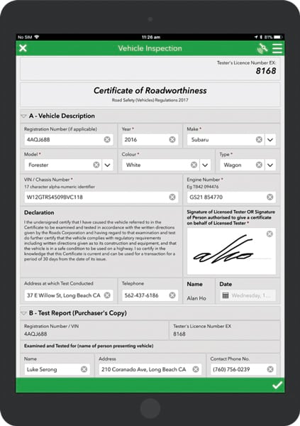
For workflows that require accountability, such as when an inspector needs to certify the condition of an asset or an auditor needs to ensure that a job was done properly, Survey123 accepts electronic signatures. Now, survey respondents are presented with a box that has more space to sign in, and each signature is saved as an image—set to exact dimensions—that gets attached to the survey. For approval and sign-off workflows, signatures can be viewed, and new signatures can be added to records, in the Survey123 in-box.
Additional Enhancements
In ArcGIS Survey123 Connect, users can work with media files and custom drawing tool palettes via the new Media tab. In the ArcGIS Survey123 field app, a new Overview folder lets users view and manage survey records through a primary map or list. In the ArcGIS Survey123 web app, users can leverage new, web-accessible date and time widgets. Finally, ArcGIS Survey123 report services allow users to include multiple records in a summary report map, which is helpful to show how many assets were inspected within a specified period, for example.

