New Framework for Government-Resident Collaboration Goes Beyond Open Data
No one cares about a neighborhood as much as the people who live in it. Our communities are where we spend our daily lives—going to work and school, walking our dogs, raising our children, making what often amounts to the largest financial decision of our lives, and sleeping every evening. Neighborhoods are part of an urban tapestry, working together to build diverse, resilient, and livable regions.
Residents and citizens want to actively engage with government to understand policies, share their local knowledge, and improve their communities. There is a tremendous opportunity to use modern technology, combined with the collective knowledge of governments and researchers, to improve constituent engagement.
Esri has worked with communities around the world to figure out what encourages effective governments to work closely with residents, and vice versa. All facets of policy making, people, processes, and technology need to be in balance and aligned to make engagement efforts honest, supported, and successful. So while innovative technology can dramatically improve citizens’ access to government and the overall success of such partnerships, it needs to be deployed in a way that supports shared outcomes. That is where ArcGIS Hub comes into play.
It Starts with a Goal

Open data is a global movement to share authoritative information that is public and reusable to drive economic development, improve government efficiency, and increase stakeholder engagement. ArcGIS Open Data enables any organization to quickly and freely share its data—both geospatial and tabular—in common, open formats with a simple user experience on officially branded websites. More than 8,000 government, nonprofit, and commercial organizations use ArcGIS Open Data to provide open information to their constituents and customers.
In working with many government staff members, research groups, and communities on ArcGIS Open Data, Esri learned both the benefits and shortcomings of open data policies. Governments often ask which pieces of data they should release first and how they can know that their open data is actually being used to improve livelihoods or businesses. And while citizens, researchers, and businesses want up-to-date, authoritative information to improve their awareness and decision-making, they often don’t know which data will be the most useful until they know what data their governments can make available.
By itself, open data is a great set of principles, but the concept often lacks focused goals or expected outcomes. Open data is much more effective when it is driven by strategic priorities and empowered to measure outcomes for improving engagement on specific, constituent-centered benefits.
In July, Esri introduced ArcGIS Hub, a new two-way engagement platform that truly connects government and citizens. ArcGIS Hub includes tools for managing open data and introduces a new framework designed to prioritize initiatives, organize data and teams, measure the progress of key performance indicators, and empower the community to understand complex relationships with explorative analytics and infographic reports. ArcGIS Hub goes beyond open data. It is a catalyst for creating smart communities.
Initiatives Provide Structured Engagement
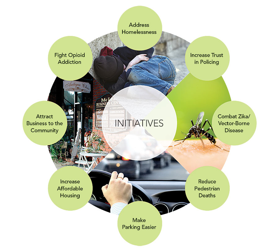
ArcGIS Hub initiatives are a new concept and capability of ArcGIS. They are focused, policy-driven goals that come straight out of executive and strategic objectives. Vision Zero, for example, is a global initiative to prevent traffic-related deaths and life-altering injuries. The goal—to have zero traffic-related deaths—is clearly identifiable as an important and measurable metric. Everyone has a vested interest in accomplishing this target, and as a result, groups are motivated and focused on how they can work together to achieve this outcome.

The platform recommends specific tools and apps to use to help citizens engage with particular initiatives. Esri Story Maps apps, for example, inform the public about the current state of affairs related to an initiative and what the government is doing to achieve associated goals. Surveys gather initiative-related information and feedback from the public and internal stakeholders. And dashboards with analytics measure progress toward accomplishing the initiative’s objectives. These tools are brought together for the public to view and use in dynamic and mobile-responsive ArcGIS Hub initiative web pages, which allow users to learn about an initiative’s goal, interact with data and maps, and provide input. They also recommend ways to engage with the government.
Initiatives in ArcGIS Hub help governments prioritize the data they need to power tools, apps, and analyses that optimize policies and actions and generate better outcomes. The Vision Zero ArcGIS Hub initiative, for example, uses common collision report data indicators and street infrastructure data that most cities have. With ArcGIS Hub, cities can provide this data in a simple user experience that makes it easy to configure maps, apps, surveys, and dashboards with compelling cartography and eye-catching charts. Cities can build surveys for garnering public input on unsafe road conditions or build an app that allows users to view the most dangerous intersections in a city. This ability to unlock the informative power of data enables everyone—from staff members in the transportation and planning departments to educators, law enforcement officers, and business executives—to work from the same data and gain new perspectives.
In addition to aiming data and apps at a specific goal, ArcGIS Hub initiatives can help governments better coordinate their own work and invite other organizations, such as civic advocacy groups, to cohost events, gather new data, perform analysis, and collaborate with tech developers to devise creative solutions to issues. Discussion and feedback from the community are captured through ArcGIS Hub conversations, which are forums to track public feedback, government responses, and ArcGIS Hub initiative team actions to ensure that everyone is working together toward the initiative’s goal.
ArcGIS Hub includes a growing gallery of initiative templates for prominent issues, such as Vision Zero, addressing the opioid crisis, and preventing vector-borne disease outbreaks. Organizations can also create their own custom ArcGIS Hub initiatives that identify and standardize new processes and goals. These initiatives can be repeatedly launched within an organization (at each school in a school district, for example) or shared with other ArcGIS Hub municipalities so that hubs around the world can adopt and adapt them for their own needs.
Become a Smart Community
If a government is going to be “of the people, by the people, for the people,” as US president Abraham Lincoln famously expressed during the Gettysburg Address, then open government—with open data—is one way to precipitate that. ArcGIS Hub extends enterprise GIS beyond government circles, providing organizations, businesses, and citizens with equitable access to data, analysis, and opportunities for cooperation.
The road to successful community collaboration begins with sharing data and implementing open data best practices. Then, find the executive leadership that will prioritize community-centered initiatives and seek out the advocacy groups that are ready and willing to collaborate. Finally, connect with Esri at esri.com/hub to learn how to create a smarter, more engaged community with ArcGIS Hub.

