Enhance data potential
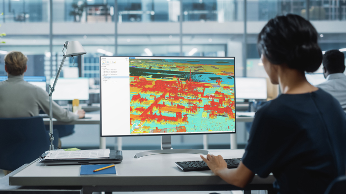
Integrate GIS data with point clouds to enhance digital elevation model (DEM) creation, reduce noise with specialized tools, and ensure data uniformity with industry standards for better analysis and interoperability.

Included with the Professional Plus user type
Solve complex problems through powerful 3D analytics

ArcGIS 3D Analyst enhances GIS capabilities with advanced 3D data operations and automated workflows, leading to smarter, faster decision-making.
Integrate GIS data with point clouds to enhance digital elevation model (DEM) creation, reduce noise with specialized tools, and ensure data uniformity with industry standards for better analysis and interoperability.

Automate manual processes such as pattern recognition and feature extraction. Leverage machine learning to accelerate the processing and analysis of spatial data to improve efficiency and productivity.

Perform three-dimensional analysis to understand complex 3D spatial relationships. Leverage geospatial insights to establish a foundation for data-driven decision-making.

Access the geoprocessing tools and capabilities of the ArcGIS system to support efficient surface creation, data preprocessing, quality assurance, maintenance, and advanced analytics.
Gain a robust suite of tools for creating, editing, and analyzing 3D data, including point clouds, surfaces, and models. 3D modeling allows for precise evaluation and resolution of complex issues, enhancing efficiency and accuracy.
Included with the Professional Plus user type
The Professional Plus user type is a comprehensive license that includes access to ArcGIS Pro Advanced, the most popular ArcGIS Pro extensions, and many other ArcGIS capabilities on web and mobile devices. With Professional Plus, you can create 2D/3D production-ready cartography, utilize artificial intelligence (AI) workflows, build custom apps, and automate your workflows.

Access blog posts, technical documentation, and tutorials to help you get started with 3D analysis.
1-800-447-9778
7:00 a.m.–5:00 p.m., Monday through Friday (PT)
Start a chat
Fill out the contact form