Access Premium Imagery through ArcGIS Online Services
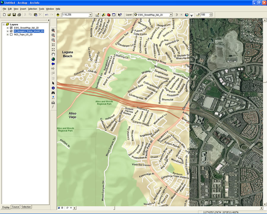
 ArcGIS Explorer shown with the default basemap of global imagery and eco-regions in Oregon from a published ArcGIS Service. In addition, pushpins showing cascade volcanoes and including live links to USGS photos have been added by importing a text file. |
ArcGIS Desktop or ArcGIS Explorer users can now connect to ArcGIS Online Services via the Web and freely access premium imagery. This service provides seamless, high-resolution imagery for the contiguous United States at approximately 1-meter resolution and 500-meter and 15-meter resolution for the world. The premium imagery is available at no-cost as part of the public ArcGIS Online Services beta program.
Easily Connect to 2D maps and 3D Globes and Combine Them with Your Local Data
ArcGIS Online Services, powered by ArcGIS Server, is hosted by Esri and deeply integrated with ArcGIS. With an Internet connection, you have immediate access to cartographically designed, seamless, multiscale base maps to which you can easily add your own data.
Use ArcGIS Online Services to create your own digital worlds in 2D and 3D by combining ArcGIS Online with your local data and services from ArcGIS Server, ArcIMS, Open Geospatial Consortium Web Map Services (WMS), and KML services.
You can also add user tasks from your own secure servers and fuse them with content and tasks from ArcGIS Online and other servers to conduct visibility modeling, proximity searches or demographic analysis. Overlay your operational layers, such as utility networks or parcel layers and discover discrepancies or confirm and resolve inconsistencies.
Connect to These Additional Free Maps and Globes
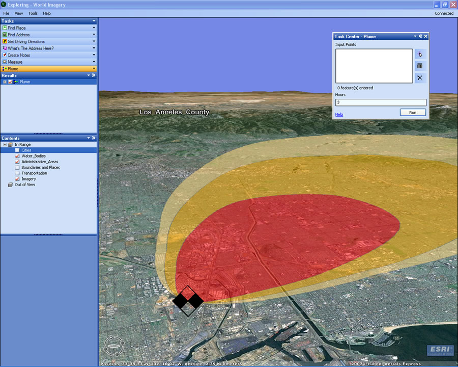
 ArcGIS Explorer with ArcGIS Online imagery and topographic map services. A custom task has been used to generate the terrain profile. |
In addition to the premium imagery, ArcGIS Desktop and ArcGIS Explorer users can connect to ArcGIS Online Services to access the following ready-to-use 2D maps and 3D globes.
- Shaded Relief—Worldwide shaded relief map at 1-kilometer and 90-meter resolution for the world.
- Street Map—Seamless, multi-scale street map, with highway-level data for the world and local street-level data for the United States and Canada.
- Physical World—Natural Earth physical map at 1.24-kilometer resolution for the world and 500-meter for the coterminous United States, and topographic maps at 1:1,000,000 scale for the world.
- Political World—Digital version of the Political World map from National Geographic's Atlas of the World, Eighth Edition.
- Historical World—Digital version of the Pinkerton 1812 map from the David Rumsey collection. The historical map is draped onto the Political world map from National Geographic's Atlas of the World, Eighth Edition.
- Protected Areas of the World—Satellite imagery and boundaries for the United Nations Environment Programme (UNEP) World Protected Areas, at 15-meter resolution worldwide. This data includes boundaries and names of areas that have been designated as places where the environment and natural resources have been protected from development and human encroachment.
The 2D maps and 3D globes work directly with pre-built tasks in ArcGIS Desktop, such as place-finder and gazetteer, and all of the default ArcGIS Explorer tasks, including Find Place, Find Address, and Get Driving Directions.
Connect to ArcGIS Online today to quick-start your GIS projects. Visit http://arcgisonline.esri.com to join the beta program.
Quick Links
- Download ArcGIS Explorer
- Visit the ArcGIS Online Resource Center
- Listen to a podcast about ArcGIS Online [06:49 | 2.38 MB]