Esri Federal User Conference Demonstrates Advances in GIS
Congressman Calls on Federal Employees to Use GIS to Build an 'Army of Reform'
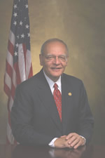
 Rep. Paul E. Kanjorski |
United States federal workers can join an "army of reform," strengthening government programs and trimming costs by harnessing the analytical power of geographic information system (GIS) technology, Rep. Paul E. Kanjorski (D-PA) said at the 2007 Esri Federal User Conference in Washington, D.C., last month.
Kanjorski, speaking at the Washington Convention Center, called on the more than 1,900 federal employees and GIS users at the conference to accept his challenge and use their expertise in geospatial technology to help Congress understand the interrelationships and complications of government programs. He also asked that they show legislators how these programs can be better evaluated for effectiveness and value so that money can be spent more wisely.
"You have . . . the tools to help make this government more efficient and effective," he told the employees, who work in diverse fields ranging from forest management to defense and intelligence. "As you look over government—in every department, in every agency—you can see where GIS could be an instrumental tool . . . over the next 2, 4, 6, to 10 years to reform government substantially at every level."
Kanjorski cited the ability one has with GIS to save money and better track projects and programs. He also encouraged users to work together on building a national GIS. "A challenge I see quite readily today is a lack of willingness to share information, a lack of incentive to share information particularly between the various levels of government," Kanjorski said. "And since most of this information resides at the local government level or at the state level, it's incumbent upon the federal government to come up with a theory of carrot and stick to accomplish some methodology that encourages and rewards those entities that push this information up the line, make it more useful, and keep it current." He encouraged users to find ways to motivate government to keep current information flowing up and down through all levels. "If we do that," he said, "All of us will have more effective tools."
Esri president Jack Dangermond presented Kanjorski with an Esri Making a Difference Award, citing the role the congressman played in developing the Pennsylvania GIS Consortium at Wilkes University and his important role in creating the Earth Conservancy, an organization that uses GIS to reclaim and develop land in Pennsylvania that was harmed by coal mining. "He is an advocate for you," Dangermond told the federal GIS community.
Dangermond commended the attendees for their strong commitment to their work, adding that their enormous knowledge and network building will go a long way toward beginning to build a national GIS.
Changes are occurring rapidly in the United States and understanding change calls for a geographic way of thinking, Dangermond said. "GIS provides a new medium for understanding. It models all the physical and cultural aspects of our world. It breaks it down into pieces; we use layers and themes and geographic breakdowns. It provides us with systematic knowledge, and it's also an integrative framework, which makes it so powerful for collaborating and working together," he said. "On one side, it's very analytic with models and spatial analysis. On the other, it's very intuitive. And I think this combination of analytic and intuitive dimensions is what makes it so attractive to people. I think it will bring us order and help us understand and create meaning from what's going on in this very rapidly changing world."
Demonstrating the Software
After the talks by Kanjorski and Dangermond, attention turned to GIS software advances, specifically new functionality with the release of ArcGIS 9.2. Dangermond said GIS on the Web provides opportunities for working in a more collaborative way.
The ArcGIS 9.2 product family allows Esri users to author data with ArcGIS Desktop software, publish the data to ArcGIS Server, and use it through Web, desktop, and mobile clients. "This environment for me is about as exciting as anything I've seen in my 40 years of working on this—this idea that I can share or publish to a broader audience and interconnect information," Dangermond said.
At 9.2, improvements have been made with mapping and visualization, interoperability, transformation procedures, content standards, support for metadata, and extending what the geodatabase can model and manage, to name a few. Improvements to the geodatabase include adding high-precision coordinates, a new class of data called terrains, intelligent images, and cadastral fabrics.
ArcGIS Image Server, a new product, was also introduced. This software dynamically performs image processing, georeferencing, and mosaicking. Its functionality significantly reduces the time between image capture and the image being available on the Web. "This will dramatically change the way people access and serve imagery," Dangermond said.
The most significant change at 9.2 is ArcGIS Server's architecture. With comprehensive functionality, it will support almost any type of client including desktop, Web, cell phones, and any geospatial client that meets Open Geospatial Consortium, Inc. (OGC), standards and other direct connections.
ArcGIS Server comes with out-of-the-box applications and services. ArcGIS Explorer, a lightweight desktop client for ArcGIS Server, allows for 2D and 3D visualization of maps and data that are published on the server. Esri staff also demonstrated and discussed product updates and new functionality with ArcGIS Server 9.2, ArcGIS geodatabase replication technology, ArcGIS tools for interoperability, and ArcGIS Online. ArcGIS Online is a family of Web-based products and services for ArcGIS users that are available via the Web including maps and globes. There were also demonstrations about ArcGIS Desktop 9.2, mission-critical GIS, deploying GIS across organizations, enterprise GIS from an IT perspective, and geoenabled service-oriented architecture.