Identifying Geocoding Errors
Using ArcGIS Business Analyst
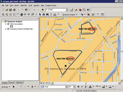 |
| The composite locator in ArcGIS Business Analyst 9.2 uses a Street Address locator to assign block numbers to locations. The assigned block numbers are compared with block numbers assigned by other vendors. |
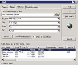 |
| The Find tool locates an address. When the composite locator is used, match scores for all locators are displayed. |
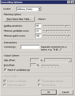 |
| Click the Options button in the Find Panel to change the minimum matching score for geocoding. Click OK to apply the changes. |
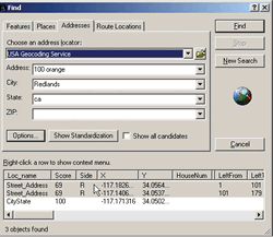 |
| The same address yields two difference locations. |
 |
| Two streets with the same name are in two different ZIP Codes. |
The composite locator in ArcGIS Business Analyst can identify geocoding errors in the data. Figure 1 shows the block number included with the address in the source data was 060670063.003016, but the composite locator assigned the block number as 060670063.004009 and correctly geocoded the address.
Geocoded addresses are assigned a score from 0 to 100—the higher the score, the greater the confidence in a correct match. In Figure 2, 655 India Street was located using the Find tool. The composite locator scores the address point as 82 and the street address as 100. Although locating an address using the address point locator would seem to be more accurate than using a street address range, the street address range shows the correct location. The address entered in the Find panel is within the range of the From and To addresses indicating successful determination of the address.
As shown in Figure 3, the minimum matching score for the Address Point locator can be increased to prevent an incorrect location from being displayed.
An incomplete address can produce other problems. Geocoding 100 Orange in Redlands, California, produces two different locations with the same matching score, as shown in Figure 4.
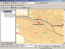
As Figure 5 illustrates, ZIP Code boundaries reveal two streets with the same name in separate ZIP Codes. To geocode the address correctly, a ZIP Code must be entered.
|