ArcUser Online
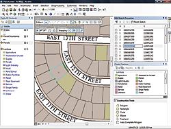
This release was called ArcGIS 9.4 in the beta phase. However, feedback from more than 2,000 beta participants indicated this update—featuring hundreds of improvements—should be called ArcGIS 10. ArcGIS 10 will make GIS easier, more accessible, and more collaborative. It employs a much simpler user interface—a map. This map-centric approach is used for interacting, querying, editing, sharing, analyzing, and combining data. The focus in ArcGIS 10 is squarely on helping users get more done. ArcGIS 10 integrates productivity tools that support the workflows of GIS professionals. Best practices templates incorporate intelligence that helps users get started quickly without having to worry about configuring the geodatabase. A new, enhanced editing experience lets users accomplish editing tasks in a more intuitive, task-based environment. Users spend less time searching for tools and less time learning how to use them. Commonly used tools for editing have been moved to a new toolbar that follows the user from task to task so it is always handy. The new toolbar for snapping is map based, and a new, quick pop-up helps users choose the desired feature. Some enhancements were developed specifically for parcel editing tasks. The Create Features panel gives a more graphic, sketch-based way of creating features. The ability to perform bulk map feature editing and automated changes in parcel ownership that retain parcel accuracy helps users spend less time accomplishing more. At ArcGIS 10, users can search by keywords or data types to find data and maps. They can also use the search function to quickly and easily find symbols to use in their maps and tools for analysis. Users can work faster because ArcGIS 10 is faster. The higher performance of ArcGIS 10 results from averaging local graphics cards on desktops and improving cache generation and management, as well as optimizing Web graphics. These caching and Web graphic improvements translate into more responsive drawing performance that includes smooth, continuous panning of data. This upcoming release also introduces the notion of time in both visualization and analysis. The software is time aware at the data, interface, and tool level. ArcGIS 10 lets users create, manage, and visualize time-aware data. They can display and animate temporal datasets as well as publish and query temporal map services. The ability to see data over time opens opportunities for more in-depth analysis.
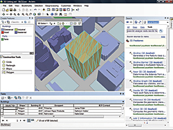
ArcGIS has always been the premier software for spatial analysis. With this release, Esri advances geographic science with new tools. Using Python, the capabilities of ArcGIS can be combined with other scientific programming to create powerful solutions and automate common tasks. Analysis and visualization in 3D is also improved in ArcGIS 10. At this release, ArcGIS becomes a full 3D GIS, offering 3D data models, editing, analysis, and visualization. It is much easier and faster to perform 3D visualization and users can do virtually everything that they do in a 2D environment in a 3D environment. ArcGIS is expanding GIS to be more fully realized on mobile devices. Now users will be able to experience all the aspects of GIS on the mobile platform in the field and, often, in real time. This release makes GIS easier to use on Tablet PCs. Not only can users create custom applications but ArcGIS Mobile also has a customizable, out-of-the-box application that allows users to extend ArcGIS. Esri is expanding this concept not only to Windows Mobile but also to the iPhone platform. Esri is providing a software developer kit (SDK) so organizations can build their own focused iPhone applications. The mobile platform enables the use of GIS information throughout organizations. The expansion of GIS use is improved with added support for cloud computing. ArcGIS at 9.3 is cloud ready. ArcGIS 10 will be even more tightly integrated with the ArcGIS Online search and share capabilities. This makes it easier for users to create and distribute projects that may include data, layers, maps, tools, scenes, globes, diagrams, and add-ins. Also at version 10, ArcGIS will be extended to support enterprise clouds. Any client can access these server-based resources and integrate data through mashups and APIs. In addition, Esri is collaborating with Amazon Web Services (AWS) and has joined the growing community of AWS Independent Software Vendors (ISVs) building services and solutions in the cloud computing environment. Another area where Esri has focused a great deal of energy over the last two years has been integrating imagery into the ArcGIS platform. With this release, ArcGIS is a strong platform for imagery. It dramatically improves display speed and builds on the notion of on-the-fly image analysis, now done on ArcGIS Server, but soon available on the desktop. The image processing tools on the desktop furnish display speed that is extraordinary. ArcGIS 10 is expected to ship during the second quarter of 2010. Find the latest information on ArcGIS 10, including podcasts and videos, at www.esri.com/whatscoming. Watch a video on ArcGIS 10. |

