County in Minnesota Uses App from ArcGIS Marketplace to Easily Store, Retrieve Property Records
Parcels of land have their own history. When a parcel is subdivided, each new parcel created is assigned its own parcel identification number (PIN) and associated documentation. Often, a parcel is affected by multiple zoning ordinances that have been adopted over the years.
Traditionally, doing research into property abstracts—to find deeds, mortgages, probate records, tax sales, and more—is tedious work. But having these records is critical for making zoning decisions.
Most cities are behind in digitizing their paper land records, so a typical cadastral database rarely contains comprehensive digital archives. This means that uncovering a parcel’s ancestry can require conducting long and often inconclusive research in the filing cabinets at the local registrar.

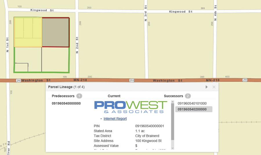
To address this common challenge, Clay County, Minnesota, speeds up parcel investigations and improves the county’s property, zoning, and planning decisions by using Parcel Lineage, an app available from ArcGIS Marketplace. The app, developed by Esri partner Pro-West & Associates, displays the entire PIN history for any recorded piece of land.
Parcel Lineage provides parcel information that correlates to historical zoning ordinance dates, meaning that parcels can be analyzed according to historical boundaries to establish which ordinance should be referenced for the request. The same process is applicable to floodplain ordinance adoption that affects historical parcel divisions, as well as to other issues such as billboard and cell tower siting requests.
“Traditionally, Clay County provided the data for abstractors to research property information in person or through a subscription service,” said Mark Sloan, the information services director at Clay County. “The Parcel Lineage tool empowers abstractors to do that work themselves by opening the app.”
The parcel fabric, a model that Esri introduced in 2010 to simplify parcel editing, makes it easy to track changes to a parcel over time. The parcel fabric is made up of key feature classes including the Parcel History layer, which contains the history of all boundary changes made to a parcel.
“By publishing the full Parcel History layer as a feature service in ArcGIS, that history can be brought into any web map and incorporated into the Pro-West Parcel Lineage app,” said Sloan.
Additionally, if a county has older digitized records that exist in document imaging systems (such as Laserfiche), those records can be easily linked and displayed within the app alongside the rest of the history.
Clay County receives requests for building permits and to create new subdivisions all the time. Requesters have high expectations when they visit a county recorder’s office to get information.
Previously, Clay County’s staff had to look through tract indexes, assessors’ sketches, old subdivision plats, and deeds to reconstruct any underlying divisions of the property. Staff often had difficulty fulfilling simple document and image requests.
But now Clay County uses Parcel Lineage to find that information. The app has proved valuable in speeding up the county’s customer service. Recorders can simply open the app for the requester, search for a PIN, and print out documents and images on the spot.
“Before the app, people who made requests for historical parcel information became frustrated being sent around from department to department to find a simple document,” said Sloan. “This app accesses information right away, since all of our real estate documents are indexed by PIN.”
Use of the app has been so successful that Pro-West and Clay County foresee greatly expanded use.
“It has huge potential for our land records staff,” said Sloan. “Its consistency with the rest of our online mapping applications will let them get started using it and achieving value from it very quickly.”

