The Relevance of Cartography: A Cartographer’s Perspective
The Sustainable Development Goals (SDGs)—adopted by the United Nations (UN) in September 2015—aim to end poverty, protect the planet, and ensure prosperity for everyone. To make this happen, the UN encourages everyone to do their part—not only governments, the private sector, and civil society but also us as individuals.
For us, the UN set up a website called The Lazy Person’s Guide to Saving the World. It has tips on what we can do from our couches and in our neighborhoods to contribute to these solutions.
While the recommendations are really worth pursuing, I do not like being categorized as a lazy person. So it made me think: How can the International Cartographic Association (ICA) contribute to meeting the SDGs by 2030?
Let’s first look at what the 17 SDGs encompass. Each goal—from ending hunger and attaining gender equality to ensuring peace and justice and building strong institutions—has several targets. If the more than 160 targets are reached, humanity and our planet will experience economic, social, and environmental improvements.
The targets are judged based on more than 300 indicators. Take Goal 4, which seeks to ensure quality education for everyone and encourage lifelong learning. This goal includes 10 targets, one of which is to ensure that all children receive free and good primary and secondary educations. The success of this target is measured by two indicators: the percentage of children who are proficient in reading and mathematics and the rate of students who complete primary and secondary schools.
So, how can we cartographers be relevant in helping society reach these targets? Mapping the indicators seems like a good first step. We all know that well-crafted maps can effectively exhibit known facts in a visual way. What’s more, online mapping technology can disseminate these facts globally to increase awareness of current states of affairs. And then there are the interactive map dashboards—connected to geographic databases at multiple scales and with space-time analytical functions—that allow decision-makers at various levels to monitor and compare indicators for policy development and action at different geographic scales.

That said, at ICA, we decided to do things a little differently. ICA’s aim is to promote the discipline of cartography throughout the world. Not least because 2016 is International Map Year, we decided that ICA should demonstrate how diverse maps and cartography really are and how they can convey all sorts of metrics, insight, and relationships with regard to the SDGs.
Thus, we decided to create an exhibition of cartographic posters about the SDGs. The posters are on the ICA website, where anyone can access and use them to enrich their own map displays, especially those related to International Map Year. Additionally, in the spirit of Goal 4, the ICA’s exhibition allows us to educate people on the importance of the SDGs while also informing them of how powerful maps can be.
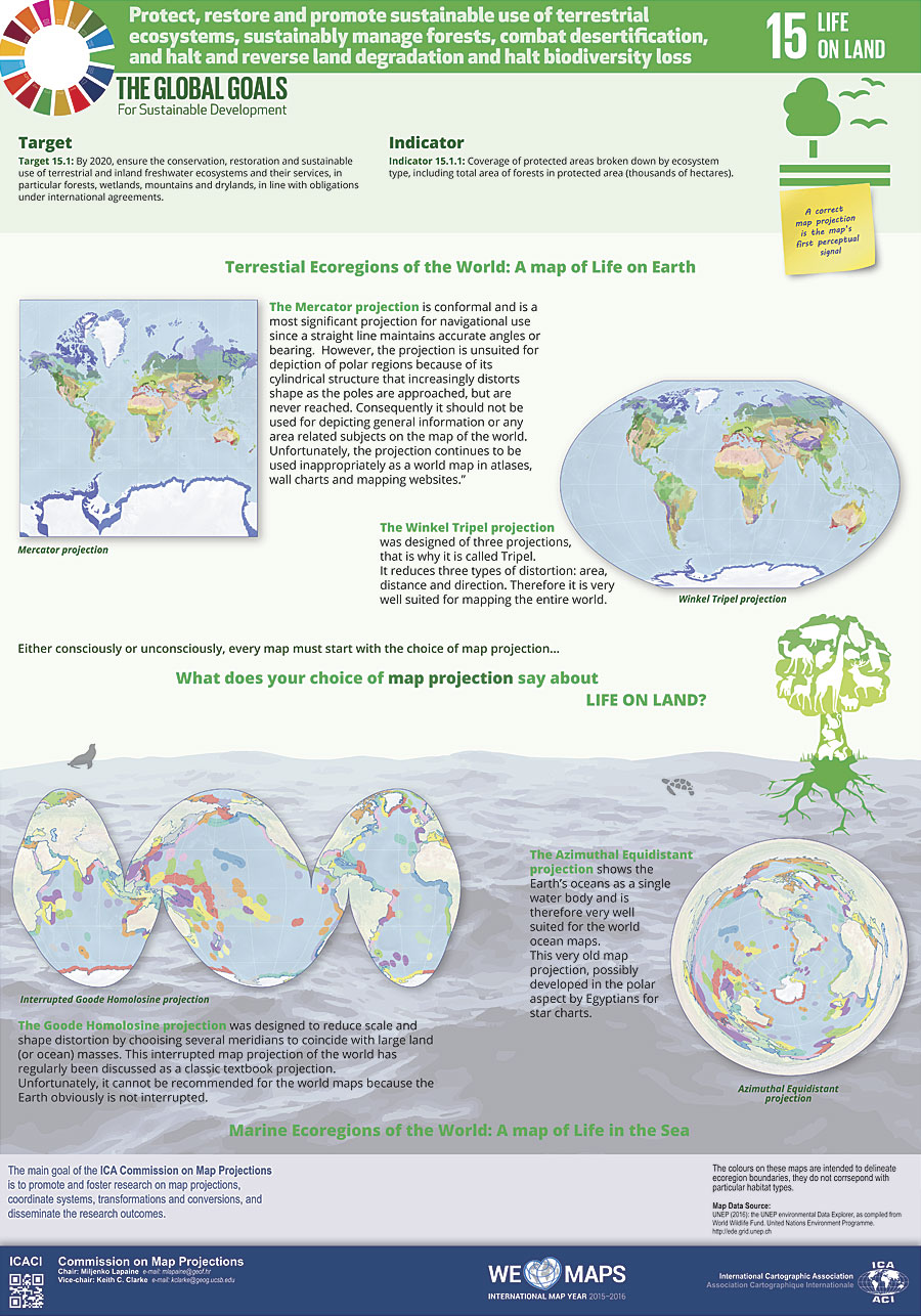
ICA’s commissions, which address a wide range of topics that cover nearly the entire discipline of cartography, each adopted one of the goals. As a starting point, the commissions selected a target of their chosen SDG, along with its indicators. Then each commission expressed its topic cartographically, through the lens of that commission’s objectives. For example, the poster for protecting life on land, made by the Commission on Map Projections, tells the story of how certain map projections can be good or bad depending on how the mapmaker wants to display all the earth’s land. The ending poverty poster, made by the Commission on Topographic Mapping, encapsulates how to use topographic maps to better understand what causes poverty. Other posters acquaint viewers with open-source technologies, the relevance of selecting the correct level of detail for administrative units, and the effects of using color in map design. Taken together, all the posters tell a story of cartographic diversity, of mapping options, and of multiple map perspectives.
Maps that matter—and are well designed—are engaging, instantly understandable, and relevant to society. They should raise interest, which is exactly what the first exhibition of these posters did when it was displayed at UN headquarters in New York during the Sixth Session of the UN Committee of Experts on Global Geospatial Information Management (UN-GGIM) in August 2016.
Does this mean that ICA has contributed enough to achieving the SDGs? Does this poster exhibition mean we can stop? No. ICA is now planning to create an atlas of good practices for mapping the SDGs.
Let’s make the world a better place with maps.
Download the posters, along with an accompanying catalog, here.
About the Author
Menno-Jan Kraak is professor of geovisual analytics and cartography at the University of Twente in the Netherlands, where he has been teaching since 1996. He has a degree in cartography from the Faculty of Geographical Sciences at Utrecht University and received his PhD in cartography from Delft University of Technology. Kraak has written extensively on cartography and GIS. His book Cartography: Visualization of Spatial Data, written with Ferjan Ormeling, has been translated into five languages. He also wrote Mapping Time: Illustrated by Minard’s Map of Napoleon’s Russian Campaign of 1812, published by Esri Press in 2014. Kraak is a member of the editorial boards of several cartography journals, including the International Journal of Cartography. He currently serves as president of the International Cartographic Association.
Read other articles in “The Relevance of Cartography” series.


