case study
Metro Nashville Engages the Public with Esri Redistricting
Key Takeaways
- The implementation of Esri Redistricting and creating a hub site with ArcGIS Hub helped change public perception of the redistricting process in Metro Nashville. Engaging the public ultimately allows them to make informed decisions when electing officials.
- Metro Nashville implemented Esri Redistricting, a GIS solution, to engage voters and elected officials to provide unprecedented access to the redistricting process, giving them a say in how district boundaries are established.
- Metro Nashville staff created a hub site to share proposed maps and information about the redistricting process. This site included maps, dashboards, and explainer videos that influenced the proposed boundaries.
Products Used: Esri Redistricting , ArcGIS Enterprise , ArcGIS Experience Builder , ArcGIS Survey123, ArcGIS Hub
Every 10 years after the US Census, states must examine and redraw district maps for local, state, and federal elections. This process, known as redistricting, is a system that considers the demographics, constituencies, and political behaviors of voters to draw map boundaries for elected positions.
Redistricting is the process by which local and state governments use decennial census data to redraw the boundaries of election districts. These boundaries consider equal population, compactness, contiguity, historical continuity, compliance with the Voting Rights Act, and communities of interest—a population that shares common social or economic interests.
The Importance of Community Engagement in Redistricting
The Metropolitan Government of Nashville and Davidson County, also known as Metro Nashville, has a population of 700,000 residents and a growing urban core. Government officials wanted to change the perception of redistricting by offering unprecedented access into the process of re-establishing boundaries for local Metro Council and School Board district residents. But due to its wide-ranging implications, such as changing the voting base for a district and legislative delegation, redistricting is often met with allegations of manipulation and unfairness.
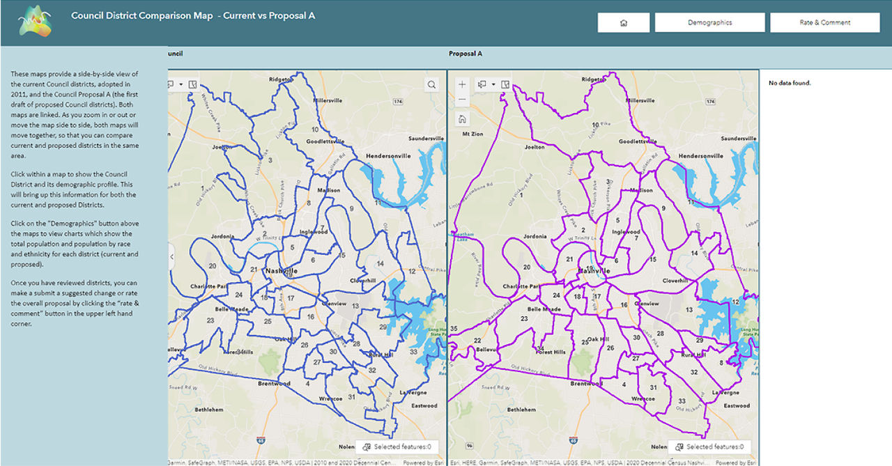
 Two side-by-side maps, one map shows old council districts, the other, the proposed boundaries by population size.
“Community engagement is a big part of what we wanted to do,” said Gregory Claxton, Planner, Metro Nashville Planning Department. Unusual for a local government, Nashville’s Planning Commission is responsible for recommending revised district boundaries for the Metro Council (a 40-member body with 35 districts) and for the Nashville School Board (composed of nine district members). The Metro Nashville Planning Department acts as staff for the Metro Nashville Planning Commission (MPC).
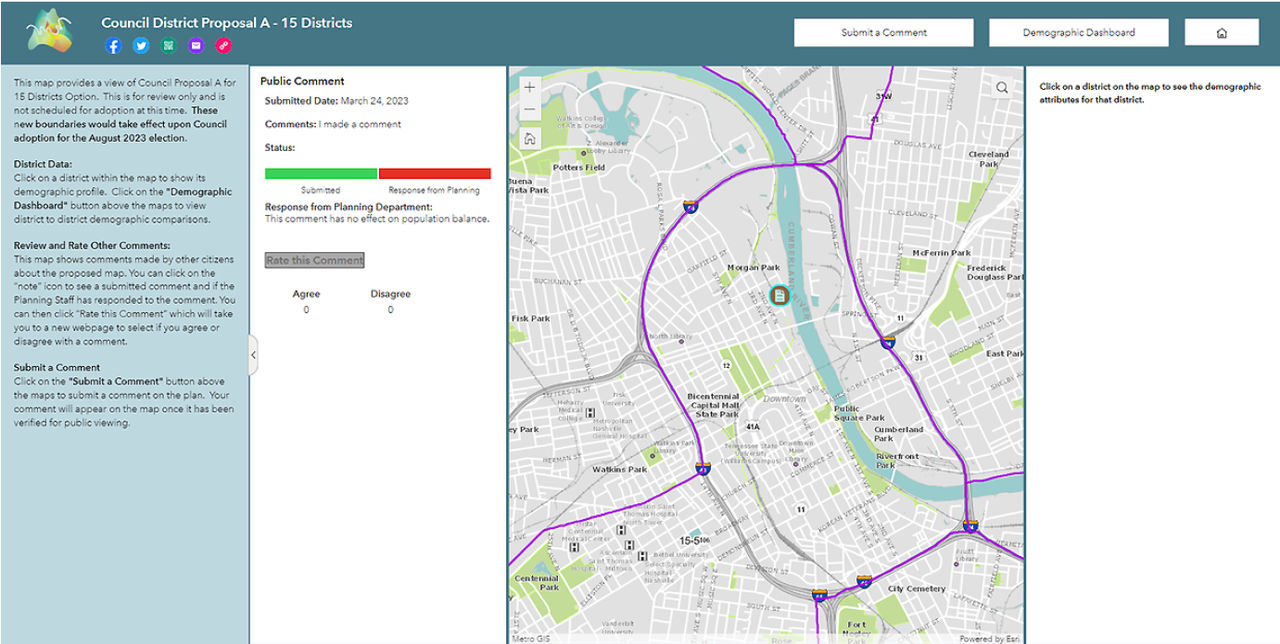
 A map zoomed in to an area in Nashville, Tennessee that shows an option for the boundary of a council district.
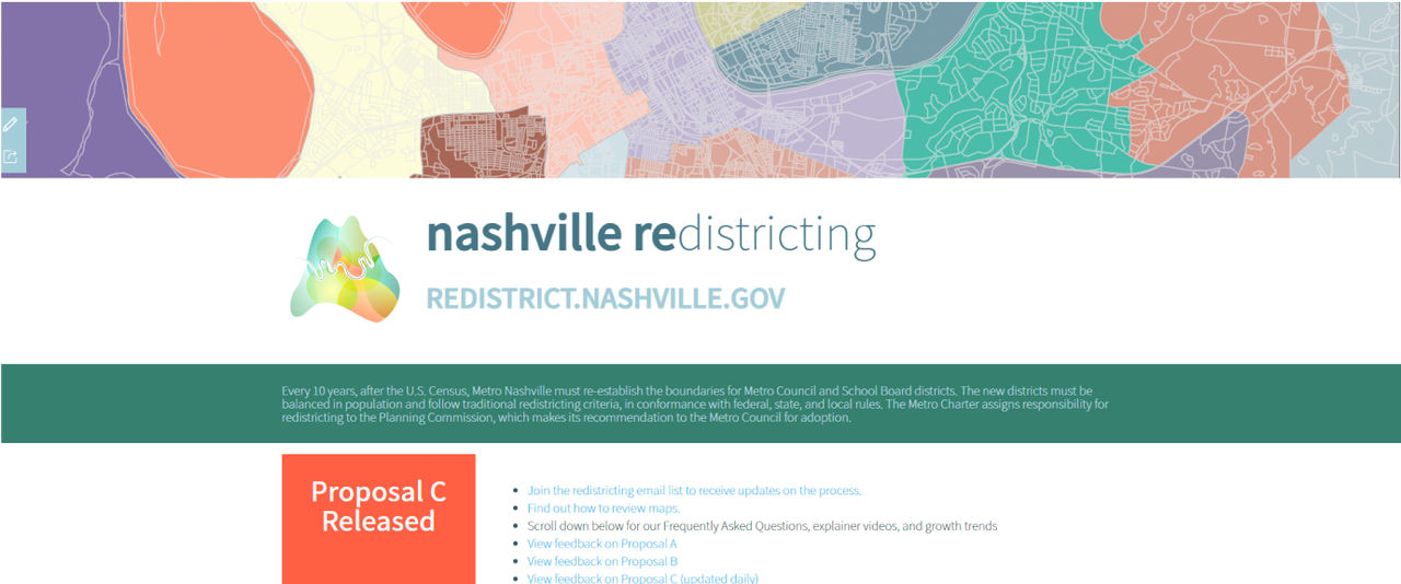
 A screencap with links to several interactive maps to better understand Nashville redistricting
Utilizing GIS to Enhance Redistricting Efforts
Because the census happens every 10 years, district boundaries can shift, but mapping technology for redistricting has become more advanced. Metro Nashville’s 2020 redistricting effort worked to provide heightened visibility and awareness into population shifts and district boundary changes. The combined city and county government implemented Esri Redistricting, a geospatial information technology solution for voters, elected officials, and candidates for elected office to gain insight and share ideas. With Esri Redistricting, along with ArcGIS Survey123, a mobile data collection application, the Planning Commission staff worked with the IT department to create an ArcGIS hub site, an online resource to share proposed maps with voters, elected officials, and candidates.
Based on data from the US Census, maps generated from Esri Redistricting are recommended for adoption by the planning commission. Creating these maps is an iterative process, whereby community members, legislators, and county staff all collaborate. Once approved by the planning commission, maps are then sent to the Metro Council and residents for review and approval.
Voters filled out a survey about their neighborhood and priorities. At the end of the survey, they were asked to choose polygons on a map that they felt were representative of their neighborhood.
“Using Esri Redistricting and ArcGIS Survey123, we had residents answer a set of questions and then ‘draw’ their community,” said Jennifer Higgs, GIS Director, Metro Nashville Information Technology Services. “We wanted people to tell us how they think of their community—sometimes it was a small neighborhood association, other times it was two-thirds of the county.”
 Instructions above an interactive map tell how residents can draw their community using clicks and drags into various shapes
Changing Public Perceptions in Metro Nashville
Implementing Esri Redistricting for Metro Nashville’s local races allowed the Planning Department to change public perceptions of redistricting. “One thing that was really gratifying is that when we sit down and talk to people, their appreciation of what we do with mapping and district boundaries grows,” explained Claxton.
With Esri Redistricting, and the hub site, the planning department created hundreds of maps and several explainer videos about redistricting, with context for the ideal district size, historical and interactive maps, and dashboards to explain demographic changes that led to the proposed boundaries. Additionally, voters could compare historical district maps using ArcGIS Experience Builder on the hub site.
Communications Director at Metro Planning, Richel Albright added, “Being able to visualize how quickly population changes can shift based on census data and then to [create] maps were really eye-opening.”
Claxton added that he understands the importance of the planning department’s role but sees the use of GIS technology as a way to further empower residents. “Ultimately, voters pick elected officials, that’s a bond we don’t want to get ourselves in between,” Claxton said. “We provide historical maps and proposed maps to share information.”
 A survey displays type boxes that allowed residents to leave information about proposed changes to districts
 A screenshot of information in a green text box about why redistricting matters for residents and the planning commission