case study
Esri Partner Timmons Group Helps Arizona IRC Harness the Power of GIS for Redistricting Success
Redistricting—the process of revising district borders to account for population shifts—is a critical process that shapes the political landscape and impacts communities across the United States. When 2020 Census data was made available, states across the country had to tackle the challenging task of redrawing electoral district boundaries to ensure fair representation for all citizens, and for many states, GIS plays a pivotal role in this process.
When the Arizona Independent Redistricting Commission (IRC) began planning Arizona’s redistricting efforts, they knew they would need help harnessing the power of GIS to overcome the complex demographic, political, and legal aspects of the process to achieve a more transparent, equitable, and efficient redistricting outcome. Esri partner Timmons Group, a leading engineering and technology firm, was the obvious choice.
“We’ve had a lot of success across the country in GIS projects addressing things like equity broadband and diversity inclusion,” said Brian Kingery, senior solutions architect, GIS administrator, and project manager on Timmons Group’s geospatial services team. “We know how to tell stories with data to make it easily consumable and digestible through the use of tools like story maps and dashboards.”
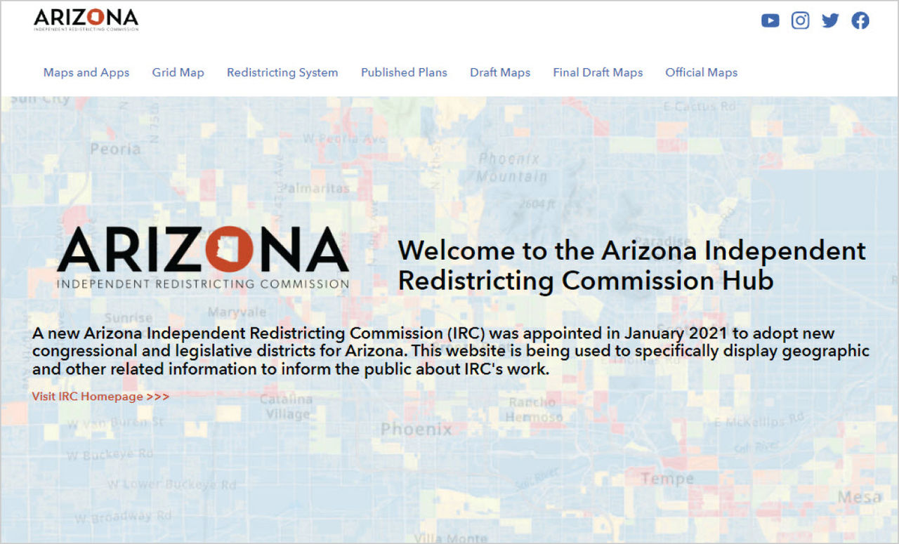 Homepage: https://redistrcting-irc-az.hub.arcgis.com/
Revolutionizing Redistricting with GIS
Redistricting occurs every 10 years in response to the US census, determining which voters are represented by which elected official. The goal is to create fair and representative districts that give all voters an equal voice in the political process. GIS improves the redistricting process by providing accurate and detailed maps of population and voting data. These maps reveal the distribution of population by race, ethnicity, and other demographic characteristics, information that can be used to ensure that the new district borders don’t discriminate against a particular group of voters.
In addition to creating maps, GIS can also be used to analyze data and identify trends. This information can be used to make informed decisions about how to draw district boundaries. For example, GIS can be used to identify areas that have experienced population growth or decline, and to adjust district boundaries accordingly.
Esri Redistricting is a web-based GIS software that streamlines the redistricting process, resulting in significant time savings. The software's advanced capabilities enable redistricting commissions to efficiently analyze vast amounts of data, perform complex calculations, and generate multiple redistricting plans with ease. This streamlined approach not only expedites the redistricting process but also allows for more thorough and comprehensive evaluations of different redistricting scenarios.
By leveraging Esri Redistricting, redistricting commissions can ensure that districts are drawn in a manner that respects the boundaries of neighborhoods, communities, and other geographic features that hold significance for the public.
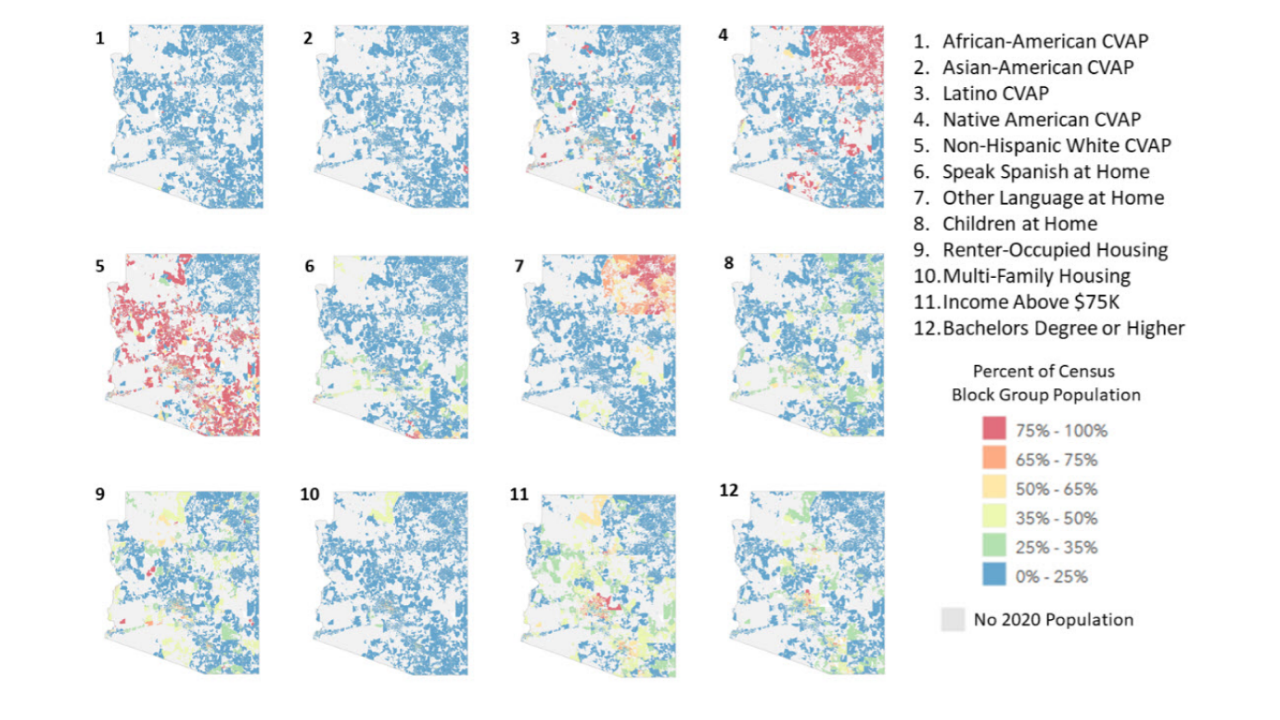 Socioeconomic Report of Arizona: Examining newly released demographic variables across the state of Arizona proved to be an important step in understanding how the new boundaries could be drawn.
Link to Socioeconomic Report of Arizona.
Giving the Public a Voice in the Process
A critical challenge faced by the commission was to create a plan that was supported by the public at a time when citizen demand for transparency during redistricting has never been higher. In response to this demand, the Arizona IRC held a series of public hearings and meetings to respond to questions and get input from the public.
“There were three sets of workshops that the commission held,” said Kingery. “The first week-long session was to go over all the draft maps, then there was a break to gather input from across the state, then another session to finalize the draft maps and another break to gather input. We came together one more time for a third session to finalize everything and officially adopt the maps.”
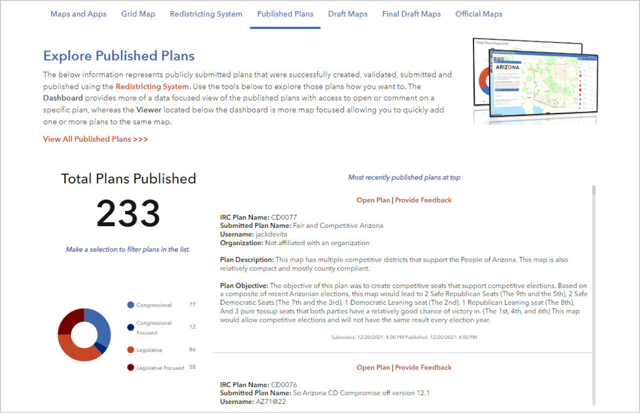 On the Published Plans page, citizens can access all submitted plans using an embedded ArcGIS Dashboard.
Link to Published Plans page.
To overcome these challenges, Arizona IRC used Esri Redistricting and the expertise of Timmons Group, a leading provider of GIS services. Arizona IRC and Timmons used ArcGIS Hub to develop Arizona Independent Redistricting Commission Hub, a free resource that allows users to explore Arizona’s congressional and legislative maps and submit suggestions throughout the process. The hub makes the latest census and state data available to residents through maps, apps, and dashboards. Users who were interested in proposing changes to the Arizona legislative and congressional maps could access Esri Redistricting 24/7 from the hub site. Access included data and functionality for plan management, editing, visualizing, and community collaboration, along with training videos showing how to use the tools. Users could draw maps and submit them to IRC. A total of 216 maps were submitted.
“Users could go there and learn about different phases of the effort. We wanted to provide a way to access all the maps and apps, whether it was to access the latest census and metrics or to explore the population and demographic pieces,” said Kingery.
The hub also provided open access to all the published redistricting plans, including draft and final maps from all phases of the project. Residents were able to provide feedback on draft map versions as well as citizen-submitted plans.
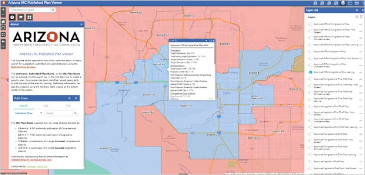 Using the Published Plan Viewer application allowed citizens to search for all User Submitted Maps as well as Commission created maps.
Link to Published Plan Viewer.
Providing Fair and Transparent Representation
Arizona IRC's success is a testament to the power of GIS technology and how Esri Redistricting enabled public engagement in the redistricting process.
“Throughout this process, we wanted to be as transparent as possible,” said Kingery. “I think that’s a key piece that led to the overall success of the project.”
By providing access to Esri Redistricting and interactive maps and other visualization tools, Timmons and Arizona IRC empowered Arizona citizens to actively participate in the redistricting process. This level of transparency helped build trust and confidence in the redistricting process, ensuring that the resulting districts truly reflected the interests and needs of the communities they serve.
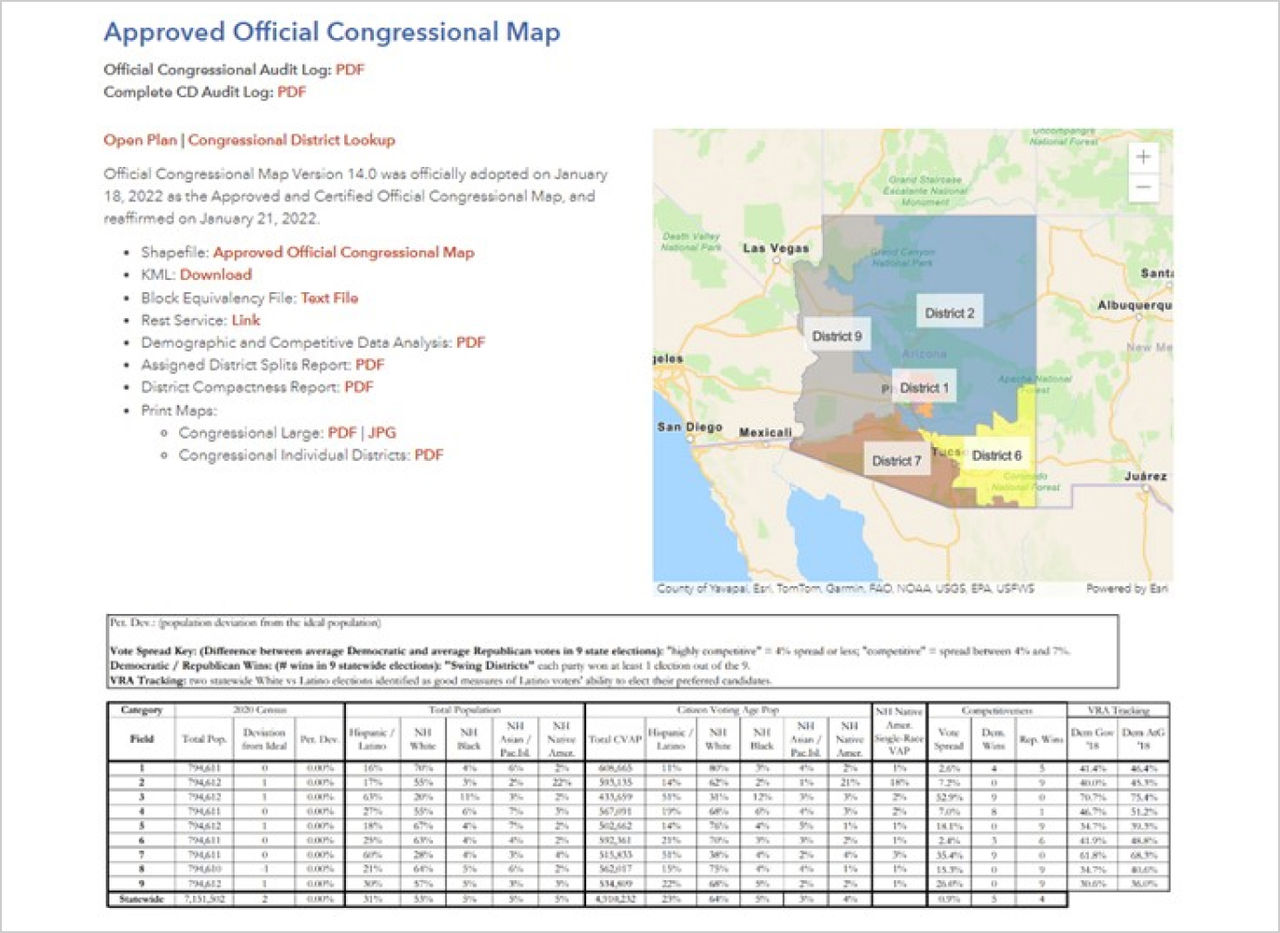 Every plan that the Commission voted was presented on the website with associated files and reports to promote transparency and also to allow others to use that information in their analysis and mapping efforts.
The Future of Redistricting
The hub remains available for reference and as an example for future redistricting plans. “Esri Redistricting is still accessible on ArcGIS Online for the foreseeable future,” said Kingery. “All the published content is still up and running, and it serves as a system of record.” Furthermore, as populations continue to shift and grow in Arizona and across the country, GIS and Esri Redistricting will play an even more important role in ensuring that districts are fair and representative. These tools will be critical to making the 2030 redistricting process more efficient and accurate. As more states follow Arizona’s example of engaging the public, the redistricting process becomes more transparent and accessible for all.
Arizona IRC’s trailblazing use of spatial technology stands as a prime example of how to tackle the redistricting process while achieving maximum transparency. Esri Redistricting brings clarity to the redistricting process by providing GIS-based tools to create interactive maps that allow the public to view and comment on proposed redistricting plans, making it easier for the public to participate in the redistricting process and ensure that their voices are heard.
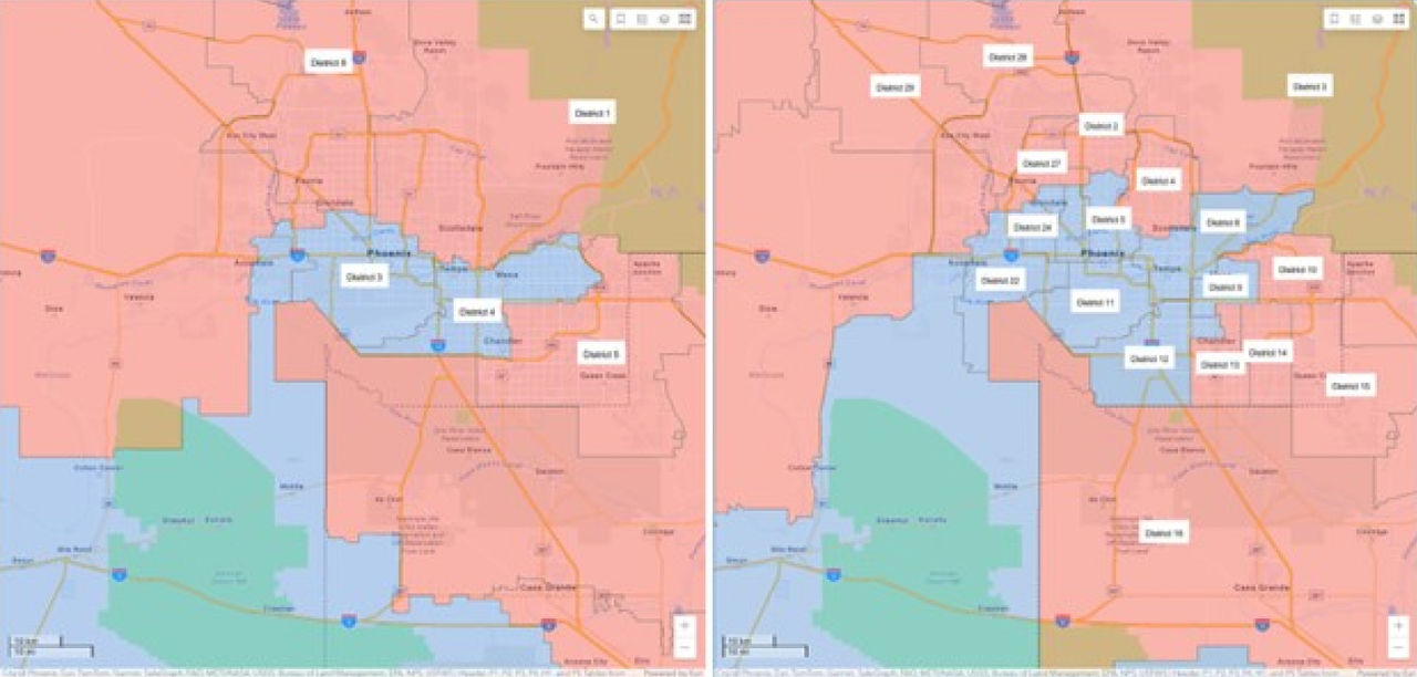 The Comparison Application provided a way for citizens to comparatively views plans side by side promoting discussion and understanding.
Link to Comparison Application.