case study
How the Wisconsin DOT Improved Efficiency by Moving Imagery Services to a Cloud-Based GIS
The Wisconsin Department of Transportation (WisDOT) has long utilized geographic information system (GIS) technology to support its business operations. In fact, it was one of the first DOTs to implement GIS, and its initial efforts date back more than four decades.
At the same time, over the years, the agency had built up vast amounts of data and imagery. As a result, much of that imagery was being held, according to GIS Unit Supervisor Adam Feidt, “all over the place.” Image files and data were stored on file servers and desktops throughout the agency and at WisDOT headquarters, in the capital city of Madison, Wisconsin.
About five years ago, this situation reached a crisis point. Distribution of imagery data from the organization’s own file servers was becoming problematic, and access to various imagery files was difficult.
With a catalog of imagery that now tops 100 terabytes, WisDOT needed a better way to manage this information resource. The agency’s large number of users needed improved access through a more cost-effective solution. Additional demand on the GIS infrastructure team came from the organization’s engineering and design group—specifically the Civil 3D users—engaged in the latest design and digital delivery methodologies.
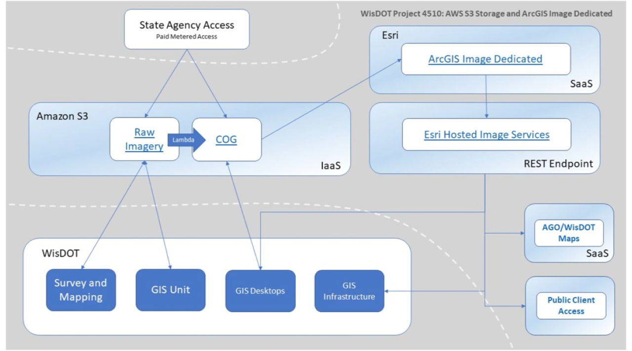
The solution has been to consolidate all their imagery onto Amazon Web Services (AWS) using Esri’s software as a service solution, ArcGIS Image Dedicated. By moving away from on-premises servers, WisDOT is now reaping the benefits of an imagery storage asset that delivers common, high-quality information at high speed to all interested parties, and does so at less than a tenth of the cost.
Imagery Data in Silos Creates Delayed Access
Several factors contributed to the complexities WisDOT experienced in managing its imagery. Hosting on internal servers enabled the department to provide data to a diverse group of stakeholders. But since many of WisDOT’s high-resolution images remained locked away in disparate locations, gaining access meant going to specific individuals or other departments. In an organization of 3,500 people, that could be difficult and time-consuming.
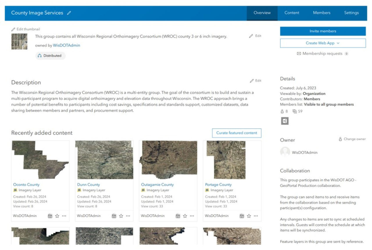
 Data can easily be shared to all stakeholders through ArcGIS Online.
Historically, WisDOT relied heavily on the National Agriculture Imagery Program (NAIP). However, for almost 20 years, digital Ortho imagery and elevation data was collected, updated, and made available at regular five-year intervals by the Wisconsin Regional Ortho Imagery Consortium (WROC).
WROC creates imagery that is of far greater resolution than NAIP’s—up to three inches—and it differs in one crucial aspect. NAIP imagery, because it is gathered during agricultural growing seasons, shows locations with foliage cover "leaf-on" whereas WROC imagery is "leaf-off". It is therefore of greater potential use to designers and engineers, as it displays the under-canopy detail. Adding to the volume of data was needed in order to provide dynamic and cached services in a variety of coordinate systems.
“We had statewide data,” explained Ben Hostetler, GIS Infrastructure Specialist. “This included a couple of caches for WROC data held at state level, and NAIP imagery at a two-foot resolution cached statewide. We also had some historical NAIP data going back to 2005. These are all dynamic image services. For 60 of our 72 counties, we provided dynamic image services at three-to-six-inch resolution.”
Adding to the complexity, Hostetler continued, “There are custom WisDOT basemaps that are refreshed annually, which create a growing library that is cached on tiles, and then there is imagery which has been held and created for individual projects. WROC’s existence had resulted in regular inflows of information, but significant amounts of the gathered data were located in noncentral locations and on various portable hard drives.”
Whatever its origin and type, having to cope with the storage and distribution of imagery at resolutions ranging from three inches to one meter required a broad range of strategies. This project helped to define the strategy for finding a better, more uniform solution.
 The GeoPortal helps the team share authoritative data across the organization.
And as Tony Van Der Wielen, GIS Infrastructure Architect at the agency, pointed out, “This is 2024; having that imagery and using portable hard drives to move it from agency to agency was pretty archaic.”
The goal was to create a statewide resource with uniform resolution and the ability for users to quickly identify and access the imagery they needed.
Increasing Options for Imagery Data
WisDOT needed to find an optimal way of managing all this data in the cloud and make it easily available through web services. Their desired solution would need to support 300 desktops and a similar number of ArcGIS Online users, create an internal enterprise environment for 1,500 users, and cater to the needs of Civil 3D users. Additionally, they wanted to be able to share the imagery with other state agencies and enable partners to upload new imagery.
Initial discussions took place in 2019, principally centered on getting key decision-makers comfortable with the security aspects of working in a cloud environment. The 2021 to 2022 period involved collaborating with AWS and Wisconsin’s Department of Enterprise Technology (DET) to get an appropriate account set up. This led to an official project start date of September 2022.
Since then, the volume of services and libraries that WisDOT can support has increased markedly. Previously, using an on-premises server solution meant that only low-resolution imagery and a five-year rotating library of images could have been considered. This is because of the cost limitations associated with both storage and scaling up fast enough to support the number of services now being provided.
Improving Performance and Reducing Cost
"There were," says Van Der Wielen, "lots of discussions about best practices and, with Esri, about the types of models and how to test them."
Similar to other public agencies, WisDOT has to balance providing services and budgets. Gaining the biggest return on investment always must be an aim, but the GIS team was careful not to make the focus of change solely about cost. Instead, the message to management was about delivering a quality service and doing so efficiently.
Using replicated content, over 100 hours of load-testing was performed on three architectural variations. First, the on-premises servers were tested, then content was moved to a hybrid of on-premises servers and AWS’s Simple Storage Service (S3). Finally, a combination of ArcGIS Image Dedicated and AWS S3 storage was tested. This revealed all the pros and cons before presentations were made to management and DET.
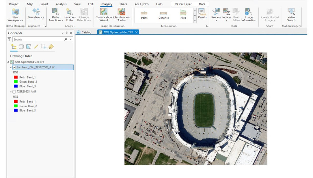
 This example of imagery showcases the level of detail WisDOT is able to see on assets and infrastructure.
“A lot of groundwork went into making sure that we were making the right decision to move to ArcGIS Image Dedicated,” said Van Der Wielen. “Our justifications were going to drive not just the project budget, but also budgets for AWS going forward.
The cost differences, however, were major. To store on-premises, the 100 terabytes of data mentioned above would cost the GIS team $260,000/year. To store that same volume of imagery in AWS and utilize ArcGIS Image Dedicated would be $20,000–$25,000/year. That substantial difference refers only to one set of savings—because users are accessing information from the same buckets, there is no duplication.
“Think about it: If WisDOT is storing 100 terabytes of data and paying to do so, and then another agency is also paying to store that same information somewhere else, you have duplication of costs," emphasized Feidt. “With this kind of architecture, we can have multiple agencies access imagery without downloading it. They can copy data over to their own buckets if they need to, or they can actually access the cloud-optimized GeoTIFFs and use them read-only.”
The ability to distribute imagery through AWS is having a ripple effect on costs elsewhere. Feidt stated that the true, additional savings are near-impossible to calculate because of the difficulty of working out exactly who is leveraging the data and where they are storing it.
More Imagery Distribution Services
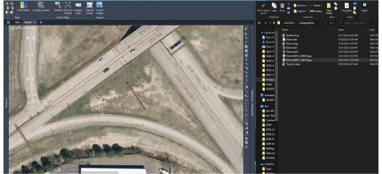
ArcGIS Image Dedicated and AWS now support streaming imagery services across all of WisDOT’s GIS platforms. This includes those for both public and private-sector use. Close cooperation with the Civil 3D deployment team has resulted in the ability to stream three-inch resolution imagery from WisDOT’s REST services and then extract smaller irregularly shaped project areas. For a project outline, all of this can take place in a matter of seconds, mosaicking everything into one image and then pulling it into the design software.
 Imagery is the foundation for WisDOT to extract asset information and data on smaller project areas.
“Instead of just streaming in, they’re creating a mosaic image that stays with the design through all the stages of a project,” Van Der Wielen explained. “That gets archived so that 10 years down the road, people will be accessing the same imagery, but can then stream in new information. The downloads are smaller, as users are no longer having to pull down a whole GeoTIFF. It’s a unique way of doing things.”
Managing a Seamless Transition
Throughout, the team stressed engagement at the earliest possible opportunity. Bill Shockley, GIS Unit Project Leader, said that the aim was to make changeover appear seamless to users. Success is measured by the fact that workflows remain uninterrupted. Only the route to obtain imagery has changed slightly. And by making access easier, the GIS team has made change become second nature. In many cases, users simply do not realize they are using the new resource.
 ArcGIS Image Dedicated has allowed WisDOT to deliver high-quality imagery to all stakeholders and departments that need it, with more efficiency.
“People are finding that their workflows are faster without even knowing why,” says Shockley.
Van Der Wielen added, “Around 95 percent of our workflows are seamless. The other 5 percent are very specific. We won’t tell people to change—but they still have the option to do things the new way. Imagery is hard. It’s the bit that needs more horsepower and, as a result, it was probably underutilized. Amazon Web Services and ArcGIS Image Dedicated has given us the solution we needed.”