case study
Connecticut Department of Transportation Uses GIS for Better Infrastructure, Project Planning, and Delivery
The combination of Esri geographic information system (GIS) technology with Microsoft's business environment is enabling the Connecticut Department of Transportation to—quite literally—break new ground in infrastructure project planning and delivery.
There is a growing movement among US state departments of transportation (DOTs) toward greater digitalization of their design and construction processes, often called digital delivery. While each DOT has approached the problem in different ways, they are all designed to capture greater efficiencies during the project delivery stage, and ultimately to better manage project data and information through the full information life cycle.
Following the lead of its European colleagues, who have long implemented building information modeling (BIM) concepts for major infrastructure projects, the Federal Highway Administration (FHWA) has been encouraging state DOTs to adopt similar concepts in their project delivery efforts. Under the term BIM for Infrastructure (BIMfi), FHWA has promoted the opportunities for greater efficiencies. As David Unkefer of the FHWA Resource Center stated: "We want to help agencies better utilize as-built data created during design and construction for business needs during operations and maintenance."
The goal for many agencies is not just the better management of the project data from a single project, but also how to create the data repository for all the various data (survey, design, GIS, construction management and inspection files) created during the project life cycle for all their projects and use that data in making future project decisions. It is precisely this larger process of digital transformation that the Connecticut Department of Transportation (CTDOT) is engaged in.

This digital transformation involves the electronic consolidation of all records pertaining to an organization's assets. It often requires thousands of hours of effort to trawl through and bring together, in uniform and accessible formats, records of many different vintages and origins.
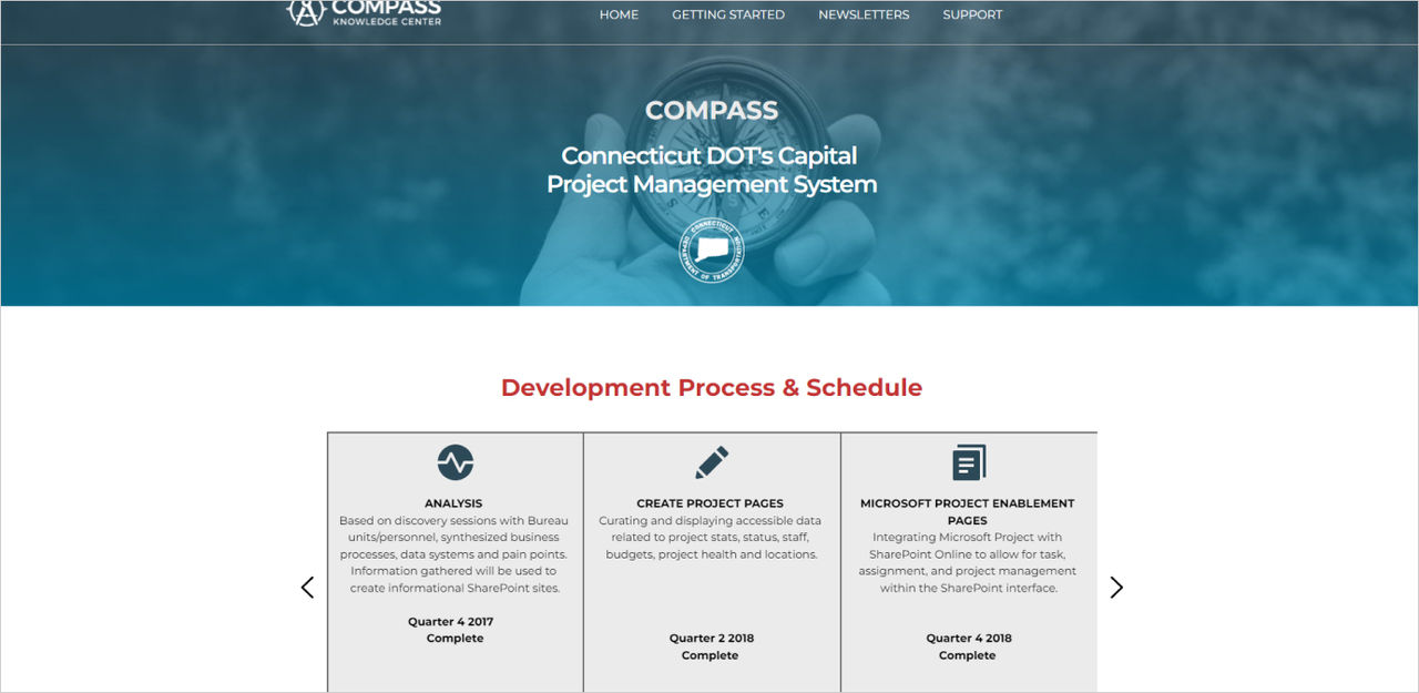
The result is not only an impressive data repository, but ultimately also a connected or common data environment (CDE) that is available to anyone who has access privileges within CTDOT, its consultants, or municipalities and planning agencies. CTDOT is launching the second version of its CDE, called COMPASS, with the goal of achieving greater efficiencies, better design results, and ultimately cost savings on all its infrastructure projects. This second-version COMPASS is integrated with ArcGIS software-based ATLAS (CTDOT's Asset Tracking and Location System).
Directional Tool
At any one time, CTDOT has around 700 active projects, and of those, roughly 150 will have advanced to the construction phase. Behind these current projects are all the legacy projects, which are also part of the authoritative GIS project layers and are accessible via ATLAS/COMPASS. The legacy projects themselves number around 10,000, and the retained contract plans stretch back to the 1920s. They include information on some bridges that are over 100 years old, all now accessible in the enterprise GIS.
This was a consolidation and digitization effort that took the better part of five years.
COMPASS organizes all this project data with Microsoft SharePoint and provides permission-enabled users with access to the projects in CTDOT's repository. OneDrive enables synchronizing of project libraries as well storing of native design and other files in the SharePoint folders. Closely integrated with the SharePoint COMPASS site is Esri's software, which provides the easy-to-use graphic front end to the entire repository. Assembled using ArcGIS Experience Builder, the GIS component of CTDOT's CDE (now version 2, built with assistance from consulting firm VHB) provides the location, visualization, and spatial analysis of the project work areas, including metadata for easy retrieval.
As a result, via ArcGIS and SharePoint, permitted users from a variety of locations can swiftly acquire deep knowledge of projects, their locations, and current activity.
Preconstruction Phase
The first stage of COMPASS is primarily designed to assist on the planning/design (or preconstruction) side of the project delivery ledger, which makes the approach unique among state DOTs. The key beneficiaries of COMPASS include project developers, design and support engineers, planners, and asset stewards. At the start of project planning, ATLAS/COMPASS integration provides a large portion of the background information a planner or design engineer, via one on-screen application, might need. Even as recently as five years ago, this would often have involved considerable effort to gather relevant data from multiple internal and external resources.

Atlas, meanwhile, resides in the service layer below COMPASS and underpins all phases of the project delivery life cycle, from conception to decommissioning. Interaction with the administrative component of Atlas enables management and configuration of both asset layers and information layers (environmental, active projects, and others) as they mature to authoritative data.
A complex intermeshing of applications supports the simplicity of the user experience.
Through the Azure cloud, COMPASS interacts with a series of business systems that are part of CTDOT's capital planning and financial systems. CTDOT currently uses AASHTOWare's Project to develop initial estimates, evaluate bidding, and track materials and project status and payments for each project.
Nightly, information from these different systems is pulled into COMPASS to keep up-to-date what is termed the composite project data.
Because COMPASS is designed to provide the CDE during the preconstruction phase, users query information through the ArcGIS interface (ATLAS), which passes the results to COMPASS. This can include mature asset information and environmental, active, and historical project information, which is then available to the design team for deeper analysis.

As the project moves from design into construction, COMPASS serves as a "virtual filing cabinet" for all of the project information, organizing all of the preconstruction documents, and provides not only document control (with search and filter capabilities) but also permit application and approval information, tracking of property maps and property acquisitions (under development), and fundamental financial information that includes budget and expenditures for each funding phase, among other critical project data. Additionally, COMPASS provides a submittal and transmission function, which provides "Ball In Court" (BIC) functionality allowing users to route, review, sign, track, and archive documents. Project scheduling and tracking are facilitated through the seamless integration of Microsoft Project and AASHTOWare's Project's task and financial tracking capabilities.
Relationship Management
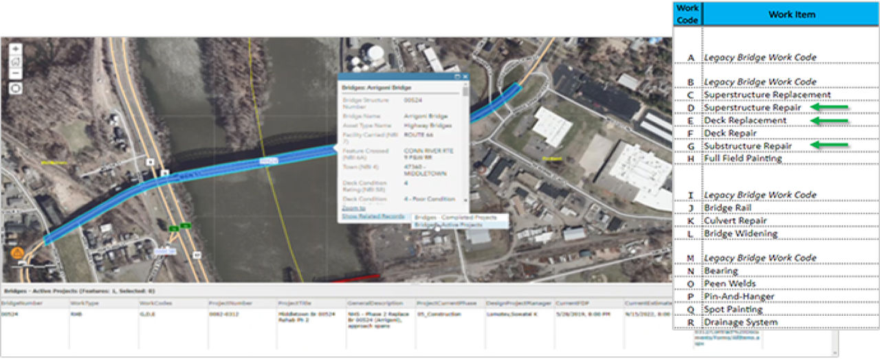
At its core, ATLAS is used to organize and manage the relationships between projects and assets, including the FHWA work types and CTDOT's work codes against each asset feature. It provides a baseline map, and authoritative layers include the road network itself, which includes a linear referencing system, providing the link to other data within the agency. This includes annual daily traffic counts, functional classification, and more. Additionally, the rights-of-way GIS layers are included in ATLAS, along with CTDOT's mature asset information, and information about/for environmental compliance and environmental planning draft reviews.

Initially setting up a project in the system can take just minutes—something that CTDOT principal engineer Bill Pratt says is greatly facilitated by the flexibility and intuitiveness inherent within Experience Builder. Very quickly, those individuals with the permissions to access and modify data can be added from active directories, and from there, there is an intuitive path to establish a new proposed project.
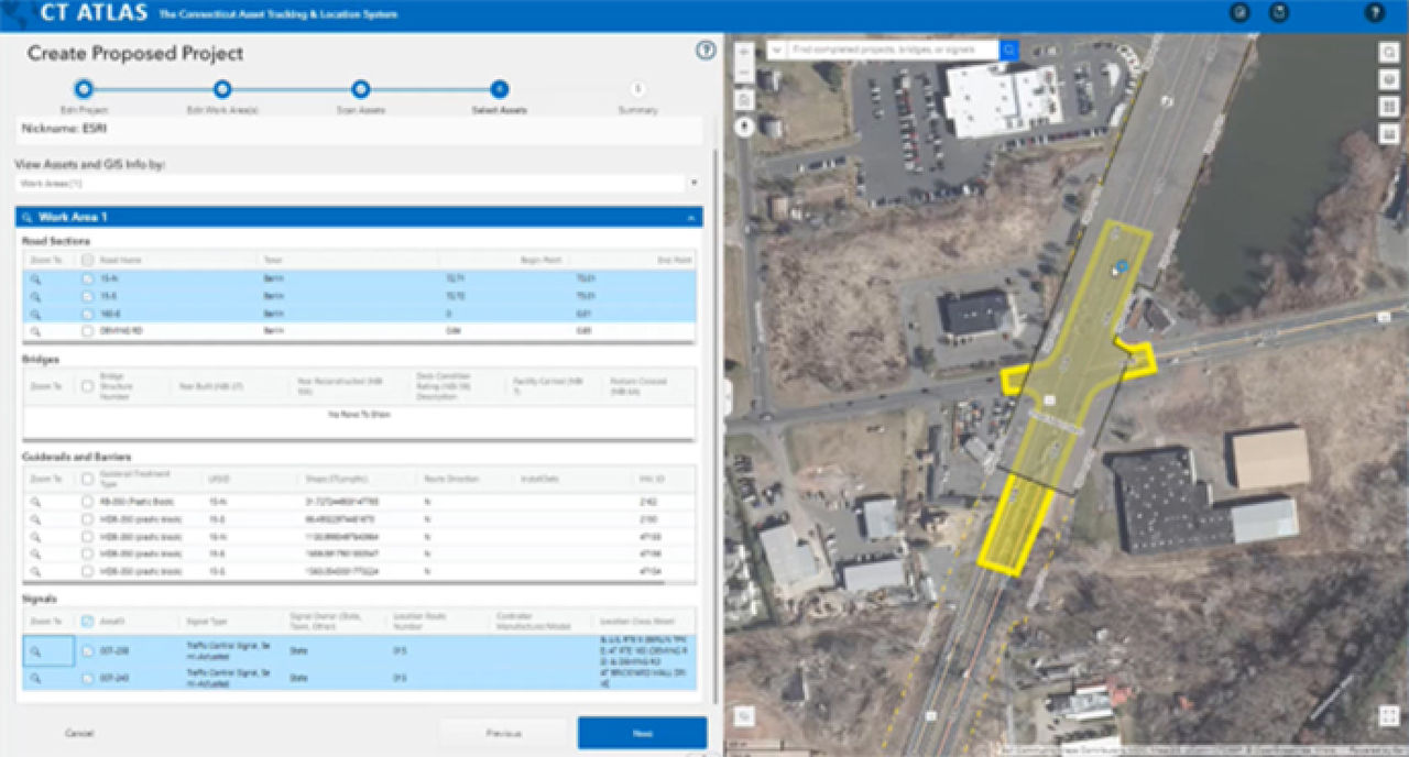
The proposed project is created in ATLAS, which in turn provisions a proposed project site in SharePoint (COMPASS) for the scanning of assets and information. Within COMPASS, this proposed project can be promoted to a funded project. This process blends the proposed project's geospatial information from ATLAS with the authoritative business data from the promoted project. This allows many opportunities to perform advanced work on project development. This process has been branded as Project Generator (PG). If a designer wants a project site in COMPASS, they must generate the proposed project in ATLAS using one of a number of different options to generate one-to-many project work area polygons. These can then be scanned for any authoritative information and mature assets.
Drawing a polygon or clicking and defining a stretch of roadway on-screen will generate access to information on all the projects, current and past, within or impacting the designated areas. Impacting might include, for instance, being in a Federal Emergency Management Agency (FEMA) flood zone—something that might necessitate mitigation or other remediation action.
Pratt notes that CTDOT tried within its business requirements to have "as many notifications as possible" when the application is scanning the project work areas for the information. Individuals defining a project can scan and filter as they need, configuring their scans on assets such as guide rails, or on environmental factors such as flood zones. The spatial query results remain in ATLAS, in the background and accessible, when the project file is pulled into COMPASS.
Where a project is driven by specific geographic location, there may only be one polygon or linear feature defined or used. However, a project that is driven by an asset type—such as bridges or traffic signals—can have tens or even hundreds of polygons. Individual asset types can be filtered in many ways. For example, CTDOT is responsible for 6,700 bridges, and filters include condition and routes or features crossed. It is also possible to identify asset types within a given geographic area and ascertain whether they are already associated with existing projects and what their work types and codes are.

Although a project involving bridges is more likely to number in the tens or twenties, it is entirely conceivable that a project directed at traffic signals could involve hundreds of sites. ATLAS will identify the relevant asset locations and then automatically scan the asset's location polygon, which Pratt describes as a game changer in terms of speed and ease. He notes that it is entirely possible to have several projects ongoing at the same location at the same time—pavement resurfacing work, for instance, can be in progress as other projects at the same locations are passing through design into realization.
The result of establishing a project in ATLAS is the provision of a new SharePoint site with many libraries, designed to hold all the relevant information for the project—type of project, location, responsible authority (town or regional agency), team members, assets scanned, and so on—as it moves through the process. Funding applications are supported with a pro forma page that again simplifies and speeds the process. API integration means that once the project originator clicks Scan—a simple banner click—a project site is provisioned in COMPASS. At the same time, ATLAS provisions over the relevant information and user interaction can begin.
Marrying Everything Up
CTDOT's standardization on producing model-centric designs allows for increased productivity and adherence to FHWA's EveryDay Counts (EDC) innovations model. CTDOT's approach to BIMfi integrates disparate technologies and practices into a data-centric approach to improve life cycle delivery and management of highway assets. As projects are completed, the as-built information for mature assets can be passed into the authoritative GIS asset inventories, and that data can be combined with future maintenance data of that asset for the management system to complete the life cycle. This process is being advanced at CTDOT through embedding asset data modeling intelligence into its CAD (BIM) features for contract pay items like guide rail.
Because of the ease of integration between Esri and Microsoft's SharePoint (and other Microsoft business solutions), the Connecticut Department of Transportation not only captures all the information for each project—what can be considered its common data environment—but has also created a project repository that stands alone among DOTs.