The department sought the assistance of Mannai WLL to help digitize the department's system with ArcGIS technology. First, staff from both organizations researched user requirements and system specifications. From there, Mannai staff planned the architecture and functionality of the MOJ application. They then employed ArcGIS Enterprise, a complete software system that helps users manage, map, visualize, and analyze their data. The result was an all-in-one application for the MOJ.
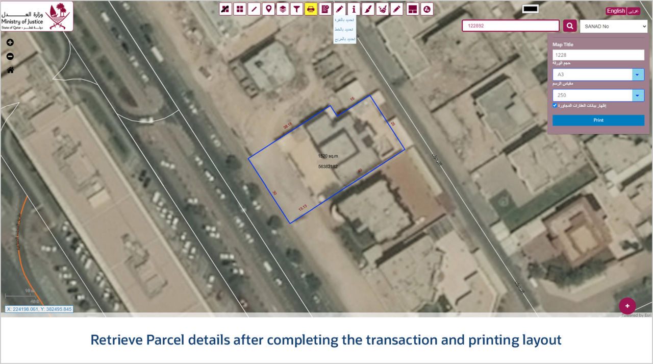
The Reengineering & Upgrade of Property Registration System, also called REGIS, was launched as a single application that integrates with multiple systems to manage real estate registration and transactions. REGIS uses Esri products, such as ArcCatalog, ArcGIS Server, ArcGIS API for JavaScript, and ArcGIS REST API, for spatial analysis, data visualization, and automation.
Now staff can exchange maps, files, and related geographic data using the ArcGIS Enterprise portal within the app. This eliminates the need for multiple systems. Additionally, REGIS enables users to register, process, update, store, search, and access real estate data. Furthermore, the application enables staff to design and produce ownership certificates. REGIS employs automated ArcGIS tools like ArcPy for things like geoprocessing, processing data, and scripts.
The REGIS app also played a crucial role in digitizing and archiving Qatar's cadastral heritage. This archive comprises close to 3,326 record sheets spread across 98 zones, providing a comprehensive understanding of Qatar's landownership history.