ArcGIS software has enabled the public to interact and work with various pieces of output from our research, bringing science into the hands of the public.
User Story
Monitoring Global Trade with GIS and Satellite Data
Introduction
Highly interconnected ports are among the most important infrastructure components for facilitating the flow of goods ranging from clothing to food. Maritime trade plays a critical role in the economic activity of many countries because ports handle 80 percent of world trade volume. But human-made and natural disasters at ports can create widespread global impacts. In March 2021, when the Ever Given, one of the largest container ships in the world, got stuck and blocked the Suez Canal—the shortest maritime route between Europe and Asia with a transit time of six and a half days—it disrupted trade worth $2.5 billion. When flooding damaged the port of Durban, the largest port in South Africa, and when an earthquake damaged the Iskenderun port in Turkey, for instance, these natural disasters caused a ripple effect on trading partners in the region.
Key takeaways:
- Real-time satellite data and GIS technology help the International Monetary Fund (IMF) provide valuable insights to policymakers to make more informed decisions.
- PortWatch, an open platform, promotes global policy dialogue by allowing policymakers from 190 member countries to access data on disruptions to global port activity.
- PortWatch can be accessed at www.imf.org/portwatch.
- Products mentioned in this story include ArcGIS Hub, ArcGIS Online, Map Viewer, and ArcGIS Experience Builder.
Monitoring ports enables governments and other organizations to analyze economic impacts that result from natural disasters or other large-scale events accurately and quickly.
The International Monetary Fund (IMF), in collaboration with the University of Oxford, created PortWatch, an open platform for policymakers and anyone who wants early insight into the potential repercussions of an issue at a port. PortWatch uses satellite-based vessel data and geographic information system (GIS) technology to monitor port activity and simulate the impacts of port disruptions on global trade. This allows decision-makers to implement policies more effectively to cope with that shock, promoting economic and financial stability.
“Having this information is useful for policymakers to track how well countries are doing in terms of the economy, especially when there is an economic downturn or recovery,” said Serkan Arslanalp, an economist at the IMF.
Solution
Policymakers can sign up on PortWatch to get email alerts when a disaster may impact a port. Given considerable lags, trade data is often not available in near real time. “Monitoring the ports in real time allows you to essentially have your finger on the pulse of the economy,” Arslanalp said.
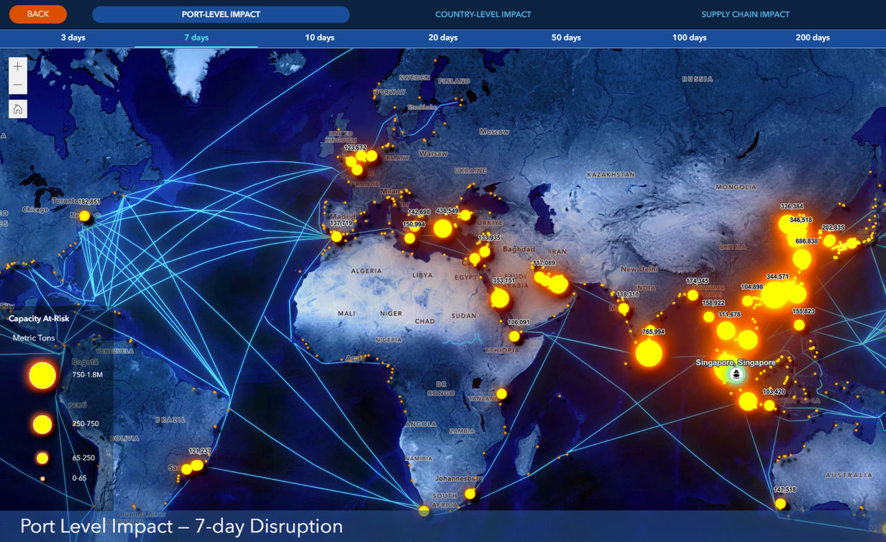
PortWatch is hosted on the cloud-based ArcGIS Hub, leveraging vessel positions captured by satellites to broaden the scope of people and countries that can access near real-time port data. This allows the IMF team to easily store data and make it available to member countries. The technology also makes it easy to visualize, update, and share automated port data. Additionally, ArcGIS Experience Builder is built into the platform for users to simulate spillovers from hypothetical disruptions and climate scenarios that may impact ports.
 Climate Scenarios: The map shows the present climate risks to ports, expressed as annual expected damages (USD per year) to physical infrastructure, from different climate hazards.
"The tools embedded in PortWatch illuminate complexities and interconnections in the international maritime trade that would remain otherwise difficult to grasp,” said Alessandra Sozzi, data scientist at the IMF. “It's not just about seeing, it's about understanding."
By leveraging satellite data and GIS technology, IMF economists, business owners, journalists, maritime experts, port authorities, and policymakers across the globe can quickly identify economic patterns, fill information gaps, and detect early warning signs of economic instability of human-made and natural disasters at ports and maritime choke points.
“PortWatch produces maritime trade data that is complementary to officials' trade data,” said Parisa Kamali, an economist at the IMF. “This data is specifically valuable for countries with low statistical capacity and high reliance on trade for consumption and growth.”
Results
The IMF launched the PortWatch online platform in November 2023. Since then, thousands of users from news organizations, businesses, and policy institutions have used the platform, and several hundred have signed up for email alerts about natural disasters that may impact trade routes.
The IMF’s vision for PortWatch’s future is to turn it into a widely used resource on trade disruptions. “The recent crisis in the Red Sea shows the potential for PortWatch to be a resource for trade disruptions beyond climate extremes and natural disasters,” said Robin Koepke, an economist at the IMF.
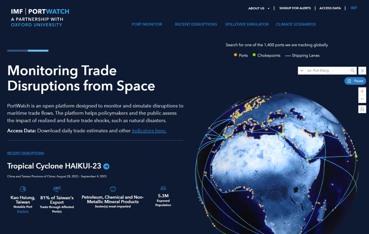
 Homepage of the PortWatch platform. The globe shows the ports and chokepoints tracked by PortWatch. Highlighted in the homepage (bottom-left) is the recent trade disruptions in the Red Sea.
Esri & Science of Where Podcast:
International Monetary Fund Senior Economist Serkan Arslanalp explains how real-time supply chain visibility keeps international trade moving in the era of climate change. Esri’s John Lenahan looks into how geospatial technology increases global economic resilience.