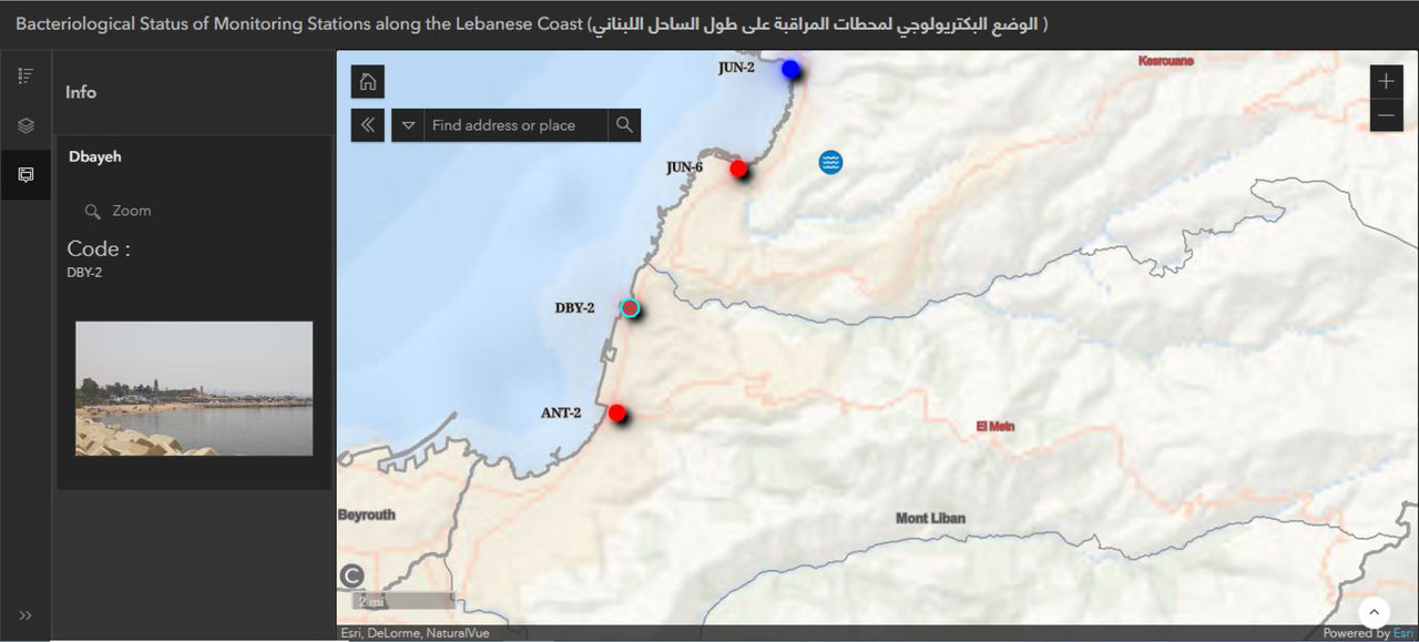
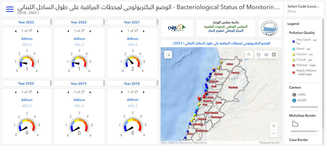
It was a nonstop period that took several years to transfer our heritage of paper maps. The long tedious research efforts and different modeling approaches resulted in delivering new thematic maps, digital data and models on a national, sub-national, regional, and local scale. Deliverables included Lebanon’s soil map in 2002, 5 series of LULC, hazard and risk maps, and pollution monitoring. CNRS-L and Esri enduring, with EL's unwavering support, notably during crises, facilitated this transition
Dr. Chadi Abdallah
Director of the National Early System Platform (NEWSP)