"This app helps us organize the entire attachment process. It is nice to see what status each job is at. It is a lot to keep up with, but the new workflow makes it so easy."
case study
Location Intelligence Optimizes Joint Use Pole Attachments
Horry Electric Cooperative, Inc. (HEC), serves over 70,000 owner-members on the western side of the Atlantic Intracoastal Waterway in South Carolina. The nonprofit organization provides information and energy-related services on a fair and equitable basis. The HEC team used Esri applications to improve joint use assets tracking, updating, and billing.
Challenge
Recent broadband initiatives affected foreign attachments to the HEC overhead system. As a result, the quantity and frequency of pole attachments for communications lines increased significantly. Previously, HEC handled the entire joint use process manually. HEC's engineering department managed its records in spreadsheets. As a result, it wasn't easy to track and process the numerous paper application submissions and as-builts and derive accurate billing counts. In addition, the delayed updates caused discrepancies between HEC records and those of communications service providers.
 HEC tracks all applications for joint pole use and tracks them until they are as-built.
Solution
First, the utility moved its spreadsheet data into a geographic information system (GIS) to make it more useful. Staff then field verified this information with ArcGIS Collector to ensure its accuracy. After validating the existing data, HEC shifted its focus to improving the more extensive joint use process.
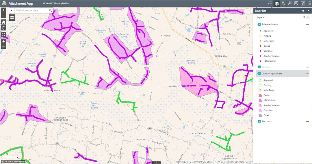
The local telephone cooperative submits many applications detailing its intended pole attachments. A GIS layer now represents each application and spatially relates it to the pole infrastructure. Each proposed attachment is marked and tracked through the application process until it is built.
HEC pole stakers use ArcGIS Field Maps to visit each location and determine the attachment suitability. Stakers may approve, deny, or note additional required work before attachment. Their determinations are immediately recorded and referenced by both HEC staff and that of the telephone cooperative.
The telephone cooperative's staff access the shared ArcGIS feature service. Therefore, they see application status and progress in near real time. For example, after approving a point, that attachment work may begin. Once complete, as-built information is also field checked and either accepted or noted for follow-up.
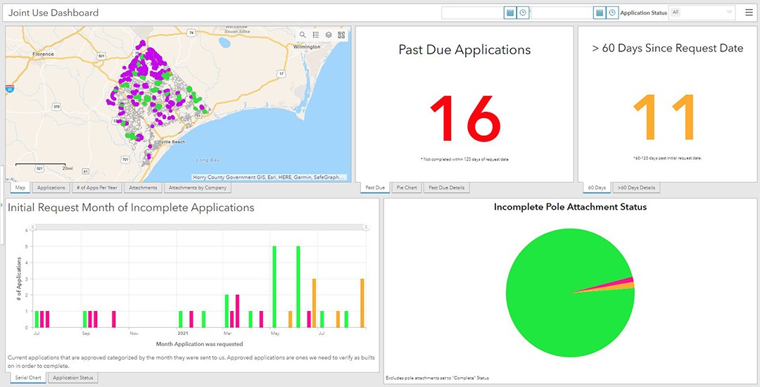
ArcGIS Dashboards is used to monitor the process and its timing and to report statistics. To ensure high levels of service, two key performance indicators (KPIs) draw specific attention to stale applications.
 HEC uses dashboards to monitor progress, timing, and key performance indicators.
Results
The new workflows have drastically improved HEC's tracking of pole attachments. In addition, by flagging older applications, HEC now prioritizes its work in ways that were not practical using spreadsheets. As a result, HEC increased service levels and helped facilitate broadband deployment.
Both cooperatives benefit from fewer record keeping discrepancies. For example, HEC's records now match the telephone cooperative's, and both align with the field installations.
HEC's billing previously underestimated the attachment quantities. Solid records now enable the annual invoices to be prepared rapidly and with a high degree of confidence. Consequently, revenue increased as a result of the improved workflow.
Moving Forward
Horry Electric Cooperative is pushing ahead to realize additional benefits from the digitally transformed workflows. HEC is further automating the applications with ArcGIS Survey123 to digitally capture all pertinent information in the GIS. Given the success of the local telephone cooperative, HEC plans to extend the improvements to other communications service providers in its service territory.
The new data and field processes will support a full audit of the Horry Electric system and its foreign pole attachments. The improved data should continue to streamline employee work, improve accuracy, and increase revenue.