Thanks to ONOVA GIS HUB, we have a useful tool for recording destruction as well as collecting and analyzing data on damaged buildings and infrastructure. This is important for further recovery and transparent investment attraction by our community. I hope that this is a significant step forward in the recovery and development of Ukraine, allowing us to collect, analyze, and use data for future planning.
case study
Ukraine Used ONOVA GIS HUB to Document Destruction from War and Aid in Recovery and Reconstruction
Challenge
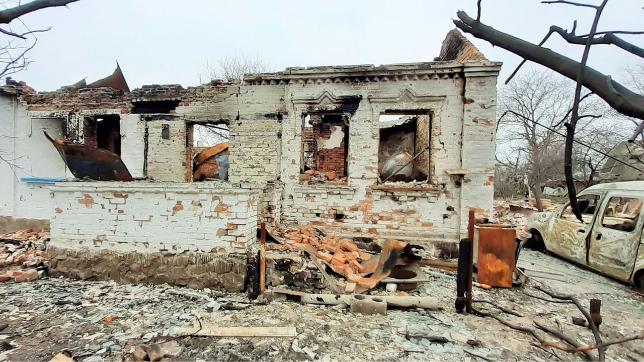
According to government data, as of the beginning of 2024, nearly 160 thousand buildings and other structures in Ukraine have been destroyed due to Russian aggression. The country has already accumulated up to 100 million tons of waste from these demolitions, and the figures are continually increasing. The process of documenting destruction, determining material damage, and working on subsequent recovery requires a more innovative and transparent approach.
With the aim of documenting the destruction, and as a foundation for more effective recovery based on Esri geographic information system (GIS) technology, the Public Union "Ukrainian Fund of Energy Efficiency and Energy Saving" (PU UFEES) collaborated with Esri Ukraine and technical partner EСOMM Сo LLC. Together they created ONOVA GIS HUB, an online tool for data collection and sharing in May 2022.
Solution
Ukraine’s Renovation League ONOVA is a united organization of participants actively involved in the renewal of Ukraine . The organization was instrumental in creating an online geographic information system (GIS) tool, ONOVA GIS HUB. The hub was designed to facilitate the prompt and comprehensive documentation of destruction as well as the collection and analysis of data related to specific objects, communities, regions, or sectors in Ukraine that suffered damage or destruction due to full-scale Russian aggression. The hub implements the latest standards and technologies to ensure effective updates.
Participants of Ukraine’s Renovation League ONOVA, utilizing ONOVA GIS HUB with the access levels granted to them, have the capability to
- Enter, edit, and analyze the data they contribute.
- Indicate the level of damage and add descriptive information about the extent of damage, including photographs and surveys for public and residential buildings.
- Add reports, expert opinions, and restoration projects and their estimated cost, and set the current stage of restoration for each infrastructure object.
- Define other data they want to have on an interactive map in addition to the data proposed by the developer.
- Determine the data to be displayed on dashboards.
- Geospatially link infrastructure facilities to the primary development plan, land cadastre, and critical infrastructure networks (water supply, electricity, heating, gas, etc.).
- Enter the names of undamaged infrastructure facilities to use the hub to plan further socioeconomic development of the community.
Results
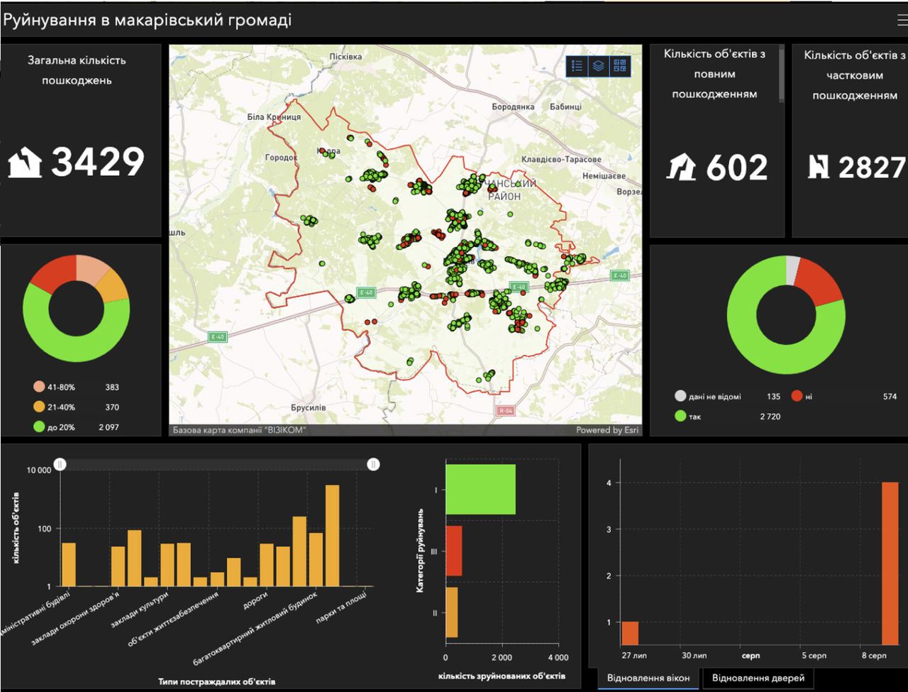
ONOVA GIS HUB has already been used by more than 50 communities in Ukraine, including the cities of Irpin, Bucha, Makariv, Chernihiv, Mykolaiv, Kharkiv, and Kremenchuk—the settlements most affected by the Russian Federation's attack. ONOVA GIS HUB has become an important tool for the digitalization of communities in the context of reconstruction.
Today, ONOVA GIS HUB is used by both public and private entities in Ukraine to form national programs for the reconstruction and development of the country. Organizations that have utilized the hub include the Ukraine Ministries of Energy; Youth and Sports; Communities, Territories, and Infrastructure Development (Ministry of Recovery); and Reintegration of the Temporarily Occupied Territories. Negotiations are underway with other government agencies.
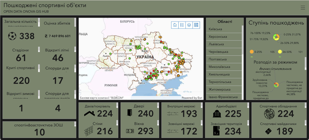
Using ONOVA GIS HUB, the Ukraine Ministry of Youth and Sports has created the most accurate map of damaged sports facilities in all regions of the country and introduced a mechanism for documenting sports facilities and youth institutions that have been damaged or destroyed during the conflict. https://e-ukraine.esri.ua/portal/apps/dashboards/5e476bfec19a4304a0915bee91a39a29
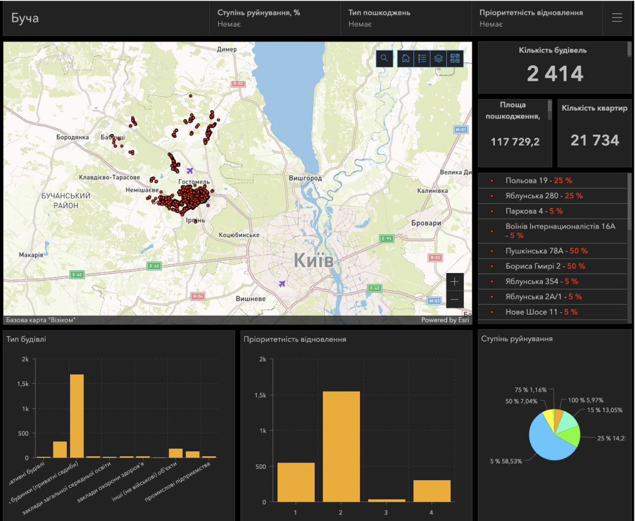
ONOVA GIS HUB’s database has already included more than 25,000 objects that have suffered to varying degrees from the consequences of Russia's armed aggression. In peacetime, ONOVA GIS HUB can serve as a tool for analyzing and planning urban development, including primary plans, financial information, and indicators of socioeconomic development. As an example, in a joint project with the Ukraine Ministry for Communities, Territories and Infrastructure Development and the Bucha territorial community, ONOVA GIS HUB’s capabilities are used to create plans for the development of social infrastructure institutions in Bucha. Bucha now plans to rebuild and renovate schools, using an analysis of available resources with the needs of the community, school bus routes, and restoration.
The success of the ONOVA GIS HUB project has led to several new developments, including integration with Ukrainian and global information resources. Namely, the Ukraine Ministry of Recovery, as the main coordinator of the reconstruction process, has signed a memorandum of understanding with the PU UFEES on the creation of the GIS of Infrastructure of Ukraine.
The ONOVA project is also currently being implemented in cooperation with the Recovery Agency (part of the Ministry of Recovery) in Borodianka, Yahidne, and Posad-Pokrovske. And project proposals for the restoration, construction, or reconstruction of individual facilities are being mapped on ONOVA GIS HUB.
In addition, a mechanism for integrating ONOVA GIS HUB with DREAM is being developed, the state online ecosystem for accountable recovery management. DREAM collects, organizes, and publishes open data at all stages of recovery projects in real time.
ONOVA GIS HUB is becoming an effective and transparent tool within the all-Ukrainian renewal process. The hub is also already playing a key role in shaping new sustainable development strategies for an independent, European, and prosperous Ukraine.
About the Founders of ONOVA GIS HUB
The Public Union "Ukrainian Fund of Energy Efficiency and Energy Saving" supports initiatives to introduce incentives and measures to improve the energy efficiency of buildings, as well as the implementation of modern European Union (EU) environmental safety standards in Ukraine. The organization is the founder of Ukraine’s Renovation League ONOVA GIS HUB.
Esri Ukraine provides an online hub for creating a corporate geographic information system (GIS) and is a distributor of Esri (USA).