
Automated Aerial Reality Capture
On-demand webinar
A complete reality capture workflow for AEC
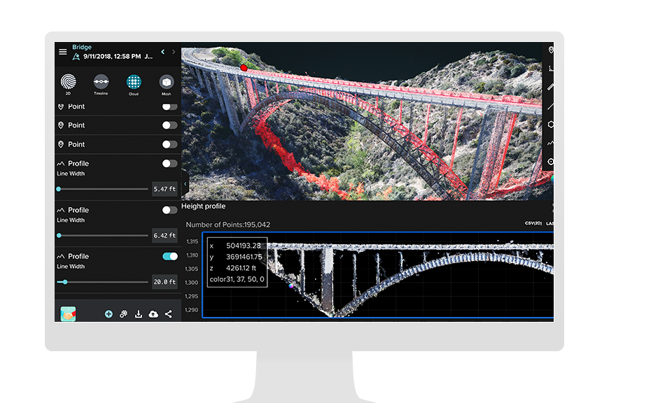
Site Scan for ArcGIS is drone mapping software that provides an end-to-end workflow for acquiring and processing drone imagery, working with the resultant data products, and managing assets.
With Site Scan, architecture, engineering, and construction (AEC) firms can
- Create 2D and 3D flight plans to capture data (add Revit or BIM files, increase situational awareness).
- Process, manage, and analyze data (import CAD overlays for easy QA/QC, perform time-based analysis & clash detection).
- Disseminate data and collaborate (improve data visualization & communication across key project stakeholders).