ArcGIS Urban

ArcGIS Urban

Collaborative, data-driven urban planning

Explore pricing
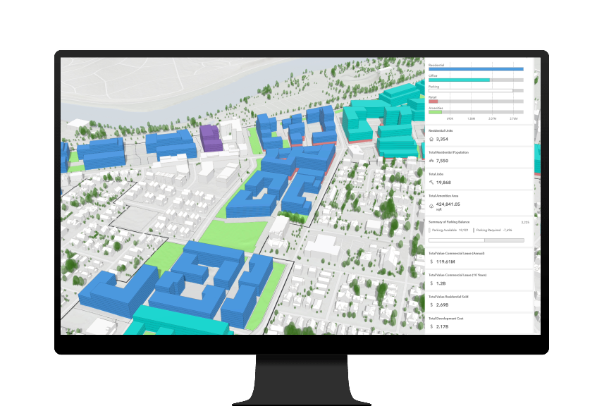
Computer monitor showing 3D visualization of building massings with select buildings colored in green, blue, and purple

Transforming urban planning and design

Empower collaboration between planners, stakeholders, and the community to address current needs and emerging demands such as housing shortages, climate resiliency, and economic uncertainty. With ArcGIS Urban, you can evaluate the impacts of multiple zoning, land-use, and development scenarios with 3D visualizations and urban analytics. 

Urban planning made simple

Encourage collaboration with stakeholders to create an inclusive and more sustainable future for your community.

A man presenting a 3D city model on a television screen in front of people in a conference room

What you can do with ArcGIS Urban

3D scenario modeling

Design in the context of your city or town’s digital twin for a comprehensive understanding of the urban environment. Leverage this digital representation to enhance collaboration with stakeholders and the public and support more informed decision-making.

Discover 3D scenario modeling
 with 3D buildings, gray roads, and green trees

Data-driven analysis

Apply ready-to-use space uses, building types, and metrics and gain real-time insights on the potential impacts of policy and development changes with urban visualizations.

Explore data-driven analysis
A pie and bar chart with numerical and text data next to 3D buildings representing a 3D scenario model of zoning changes

Project e-submission

Manage the urban development pipeline as part of a digital twin of your city. Integrate building information modeling (BIM), external 3D content, and data from your permitting system to streamline the project review process. 

Learn about project tracking
City skyline showing tall buildings, green trees, and a blue sky with select buildings highlighted red with a map pin on top

Collaborative urban planning

Communicate proposals and increase buy-in with easy-to-understand visualizations and metrics. Reach new audiences and boost access to key demographic groups by incorporating online feedback and discussions throughout the planning process. 

Support collaborative planning
3D buildings colored in green and purple representing transparent envelopes showing the maximum buildable height

Extendable planning system

ArcGIS Urban is the heart of your city planning system, seamlessly integrating with various complementary products through its API, allowing for effortless collaboration, data exchange, and immersive experiences like extended reality (XR) for exploring and analyzing urban planning scenarios. 

Extend your planning system
A virtual city streetscape showing tall buildings, a road, and cars representing the designs for new street lighting

How it works

Transform the traditional planning process with a systems approach to urban planning. Design in the context of your city or town’s digital twin and improve collaboration with stakeholders.

Foundation for your digital planning twin

No 3D data is required to establish a digital twin of your city, town, or region with the pre-built buildings and trees in ArcGIS Urban. Leverage GIS data directly from your organization's GIS for data-driven analysis on zoning, land-use, and development projects.

Black and white 3D imagery of a city’s roads and buildings with select building projects highlighted in purple

System of record and insight for zoning

Centralize and structure zoning information to manage regulations, track changes, and visualize spatial patterns. Integrate diverse data sources like land use, building information, and demographics for deeper insights into the impacts of proposed zoning changes.

Multi-colored image of 3D buildings representing 3D transparent envelopes showing maximum buildable height in a neighborhood

Visualizations of design proposals

Evaluate development proposals in 3D to understand potential impacts to the surrounding neighborhood in ways that static 2D renderings fail to capture. Avoid oversights and misunderstandings before construction for a faster, more reliable project review process.

A virtual streetscape with a road, cars, and white buildings representing a new building proposal

Assessment of development impacts

Monitor and support your goals with key performance indicators to navigate uncertainty in the short term while considering impacts to long-term policy initiatives.

: A digital rendering of buildings and green trees representing a study area for a new development project

ESRI BLOG

Inside a European urban development project

We’re transforming traditional GIS into a project information model, and ultimately, a digital twin.

Petr Bocharnikov

Digital Strategist, Sokigo

Read the blog

An ArcGIS planning ecosystem

ArcGIS Urban is a powerful, interconnected system for urban planning and development that is at the heart of the ArcGIS planning ecosystem. Integrate with other ArcGIS products like ArcGIS Hub, which fosters community engagement by sharing data and gathering feedback, or ArcGIS CityEngine, which provides advanced urban visualization capabilities for more complex modeling and design.

ArcGIS CityEngine

ArcGIS CityEngine

ArcGIS CityEngine is advanced software for 3D city design. Create conceptual proposals based on regulation to quickly assess their impact in ArcGIS Urban, and then seamlessly transition to ArcGIS CityEngine to add the desired design and aesthetic details with more realistic visualizations.

Explore ArcGIS CityEngine
ArcGIS Hub

ArcGIS Hub

ArcGIS Hub is an easy-to-configure cloud platform that organizes people, data, and tools to accomplish goals. With ArcGIS Hub, create engaging websites to share plan scenarios and project phases and gather feedback through discussions, commenting, and map-based feedback.

Explore ArcGIS Hub

Contact sales

Please share your information and our sales team will contact you soon. We look forward to communicating with you.