Environmental Analysis
Evaluate and understand the environmental impacts of proposed development projects and solicit feedback from stakeholders.
You are tasked with balancing road and highway operations with environmental sustainability goals. It's essential to ensure that the transportation network supports a healthy economy and respects delicate ecosystems. Whether balancing new projects with environmental limitations, wildlife preservation constraints, or stormwater runoff considerations, GIS provides a way to ensure that you responsibly monitor and manage resources.
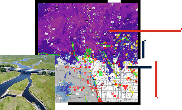
Ensuring a sustainable transportation system requires a wide range of biological and environmental studies and assessments. GIS allows you to analyze a wealth of data and determine the most environmentally positive course of action. With GIS, you can combine data from multiple agencies for analysis and collaboration, then compare alternatives to make the best decisions. Communicate issues to constituents and solicit their involvement with smart maps for stronger public engagement.
Use GIS to understand wetland boundaries or endangered species, model stormwater runoff and air quality impacts, improve environmental quality monitoring, and ensure compliance with regulations.
Departments of transportation must plan for climate change impacts on road and highway infrastructure. Building resiliency into current transportation projects requires a solid understanding of future climatic change. Whether it's from sea level rise or from increases in precipitation, storm intensity, or temperature extremes, GIS can help you understand and plan for these changes in the environment. With GIS, you can design more resilient transportation systems for the future.
Departments of transportation are responsible for a wide range of cultural resources including archaeological sites, historic bridges, and other landmarks. The first step to effective management is knowing where they are. You can capture the location of cultural resources to better document and understand their condition and see how to preserve these sensitive resources.
Coordination with tribal governments is an important part of intergovernmental affairs and comprehensive statewide planning. GIS provides a framework for rich data and information sharing and collaboration.
Video
The National Association of Environmental Professionals and Esri show how GIS can be the foundation for building eco-friendly infrastructures.
Case study
The Colorado Department of Transportation uses GIS to build a strong foundation for resiliency efforts that preserve and rebuild infrastructure.
User Story
The Maryland State Highway Administration uses GIS to improve infrastructure resilience and help the state better prepare for the future.
User Story
The Vermont Agency of Transportation builds resilience into infrastructure plans using GIS technology.
ArcGIS StoryMaps
Discover how to plan land development and land conservation together in a way that prioritizes and is consistent with natural environment patterns.
VIDEO
In Utah, real-time tracking and analysis reduce dangerous pelican strikes above an airport as well as vehicle collisions with moose and deer on roads.
ArcGIS Solutions includes sets of ready-to-use-configurations for roads and highways sustainability.
Evaluate and understand the environmental impacts of proposed development projects and solicit feedback from stakeholders.
Develop local flooding scenarios and visualize the impact of flooding on public infrastructure, critical facilities, and vulnerable populations.
Expedite debris clearance, assess volume, and monitor the removal of disaster debris accumulated on roads, rights-of-way, and public facilities.
Conduct initial damage assessments after a natural disaster or catastrophic incident.